209 New Brighton Road, Burwood
27 reports on record since March 2019 · 18 with photographs. The street’s heaviest record is 309 New Brighton Road — 49 reports on file. Indicative rating valuation and school zones, hazards, bin day and what stood here before.
What gets reported here
- Graffiti — 14
- Graffiti on a fence, building or structure — 5
- Water Leak — 2
- Roading/Streets — 2
- Water Fountain — 1
- Sewer - Leak / Blockage — 1
Photographed here 18 on record


Reported here
 Graffiti on a fence, building or structure —
 Graffiti on metal box
 Graffiti on a fence, building or structure —
 On wall near water station
 Graffiti on a fence, building or structure —
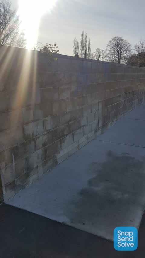
 Graffiti on concrete block wall
 Graffiti on a traffic light pole or cabinet, or wa —
  Water Leak —
 Water fountain at Horse shoe lake at PS205 constantly running and showing excess water at ground level. Turn of or fix.
 Water Fountain —
 Continuous running, flooding from over flow,
 Water Leak —
 Drinking fountain is leaking and waste pipe is broken. Prob needs replacing or decommissioned.
 Graffiti on a fence, building or structure —
 By water station (?) building
 Sewer - Leak / Blockage —
 Drinking water leaking
 Graffiti on a fence, building or structure —
 On the wall by the old water station
- Graffiti —
- Graffiti —
- Graffiti —
- Graffiti —
- Graffiti —
- Graffiti —
- Graffiti —
- Graffiti —
- Graffiti —
 Graffiti —
  Graffiti —
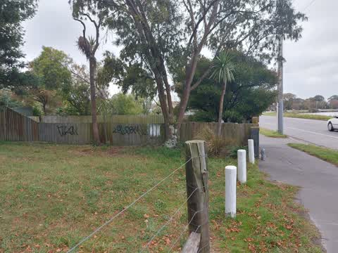
 Several tags on fence of 221 New Brighton Rd (near 3 white posts)
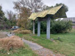 Graffiti —
 Tag on an old park shelter? Has a Triangle and letters AON Next to current construction site at pump station
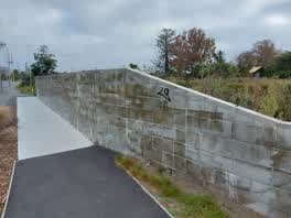 Graffiti —
 Tag on wall by 209 New Brighton Rd
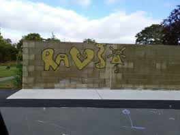 Graffiti —
 Roading/Streets —
pothole
Roading/Streets —
pothole
Rubbish/Recycling —
Bags of rubbish
Also reported on New Brighton Road
- 309 New Brighton Road — 49 reports
- 393 New Brighton Road — 38 reports
- 85 New Brighton Road — 33 reports
- 348 New Brighton Road — 27 reports
- 75E New Brighton Road — 26 reports
- 75 New Brighton Road — 26 reports
- 189 New Brighton Road — 24 reports
- 389 New Brighton Road — 21 reports
The street’s crash record
NZTA’s record names New Brighton Road in 77 crashes that hurt somebody since 2006 — 1 person killed, 12 seriously hurt.
The green nearby
- Horseshoe Lake Reserve — 48 m to the edge · Regional · 33 ha
Parks within half a kilometre, measured to the boundary — the council’s open data.
On the doorstep
- Lake Terrace Dairy — 368 m away · Dairies & convenience
Businesses within four hundred metres, measured at the pin — OpenStreetMap and the council directories.
The bus nearby
- New Brighton Rd near Locksley Ave — 127 m away · route 7
- New Brighton Rd near Locksley Ave — 142 m away · route 7
The closest Metro stops, within four hundred and fifty metres.
The tracks through here
- Walk and bike track through Burwood — 16 m to the line · walk · bike
- Walk and bike track through Burwood — 66 m to the line · walk · bike
- Walk and bike track through Burwood — 108 m to the line · walk · bike
- Walk and bike track through Burwood — 206 m to the line · walk · bike
- Walk and bike track through Burwood — 359 m to the line · walk · bike
Tracks whose line passes within half a kilometre, measured to the line itself — the council’s open data.
The named ground
Named water within 500 m of this address, measured to the line or the edge; the council’s own structure register — bridges, boardwalks and steps standing nearby — the open map’s record.
Renting nearby
new bonds in Burwood ran about $600 a week — $50 above the city median of $550 — the suburb page keeps the rent record →.
The civic layer
This ground votes in Burwood ward — the Coastal-Burwood-Linwood community board. Ward lines don’t always follow suburb lines; this one is measured at the pin, not the suburb’s centre.
What stood on this ground → · On the map → · From the air — the Crown’s aerials back to 1936; search the address on RetroLens →
Questions, answered briefly
27 council reports on record since March 2019 — most often graffiti (14), graffiti on a fence, building or structure (5), water leak (2).
Burwood, Christchurch — on New Brighton Road.
Nothing on the heritage register at this exact spot — the record around this ground →
Horseshoe Lake Reserve — 48 m to its edge, 33 ha.