405 New Brighton Road, Burwood
12 reports on record since March 2020 · 10 with photographs. The street’s heaviest record is 309 New Brighton Road — 49 reports on file. Indicative rating valuation and school zones, hazards, bin day and what stood here before.
What gets reported here
- Graffiti — 8
- Rubbish/Recycling — 1
- Roading/Streets — 1
- Poles and Signage - General — 1
- Parks — 1
Photographed here 10 on record



Reported here
 Poles and Signage - General —
 The 70km/h road sign is the wrong way around needs turning so as not to confuse traffic exiting Anzac Drive (which is 70) when entering New
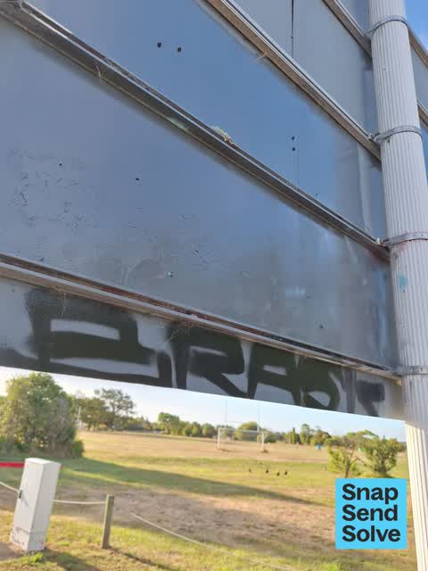
 Graffiti —
  Graffiti —
  Graffiti —
  Graffiti —
  Graffiti —
  Graffiti —
 - Graffiti —
- Graffiti —
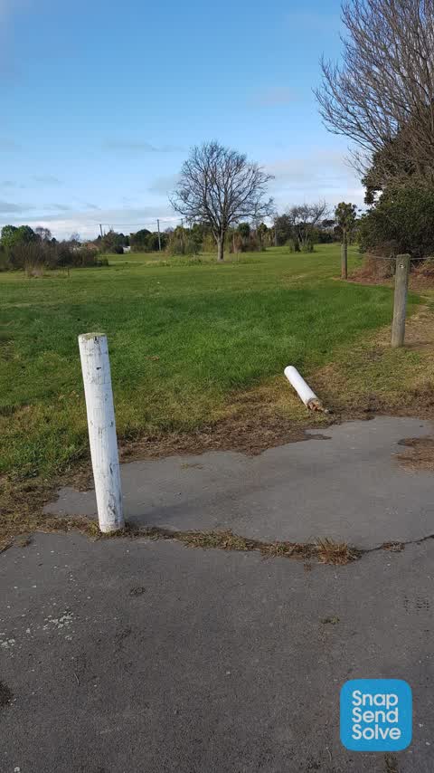
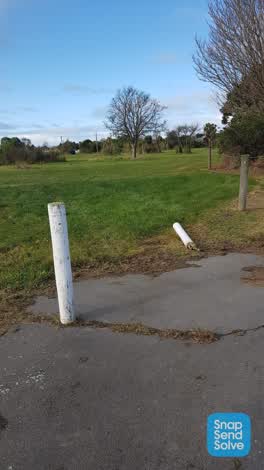 Parks —
 Antha brake in see a car been in there
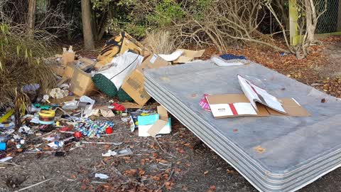
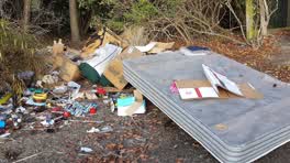 Rubbish/Recycling —
 fly tipping near 7th tee in red zone frisbee golf park
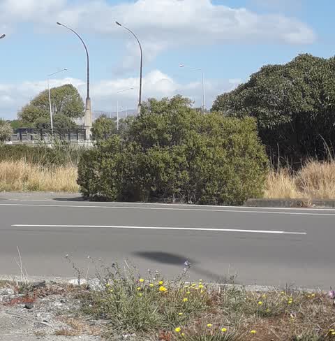
Roading/Streets —
this bush is growing out over the road and obstructs the traffic view and makes cyclists come out into the road not the cycle lane.
Also reported on New Brighton Road
- 309 New Brighton Road — 49 reports
- 393 New Brighton Road — 38 reports
- 85 New Brighton Road — 33 reports
- 348 New Brighton Road — 27 reports
- 209 New Brighton Road — 27 reports
- 75E New Brighton Road — 26 reports
- 75 New Brighton Road — 26 reports
- 189 New Brighton Road — 24 reports
The street’s crash record
NZTA’s record names New Brighton Road in 77 crashes that hurt somebody since 2006 — 1 person killed, 12 seriously hurt.
The green nearby
- Anzac Drive Reserve — 24 m to the edge · 14 ha
- Dixon Reserve — 34 m to the edge
- Cedarwood Reserve — 80 m to the edge · 1 ha
- Brooker Reserve — 205 m to the edge · 1 ha
- Amelia Rogers Reserve — 258 m to the edge · 2 ha
Parks within half a kilometre, measured to the boundary — the council’s open data.
The tracks through here
- Walk and bike track through Burwood — 15 m to the line · walk · bike
- Walk and bike track through Burwood — 25 m to the line · walk · bike
- Walk and bike track through Burwood — 57 m to the line · walk · bike
- Walk and bike track through Burwood — 71 m to the line · walk · bike
- Walk and bike track through Burwood — 96 m to the line · walk · bike
Tracks whose line passes within half a kilometre, measured to the line itself — the council’s open data.
The named ground
Named water within 500 m of this address, measured to the line or the edge; the council’s own structure register — bridges, boardwalks and steps standing nearby — the open map’s record.
The remembered names nearby
- Stephen and Rebecca Brooker Settled on 40 Acres of Land — 213 m away ·
STEPHEN AND REBECCA BROOKER SETTLED ON 40 ACRES OF LAND BETWEEN BARKERS ROAD AND BOWER AVE
· 2009 - Donated by the Lions Club of Christchurch Seaview 2002 — 246 m away ·
DONATED BY THE LIONS CLUB OF CHRISTCHURCH SEAVIEW 2002
· 2009
Inscribed plaques within two hundred and fifty metres — the register’s pins, not surveyed spots. The whole roll is at /plaques.
Renting nearby
new bonds in Burwood ran about $600 a week — $50 above the city median of $550 — the suburb page keeps the rent record →.
The civic layer
This ground votes in Burwood ward — the Coastal-Burwood-Linwood community board. Ward lines don’t always follow suburb lines; this one is measured at the pin, not the suburb’s centre.
What stood on this ground → · On the map → · From the air — the Crown’s aerials back to 1936; search the address on RetroLens →
Questions, answered briefly
12 council reports on record since March 2020 — most often graffiti (8), rubbish/recycling (1), roading/streets (1).
Burwood, Christchurch — on New Brighton Road.
Nothing on the heritage register at this exact spot — the record around this ground →
Anzac Drive Reserve — 24 m to its edge, 14 ha.