25 Harbour View Terrace, Cass Bay
13 reports on record since July 2022 · 9 with photographs. The street’s heaviest record is 39 Harbour View Terrace — 17 reports on file. Indicative rating valuation and school zones, hazards, bin day and what stood here before.
What gets reported here
Photographed here 9 on record


Reported here
 Water Pollution - Sediment —
 The steps leading down to the small beach from Harbour View Terrace, cass bay, are very wet with puddles which I suspect are from the sewage
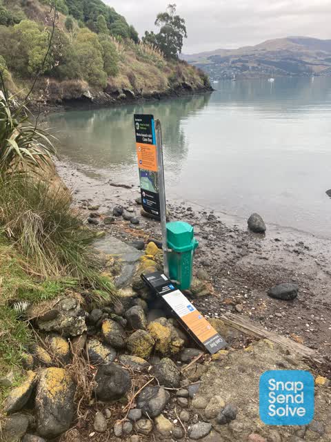
 Rubbish and Bins - General —
 Public bin on beach fallen over. Including sign. Middle beach Cass Bay
 Overgrown Vegetation —
 Overgrown grass in Cass Bay reserves and vegetation blocking paths
 Overgrown Vegetation —
 Walkway between Cass Bay and Corsair, really close to Cass Bay end. Couldn't find a beach walkways section to put it in. Please put the re
 Graffiti somewhere else —
 On rubbish bin by walkway Cass Bay
 Water Leak —
 Water running on reserve walking track in front of 25 Harbour View Terrace. Unclear where it is coming from
 Overgrown Vegetation —
 - Facility - General Request —
- Water Leak —
- Water Leak —
- Sewer - Leak / Blockage —
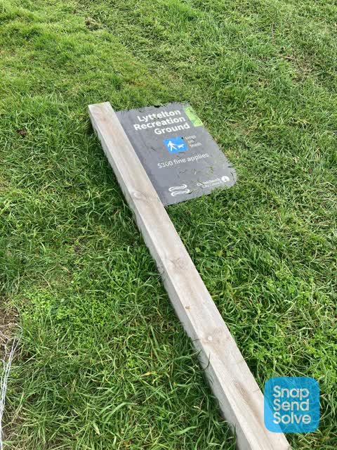
 Parks —
 Sign and post have been removed from ground
 Parks —
 Broken sign at Cass bay walkway; down by the water
Also reported on Harbour View Terrace
- 39 Harbour View Terrace — 17 reports
- 15 Harbour View Terrace — 8 reports
- 23 Harbour View Terrace — 7 reports
- 20 Harbour View Terrace — 6 reports
- 35 Harbour View Terrace — 3 reports
- 31 Harbour View Terrace — 3 reports
- 18 Harbour View Terrace — 3 reports
- 17 Harbour View Terrace — 3 reports
The green nearby
- Cass Bay Walkway — 47 m to the edge
- Corsair Bay Reserve — 134 m to the edge · 8 ha
- Cass Bay Playground — 179 m to the edge
- Pony Point — 228 m to the edge · Regional · 7 ha
- Police Reserve — 250 m to the edge
Parks within half a kilometre, measured to the boundary — the council’s open data.
On the doorstep
- Lyttelton Kayaks — 183 m away · Attractions
Businesses within four hundred metres, measured at the pin — OpenStreetMap and the council directories.
The bus nearby
The closest Metro stops, within four hundred and fifty metres.
The named ground
Named places within 1.5 km of this address; the council’s own structure register — bridges, boardwalks and steps standing nearby — the open map’s record.
Renting nearby
new bonds in Cass Bay ran about $600 a week — $50 above the city median of $550 — the suburb page keeps the rent record →.
The civic layer
This ground votes in Banks Peninsula ward — the Banks Peninsula community board. Ward lines don’t always follow suburb lines; this one is measured at the pin, not the suburb’s centre.
What stood on this ground → · On the map → · From the air — the Crown’s aerials back to 1936; search the address on RetroLens →
Questions, answered briefly
13 council reports on record since July 2022 — most often water leak (3), overgrown vegetation (3), parks (2).
Cass Bay, Christchurch — on Harbour View Terrace.
Nothing on the heritage register at this exact spot — the record around this ground →
Cass Bay Walkway — 47 m to its edge.