104 Salisbury Street, Christchurch Central City
15 reports on record since February 2016 · 10 with photographs. The street’s heaviest record is 118 Salisbury Street, 26 reports on file. Indicative rating valuation and school zones, hazards, bin day and what stood here before.
What gets reported here
Photographed here 10 on record




Reported here
 Dumped Rubbish,
Rubbish on footpath
 Graffiti on a fence, building or structure,
 Graffiti on a fence, building or structure,
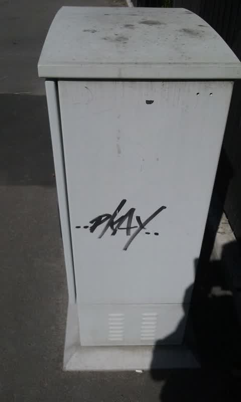
On a cabinet in front of n104
 Graffiti on a cabinet, pole or railway asset,
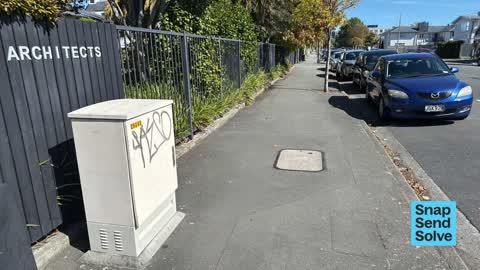
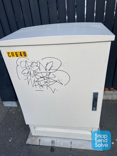
Gray paint tag on Enable asset by 104 Salisbury Street.
 Graffiti somewhere else,
Graffiti on cream cabinet
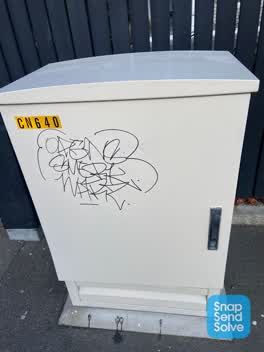
 Graffiti on a cabinet, pole or railway asset,
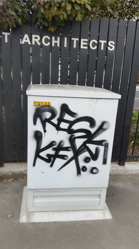
Black paint tags on top and front of Enable asset CN 640 at 104 Salisbury Street.
- Graffiti,
- Graffiti,
- Graffiti,
- Graffiti,
- Roads - General,
 Graffiti,
Black paint tag on CN640 asset by Sheppard & Rout Architects on Salisbury Street.
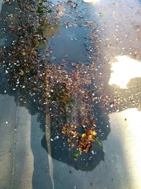
Water Supply,
Water leak
Graffiti,
Graffiti on enable cabinet
Graffiti,
Didn't remove graffiti on. Till now
Also reported on Salisbury Street
- 118 Salisbury Street, 26 reports
- 224 Salisbury Street, 17 reports
- 5 Salisbury Street, 16 reports
- 95 Salisbury Street, 15 reports
- 251B Salisbury Street, 13 reports
- 56 Salisbury Street, 12 reports
- 245 Salisbury Street, 12 reports
- 239B Salisbury Street, 12 reports
From the air, then
Sourced from Canterbury Maps and partners. LINZ, CC BY 3.0 NZ. Each frame is cut from Environment Canterbury’s historic imagery MapServer for that decade, only where the Footprints layer names a CC BY survey (NZAM-covered spots stay out). RetroLens holds more Crown aerials →
The street’s crash record
NZTA’s record names Salisbury Street in 84 crashes that hurt somebody since 2006, 2 people killed, 14 seriously hurt.
The green nearby
- Aldred Reserve, 102 m to the edge
- Rose Historic Chapel Reserve, 183 m to the edge · Botanic
- Victoria Triangles, 226 m to the edge
- Victoria Square, 330 m to the edge · Botanic · 2 ha
- Cranmer Square, 404 m to the edge · Botanic · 2 ha
Parks within half a kilometre, measured to the boundary, the council’s open data.
The civic shelf nearby
- Aldersgate, 418 m away · Car park
- Armagh Street, 478 m away · Car park
Libraries, halls and the rest within half a kilometre, the council’s open data.
On the doorstep
- Focus Motels and Executive Suites, 108 m away · Motels
- Centre Point on Colombo Motel, 127 m away · Motels
- Centrepoint on Colombo, 131 m away · Motels
- Holy Grill Food Truck, 136 m away · Fast food
Businesses within four hundred metres, measured at the pin: OpenStreetMap and the council directories.
The bus nearby
- Salisbury St near Gracefield Ave, 82 m away · route 1, route 29, route 95
- Colombo St near Salisbury St, 122 m away · route 27
The closest Metro stops, within four hundred and fifty metres.
The tracks through here
- Walk and bike track through Christchurch Central City, 43 m to the line · walk · bike
- Walk and bike track through Christchurch Central City, 249 m to the line · walk · bike
- Walk and bike track through Christchurch Central City, 366 m to the line · walk · bike
- Walk and bike track through Christchurch Central City, 405 m to the line · walk · bike
- Walk and bike track through Christchurch Central City, 478 m to the line · walk · bike
Tracks whose line passes within half a kilometre, measured to the line itself, the council’s open data.
The named ground
Named water within 500 m of this address, measured to the line or the edge; Named places within 1.5 km of this address, the open map’s record.
The remembered names nearby
- Aldred Reserve plaque, 132 m away ·
ALDRED PARK / IN 1993 A SUGGESTION WAS PUT TO THE CHRISTCHURCH CITY COUNCIL BY THE VICTORI
· 2004 - Heritage Christchurch Former St Mary’S Convent Chapel Built, 217 m away ·
HERITAGE CHRISTCHURCH Former St Mary’s Convent Chapel Built 1910 Architect Luttrell Brothe
· 2009 - A.M.D.G. Hic Lapis a Rr Dd J.J. Grimes S.M ., 220 m away ·
A.M.D.G. Hic Lapis A RR DD J.J. Grimes S.M ... Latin dedication
· 2009
Inscribed plaques within two hundred and fifty metres, the register’s pins, not surveyed spots. The whole roll is at /plaques.
Renting nearby
new bonds in Christchurch Central City ran about $508 a week, $42 below the city median of $550, the suburb page keeps the rent record →.
What was here, Former St Mary's Convent Chapel and Setting
224 m away · 67/868 Colombo Street · located to ±12 m · the place’s own record →
On the register. Nothing researched here yet.
The civic layer
This ground votes in Central ward, the Papanui-Innes-Central community board. Ward lines don’t always follow suburb lines; this one is measured at the pin, not the suburb’s centre.
What stood on this ground → · On the map → · From the air, the Crown’s aerials back to 1936; search the address on RetroLens →
Questions, answered briefly
15 council reports on record since February 2016, most often graffiti (7), graffiti on a fence, building or structure (2), graffiti on a cabinet, pole or railway asset (2).
Christchurch Central City, Christchurch, on Salisbury Street.
The heritage register names a place at or beside it, Former St Mary's Convent Chapel and Setting.
Aldred Reserve, 102 m to its edge.