107 Saint Asaph Street
13 council reports since February 2021, 10 carrying a photograph. The street’s heaviest record is 207 Saint Asaph Street, 79 reports on file.
On the register here
- St Michael's School Hall and Setting, 243 Durham Street South (202m)
- St Michael's School Stone Building and Setting (217m)
- St. Michael and All Angels Church & Setting, 90 Oxford Terrace (232m)
- Commercial Building and Setting, Former W. Williamson Construction Company, 181 Montreal Street (236m)
- St Michael and All Angels Church Belfry and Setting, 90 Oxford Terrace (239m)
From the air, then
Sourced from Canterbury Maps and partners. LINZ, CC BY 3.0 NZ. Each frame is cut from Environment Canterbury’s historic imagery MapServer for that decade, only where the Footprints layer names a CC BY survey (NZAM-covered spots stay out). RetroLens holds more Crown aerials →
The green nearby
- Tiffany Reserve, 247 m to the edge
- Friendship Corner, 305 m to the edge · Botanic
- Bridge Of Remembrance, 365 m to the edge · Botanic
- Botanic Gardens, 469 m to the edge · Botanic · 21 ha · playground, 53 pieces
Parks within half a kilometre, measured to the boundary, the council’s open data. The whole roll is at /parks.
The civic shelf nearby
- Scales, 326 m away · Car park
- Re:start - Lichfield Street, 404 m away · Car park
Libraries, halls and the rest within half a kilometre, the council’s open data.
On the doorstep
- Euromarque CMG Motors, 37 m away · Car dealers
- CMG Motors, 40 m away · Car dealers
- PB Tech, 78 m away · Computers
- CMG Motorcycles, 90 m away · Motorcycle shops
Businesses within four hundred metres, measured at the pin, OpenStreetMap and the council directories.
The bus nearby
- St Asaph St near Montreal St, 113 m away · route 3, route 5, route 7, route 60, route 80, route 81, route 84, route 85, route 86
- St Asaph St near Colombo St, 333 m away · route 3, route 5, route 7, route 60, route 80, route 81, route 84, route 85, route 86
The closest Metro stops, within four hundred and fifty metres.
The tracks through here
- Walk and bike track through Christchurch Central City, 111 m to the line · walk · bike
- Walk and bike track through Christchurch Central City, 291 m to the line · walk · bike
- Walk and bike track through Christchurch Central City, 302 m to the line · walk · bike
- Walk and bike track through Christchurch Central City, 320 m to the line · walk · bike
- Walk and bike track through Christchurch Central City, 337 m to the line · walk · bike
Tracks whose line passes within half a kilometre, the council’s open data.
The named ground
Named water within 500 m of this address, measured to the line or the edge; Named places within 1.5 km of this address; the council’s own structure register, bridges, boardwalks and steps standing nearby, the open map’s record.
Renting nearby
new bonds in Christchurch Central City ran about $508 a week, $42 below the city median of $550, the suburb page keeps the rent record →.
What gets reported here
Photographed here 10 on record




What’s on record
 Graffiti on a fence, building or structure, 7 Sept 2026
graffiti on bollard near by
 Graffiti on a fence, building or structure, 7 Sept 2026
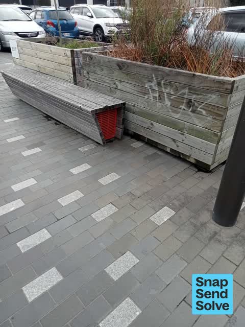
graffiti on planter boxs nearby
 Graffiti on a fence, building or structure, 7 Sept 2026
graffiti on planter boxs nearby
 Graffiti on a fence, building or structure, 9 Feb 2026
Graffiti on planter boxes down Lava Lane. Thank you.
 Roads - General, 3 Oct 2025
There's a loose paving stone on the street or they are wobbly.
 Graffiti on a cabinet, pole or railway asset, 22 Jun 2024
White paint tag on wooden pole EV305 by 107 St Asaph Street.
 Graffiti somewhere else, 30 Mar 2024
Across the road from Maseratti car salon
- Poles and Signage - General, 20 Nov 2023
- Damaged Street Sign, 20 Nov 2023
- Vandalism - General, 8 Feb 2023
 Graffiti, 22 Jun 2022
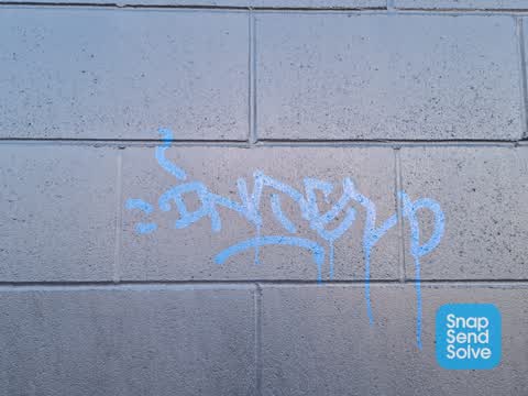
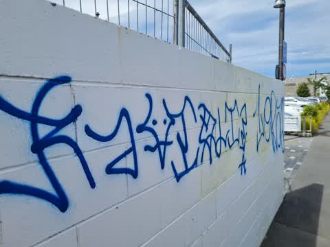
Tagging on block wall on st asaph street
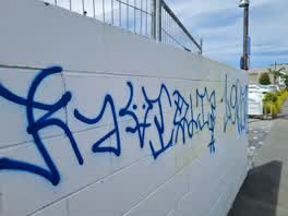 Graffiti, 20 Dec 2021
105 st asaph street
 Roading/Streets, 14 Feb 2021
Car yard parking their vehicle over the cycleway (again)
Elsewhere on Saint Asaph Street
- 207 Saint Asaph Street, 79 reports
- 56 Saint Asaph Street, 55 reports
- 303 Saint Asaph Street, 55 reports
- 295 Saint Asaph Street, 54 reports
- 215 Saint Asaph Street, 46 reports
- 270 Saint Asaph Street, 44 reports
- 255 Saint Asaph Street, 44 reports
- 251 Saint Asaph Street, 41 reports
The civic layer
This ground votes in Central ward, the Papanui-Innes-Central community board is its local layer. Ward lines don’t always follow suburb lines; this one is measured at the pin, not the suburb’s centre. The whole roll is at /wards.
Saint Asaph Street, the whole record → · Everything about Christchurch Central City → · What stood on this ground → · On the map → · From the air, RetroLens holds the Crown’s aerials back to 1936; search the address there →
Questions, answered briefly
13 council reports on record since February 2021, most often graffiti on a fence, building or structure (4), graffiti (2), vandalism - general (1).
Christchurch Central City, Christchurch, on Saint Asaph Street.
The heritage register names 5 places at or beside it, St Michael's School Hall and Setting, St Michael's School Stone Building and Setting.
Tiffany Reserve, 247 m to its edge.