130-134 Oxford Terrace, Christchurch Central City
16 reports on record since November 2016 · 16 with photographs. The street’s heaviest record is 159 Oxford Terrace, 181 reports on file. Indicative rating valuation and school zones, hazards, bin day and what stood here before.
What gets reported here
- Roading/Streets, 10
- Graffiti, 4
- Rubbish/Recycling, 1
- Parks, 1
Photographed here 16 on record
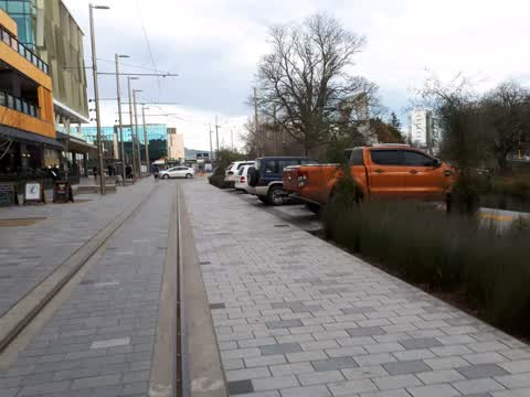
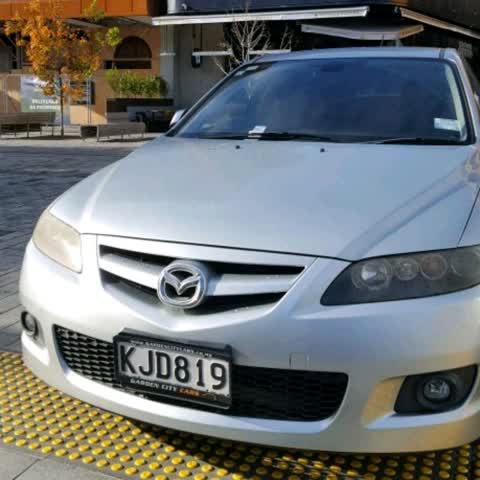

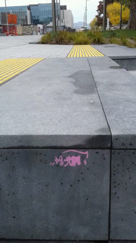
Reported here
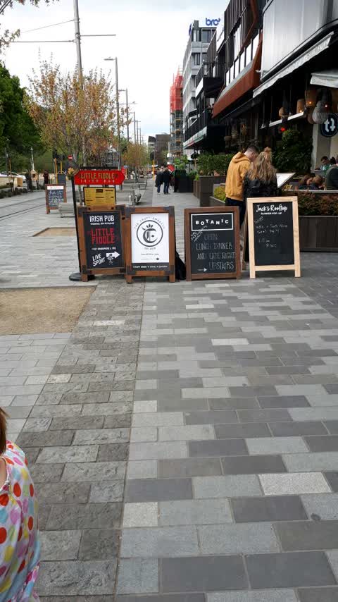
Roading/Streets,
A board blocking the accessible path of travel, particularly for vision impaired travelers following the tactile deliniator
Roading/Streets,
Roading/Streets,
Menu board outside fenced dining area is an instance
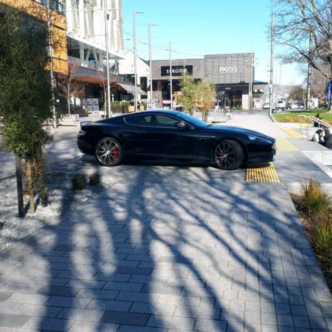
Parks,
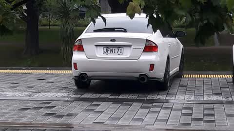
It's really disrespectful to park illegally by the bridge of remembrance. Penalty should be strictly enforced.
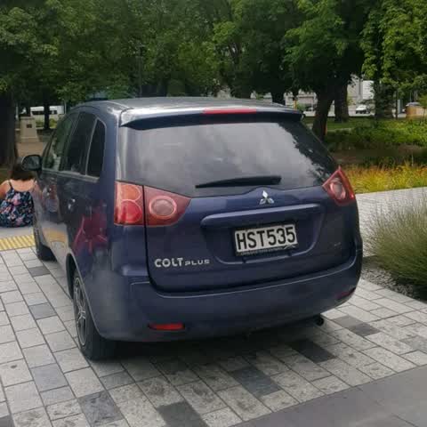
Roading/Streets,
Yet another parker
Rubbish/Recycling,
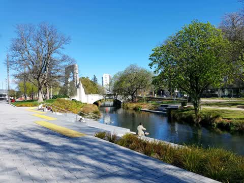
Where are the rubbish bins provided for such a beautiful and popular lunch spot, have just seen wildlife eat plastic from the garden, the on
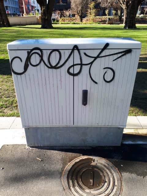
Graffiti,
Black spray paint on box
Roading/Streets,
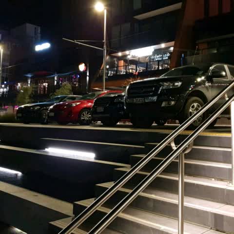
People are turning the new waterfront on Oxford Tce into their own free private carpark after dark. I thought the whole concept of the area
Roading/Streets,
Why are all these cars allowed to park here and it also ruins the view
Roading/Streets,
Please add a no parking sign. It's very disrespectful to be parking there by the bridge of rememberance. A higher fine as well.. stop treati
Roading/Streets,
Is this legal? Parking on The Terrace
Graffiti,
On polished stone step
Roading/Streets,
Cars parking on the promenade at all hours of the day and night.
Roading/Streets,
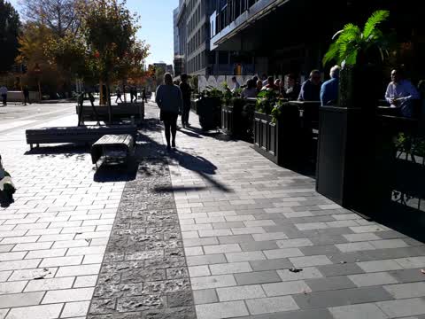
Pathway is sticky to walk on
Graffiti,
Graffiti,
Between steps and bridge
Also reported on Oxford Terrace
- 159 Oxford Terrace, 181 reports
- 153 Oxford Terrace, 174 reports
- 95 Oxford Terrace, 126 reports
- 211 Oxford Terrace, 126 reports
- 182 Oxford Terrace, 122 reports
- 184 Oxford Terrace, 109 reports
- 294 Oxford Terrace, 92 reports
- 152 Oxford Terrace, 87 reports
From the air, then
Sourced from Canterbury Maps and partners. LINZ, CC BY 3.0 NZ. Each frame is cut from Environment Canterbury’s historic imagery MapServer for that decade, only where the Footprints layer names a CC BY survey (NZAM-covered spots stay out). RetroLens holds more Crown aerials →
The street’s crash record
NZTA’s record names Oxford Terrace in 56 crashes that hurt somebody since 2006, 1 person killed, 11 seriously hurt.
The green nearby
- Bridge Of Remembrance, 66 m to the edge · Botanic
- Friendship Corner, 89 m to the edge · Botanic
- Scott Statue Reserve, 138 m to the edge · Botanic
- Tiffany Reserve, 147 m to the edge
- Godley Statue Reserve, 226 m to the edge · Botanic
Parks within half a kilometre, measured to the boundary, the council’s open data.
The civic shelf nearby
- Civic Offices, 187 m away · Council office
- Scales, 255 m away · Car park
- Triangle, 270 m away · Car park
- Re:start - Lichfield Street, 324 m away · Car park
- Turanga Library, 379 m away · Library · Cathedral Square, Christchurch
- Armagh Street, 454 m away · Car park
Libraries, halls and the rest within half a kilometre, the council’s open data.
On the doorstep
- Roca, 17 m away · Restaurants
- Chiwahwah, 18 m away · Restaurants
- Fat Eddies, 18 m away · Bars & pubs
- Grant Thornton, 18 m away · Business
Businesses within four hundred metres, measured at the pin: OpenStreetMap and the council directories.
The bus nearby
- Hereford St near Montreal St, 232 m away · route 8
- Hereford St near Montreal St, 233 m away · route 8
The closest Metro stops, within four hundred and fifty metres.
The tracks through here
- Walk and bike track through Christchurch Central City, 2 m to the line · walk · bike
- Walk and bike track through Christchurch Central City, 7 m to the line · walk · bike
- Walk and bike track through Christchurch Central City, 110 m to the line · walk · bike
- Walk and bike track through Christchurch Central City, 111 m to the line · walk · bike
- Walk and bike track through Christchurch Central City, 173 m to the line · walk · bike
Tracks whose line passes within half a kilometre, measured to the line itself, the council’s open data.
The named ground
Named water within 500 m of this address, measured to the line or the edge; Named places within 1.5 km of this address; the council’s own structure register, bridges, boardwalks and steps standing nearby, the open map’s record.
The remembered names nearby
- The Somme, 40 m away ·
THE SOMME / This tree was planted to commemorate the 100th anniversary of New Zealand's in
· 2016 - 2835 Sergeant Henry James Nicholas VC MM, 43 m away ·
2835 Sergeant Henry James Nicholas VC MM / 1st Battalion, Canterbury Regiment / (biographi
· 2016 - Citation for the Victoria Cross, 44 m away ·
Citation for the Victoria Cross / 24213 Pte Henry James Nicholas
· 2016
Inscribed plaques within two hundred and fifty metres, the register’s pins, not surveyed spots. The whole roll is at /plaques.
Renting nearby
new bonds in Christchurch Central City ran about $508 a week, $42 below the city median of $550, the suburb page keeps the rent record →.
What was here, Hereford Street Bridge
54 m away · 71 Hereford Street · located to ±24 m · the place’s own record →
On the register. Nothing researched here yet.
What was here, Mill Island and Setting
77 m away · 71 Hereford Street · located to ±19 m · the place’s own record →
On the register. Nothing researched here yet.
What was here, Bridge of Remembrance and Setting
87 m away · 88 Cambridge Terrace · located to ±27 m · the place’s own record →
On the register. Nothing researched here yet.
What was here, Public Trust Building
104 m away · 152 Oxford Terrace · located to ±24 m · the place’s own record →
On the register. Nothing researched here yet.
What was here, Captain Robert Falcon Scott Statue and Setting
146 m away · 153 Oxford Terrace · located to ±3 m · the place’s own record →
On the register. Nothing researched here yet.
The civic layer
This ground votes in Central ward, the Papanui-Innes-Central community board. Ward lines don’t always follow suburb lines; this one is measured at the pin, not the suburb’s centre.
What stood on this ground → · On the map → · From the air, the Crown’s aerials back to 1936; search the address on RetroLens →
Questions, answered briefly
16 council reports on record since November 2016, most often roading/streets (10), graffiti (4), rubbish/recycling (1).
Christchurch Central City, Christchurch, on Oxford Terrace.
The heritage register names 5 places at or beside it, Hereford Street Bridge, Mill Island and Setting.
Bridge Of Remembrance, 66 m to its edge.