140 Durham Street South, Christchurch Central City
11 reports on record since July 2023 · 9 with photographs. The street’s heaviest record is 214 Durham Street South — 33 reports on file. Indicative rating valuation and school zones, hazards, bin day and what stood here before.
What gets reported here
- Graffiti — 5
- Graffiti somewhere else — 3
- Water Leak — 1
- Graffiti on a fence, building or structure — 1
- General Request — 1
Photographed here 9 on record


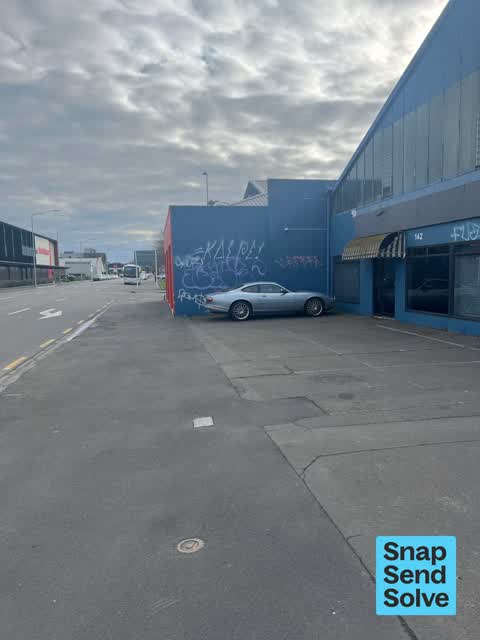


Reported here
 Graffiti on a fence, building or structure —
 Multiple paint tags on building wall at 142 Durham Street South are a major eyesore! If not in scope please ask the owner to clean it up.
 Graffiti somewhere else —
 Beside the new world supermarket parking lot
 General Request —
 Is that a dope plant in the window?
 Graffiti somewhere else —
  Graffiti somewhere else —
  Water Leak —
 Water leaking for several days
 Graffiti —
 Multiple paint tags at 142 Durham Street South facing the footpath.
 Graffiti —
  Graffiti —
 - Graffiti —
- Graffiti —
Also reported on Durham Street South
- 214 Durham Street South — 33 reports
- 176 Durham Street South — 30 reports
- 175 Durham Street South — 25 reports
- 241 Durham Street South — 22 reports
- 227 Durham Street South — 19 reports
- 158F Durham Street South — 19 reports
- 158 Durham Street South — 19 reports
- 188 Durham Street South — 18 reports
The street’s crash record
NZTA’s record names Durham Street South in 20 crashes that hurt somebody since 2006 — 4 seriously hurt, nobody killed.
The green nearby
- Carlyle Reserve — 319 m to the edge
Parks within half a kilometre, measured to the boundary — the council’s open data.
On the doorstep
- MvR Tailoring — 15 m away · Tailors
- New World Durham Street — 50 m away · Supermarkets
- The National — 52 m away · Galleries
- Guruji Indian Supermarket - Central City — 58 m away · Delis
Businesses within four hundred metres, measured at the pin — OpenStreetMap and the council directories.
The bus nearby
- Moorhouse Ave near Montreal St — 69 m away · route 140
- Moorhouse Ave near Orbell St — 117 m away · route 140
The closest Metro stops, within four hundred and fifty metres.
The tracks through here
- Walk and bike track through Christchurch Central City — 66 m to the line · walk · bike
- Walk and bike track through Christchurch Central City — 66 m to the line · walk · bike
- Walk and bike track through Christchurch Central City — 247 m to the line · walk · bike
- Walk and bike track through Christchurch Central City — 247 m to the line · walk · bike
- Walk and bike track through Christchurch Central City — 451 m to the line · walk · bike
Tracks whose line passes within half a kilometre, measured to the line itself — the council’s open data.
The named ground
Named places within 1.5 km of this address — the open map’s record.
Renting nearby
new bonds in Christchurch Central City ran about $508 a week — $42 below the city median of $550 — the suburb page keeps the rent record →.
What was here — New City Hotel and Setting
215 m away · located to ±20 m · the place’s own record →
On the register. Nothing researched here yet.
The civic layer
This ground votes in Central ward — the Papanui-Innes-Central community board. Ward lines don’t always follow suburb lines; this one is measured at the pin, not the suburb’s centre.
What stood on this ground → · On the map → · From the air — the Crown’s aerials back to 1936; search the address on RetroLens →
Questions, answered briefly
11 council reports on record since July 2023 — most often graffiti (5), graffiti somewhere else (3), water leak (1).
Christchurch Central City, Christchurch — on Durham Street South.
The heritage register names a place at or beside it — New City Hotel and Setting.
Carlyle Reserve — 319 m to its edge.