154 Worcester Street, Christchurch Central City
34 reports on record since March 2018 · 32 with photographs. The street’s heaviest record is 142 Worcester Street — 103 reports on file. Indicative rating valuation and school zones, hazards, bin day and what stood here before.
What gets reported here
Photographed here 32 on record




Reported here
 Graffiti on a fence, building or structure —
Graffiti on street lamp
 Graffiti on a fence, building or structure —
Graffiti on street light pole
 Road Signage —
The signage for the stadium traffic management plan needs improvement. Signs and fencing gets left for weeks around the vicinity of Latimer
 Graffiti on a traffic light pole or cabinet, or wa —
Latimer Sq, outside The Christchurch Club - second street light post from corner of Hereford St is tagged
 Graffiti on a fence, building or structure —
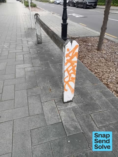
White paint tag on wooden rail top by 154 Worcester Street.
 Graffiti on a traffic light pole or cabinet, or wa —
White paint tag on art deco lamp pole by 154 Worcester Street.
 Graffiti on a fence, building or structure —
See pic
 Graffiti on a fence, building or structure —
See pic
 Graffiti on a fence, building or structure —
See pic
 Graffiti on a fence, building or structure —
Graffiti on black block seating near corner
 Graffiti on a fence, building or structure —
Water meter
 Graffiti on a fence, building or structure —
Historic structure
 Pavement - Damaged —
Paving stones lifted. Danger to pedestrians.
 Graffiti on a fence, building or structure —
Silver and black paint tags on art deco lamp post and glass by 154 Worcester Street.
- Overgrown Vegetation —
My friend is totally blind. She walks from Latimer Square along the south side of Worcester St. The footpath is very wide. She uses the 25 c
 Graffiti somewhere else —
Seat
 Graffiti on a cabinet, pole or railway asset —
Black paint tag on gas asset at 154 Worcester Street corner of Latimer Square.
 Graffiti on a sign, mural or public art —
 Graffiti —
Outside the Christchurch Club, Latimer Square side. Think I reported this ages ago
- Pavement - Damaged —
 Graffiti —
 Roading/Streets —
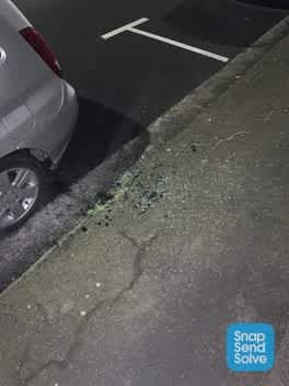
Glass in gutter and on footpath
 Graffiti —
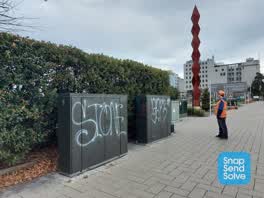
Large graffiti on unlabelled green boxes on corner of Christchurch Club - near large steel sculpture
 Graffiti —
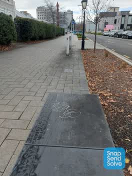
Tagging on stone box seat - corner of Latimer and Worcester St
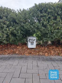 Graffiti —
Tagging on gas meter box outside the Christchurch Club on Worcester near Latimer Square.
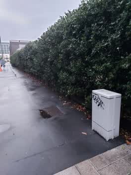 Graffiti —
Graffiti on grey GE box on corner of The Christchurch Club on Latimer Square
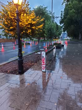 Graffiti —
Graffiti on staging post outside The Christchurch Club on Worcester St
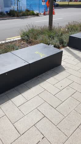 Graffiti —
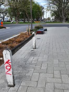 Graffiti —
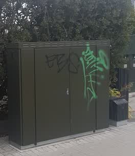 Graffiti —
This is by the Gentleman's club on Worcester St.
Graffiti —
Roading/Streets —
Broken glass on footpath
Graffiti —
Also reported on Worcester Street
- 142 Worcester Street — 103 reports
- 3 Worcester Street — 78 reports
- 78 Worcester Street — 69 reports
- 67 Worcester Street — 60 reports
- 138 Worcester Street — 60 reports
- 151 Worcester Street — 50 reports
- 40 Worcester Street — 40 reports
- 270 Worcester Street — 33 reports
The street’s crash record
NZTA’s record names Worcester Street in 64 crashes that hurt somebody since 2006 — 9 seriously hurt, nobody killed.
The green nearby
- Latimer Square — 39 m to the edge · Botanic · 2 ha
- Cathedral Square — 321 m to the edge · Botanic
- City Mall — 356 m to the edge
- High Street Triangles — 379 m to the edge
- Poplars Reserve — 384 m to the edge · Botanic
Parks within half a kilometre, measured to the boundary — the council’s open data.
The civic shelf nearby
- Turanga Library — 375 m away · Library · Cathedral Square, Christchurch
- Triangle — 414 m away · Car park
Libraries, halls and the rest within half a kilometre — the council’s open data.
On the doorstep
- Christchurch Club — 27 m away · Clubs
- Christchurch Central City Apartment — 114 m away · Apartments
- Cathedral Square Market — 142 m away · Markets
- Bloody Mary's — 164 m away · Bars & pubs
Businesses within four hundred metres, measured at the pin — OpenStreetMap and the council directories.
The bus nearby
- Hereford St near Latimer Square — 102 m away · route 60
- Hereford St near Latimer Square — 122 m away · route 60
The closest Metro stops, within four hundred and fifty metres.
The tracks through here
- Walk and bike track through Christchurch Central City — 12 m to the line · walk · bike
- Walk and bike track through Christchurch Central City — 164 m to the line · walk · bike
- Walk and bike track through Christchurch Central City — 254 m to the line · walk · bike
- Walk and bike track through Christchurch Central City — 266 m to the line · walk · bike
- Walk and bike track through Christchurch Central City — 348 m to the line · walk · bike
Tracks whose line passes within half a kilometre, measured to the line itself — the council’s open data.
The named ground
Named water within 500 m of this address, measured to the line or the edge; Named places within 1.5 km of this address; the council’s own structure register — bridges, boardwalks and steps standing nearby — the open map’s record.
The remembered names nearby
- Afac — 165 m away ·
afac / (dedication text illegible – backlit)
· 2013 - In Memory of / Jaime Robert McDowell Gilbert — 186 m away ·
IN MEMORY OF / JAIME ROBERT MCDOWELL GILBERT / WHO LOST HIS LIFE / AT THIS LOCATION IN THE
· 2018
Inscribed plaques within two hundred and fifty metres — the register’s pins, not surveyed spots. The whole roll is at /plaques.
Renting nearby
new bonds in Christchurch Central City ran about $508 a week — $42 below the city median of $550 — the suburb page keeps the rent record →.
What was here — Christchurch Club and Setting
17 m away · 154 Worcester Street · located to ±16 m · the place’s own record →
On the register. Nothing researched here yet.
What was here — Latimer Square and Setting
on this spot · located to ±119 m · the place’s own record →
On the register. Nothing researched here yet.
What was here — Shands Emporium: Former Commercial Building
181 m away · 217 Manchester Street · located to ±6 m · the place’s own record →
On the register. Nothing researched here yet.
What was here — Former Trinity Congregational Church and Setting
184 m away · 124 Worcester Street · located to ±14 m · the place’s own record →
On the register. Nothing researched here yet.
What was here — Commercial Building and Setting, Former State Insurance
203 m away · 58/28 Cathedral Square · located to ±28 m · the place’s own record →
On the register. Nothing researched here yet.
The civic layer
This ground votes in Central ward — the Papanui-Innes-Central community board. Ward lines don’t always follow suburb lines; this one is measured at the pin, not the suburb’s centre.
What stood on this ground → · On the map → · From the air — the Crown’s aerials back to 1936; search the address on RetroLens →
Questions, answered briefly
34 council reports on record since March 2018 — most often graffiti (13), graffiti on a fence, building or structure (10), roading/streets (2).
Christchurch Central City, Christchurch — on Worcester Street.
The heritage register names 5 places at or beside it — Christchurch Club and Setting, Latimer Square and Setting.
Latimer Square — 39 m to its edge, 2 ha.