151 Worcester Street, Christchurch Central City
50 reports on record since February 2018 · 38 with photographs. The street’s heaviest record is 142 Worcester Street — 103 reports on file. Indicative rating valuation and school zones, hazards, bin day and what stood here before.
What gets reported here
Photographed here 38 on record


Reported here
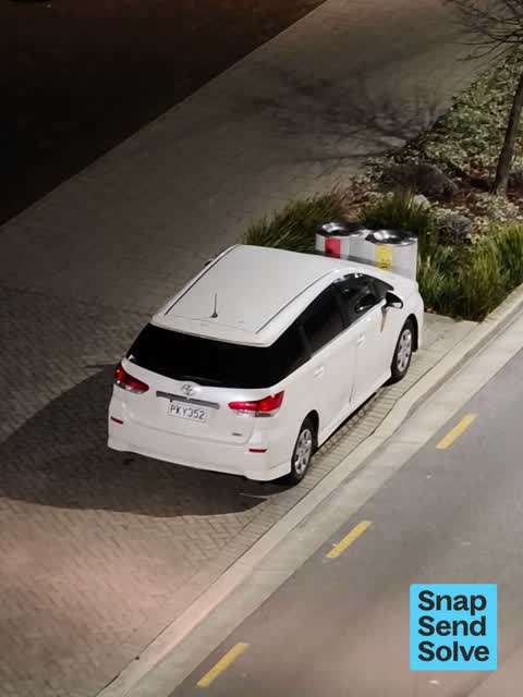
 Hazard — vehicle —
illegal parking
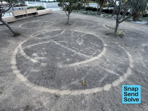
 Park - General Request —
E-SCOOTER DAMAGE TO PARK: Kids riding e-scooters are tearing up Rauora Park. The heavy scooters that allow excess speeds are causing damage
 Park - General Request —
Sunday morning rubbish left from Saturday night community feeding. There are no public toilets nearby so people urinate on Rauora park. This
 Pavement - Damaged —
Slip proof strip unstuck dog tripped on it so could a human
 Graffiti on a fence, building or structure —
On concrete wall by park
 Graffiti on a fence, building or structure —
 Fallen Tree —
Tree branch down in reserve
 Poles and Signage - General —
Cnr huanui lane and Worcester st. Graffiti on no stopping sign. Please clean ASAP. Complaints from councillers coming in about trade vehic
 Graffiti on a fence, building or structure —
 Graffiti on a fence, building or structure —
Graffiti on signage
 Graffiti on a fence, building or structure —
On seat
 Graffiti on a fence, building or structure —
Shared Zone Sign
 Graffiti on a fence, building or structure —
 Graffiti on a fence, building or structure —
TAGGING on concrete edging of park. Please use chemical removal to protect appearance of concrete. Thank you.
 Graffiti on a fence, building or structure —
 Graffiti on a fence, building or structure —
Graffiti on bin
 General Request —
 Graffiti on a sign, mural or public art —
 Park - General Request —
Lady had set up camp with her tent in Rauora park and is seen washing herself in these pics
 Damaged Street Sign —
 Hazard — vehicle —
Illegal parking
 Graffiti on a sign, mural or public art —
4Z black paint tag on reverse side of path sign by 151 Worcester Street, corner of Huanui Lane.
 Graffiti —
Property of chch city council oppsite 7/163 Worcester st appt
 Graffiti —
 Graffiti —
Meter Box
 Graffiti —
Shared Zone sign
 Graffiti —
Orion cabinet
 Abandoned Vehicle —
Been parked here for 4 days
- Hazard — vehicle —
- Graffiti —
- Graffiti —
- Graffiti —
- Graffiti —
- Graffiti —
- Pavement - General —
- Graffiti —
- Hazard — vehicle —
- Graffiti —
- Graffiti —
- Graffiti —
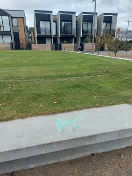 Graffiti —
Green tag on low concrete wall in Rauora Park near Worcester St
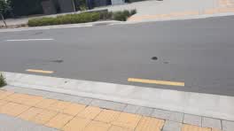 Roading/Streets —
Small potholes in surface of eastbound lane of Worcester St near the Christchurch Club & new housing build
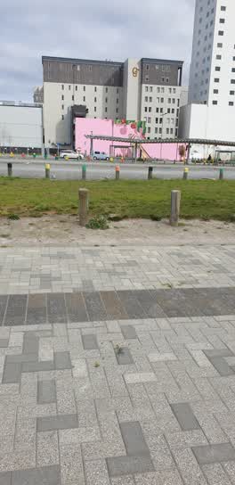 Roading/Streets —
Broken wine bottles. More towards North
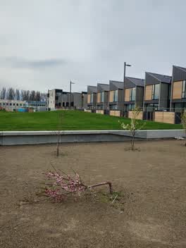 Parks —
Tree snapped in half. Needs replacing
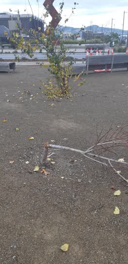 Parks —
Snapped tree
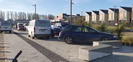 Roading/Streets —
I regularly commute by bike through Huanui Lane. The clutter of vehicles is getting worse and today it was ridiculous
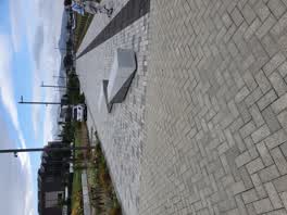 Roading/Streets —
relocate lane barrier, contractors are getting cheeky and parking in here
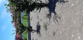 Parks —
Lots of weeds starting to grow on Gravel areas
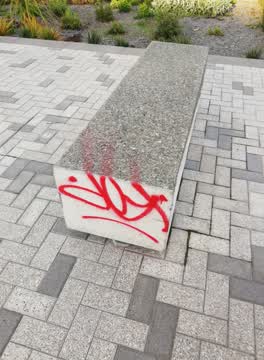 Graffiti —
Also reported on Worcester Street
- 142 Worcester Street — 103 reports
- 3 Worcester Street — 78 reports
- 78 Worcester Street — 69 reports
- 67 Worcester Street — 60 reports
- 138 Worcester Street — 60 reports
- 40 Worcester Street — 40 reports
- 154 Worcester Street — 34 reports
- 270 Worcester Street — 33 reports
The street’s crash record
NZTA’s record names Worcester Street in 64 crashes that hurt somebody since 2006 — 9 seriously hurt, nobody killed.
The green nearby
- Latimer Square — 123 m to the edge · Botanic · 2 ha
- Cathedral Square — 236 m to the edge · Botanic
- City Mall — 314 m to the edge
- Edmonds Band Rotunda — 326 m to the edge · Botanic
- High Street Triangles — 335 m to the edge
Parks within half a kilometre, measured to the boundary — the council’s open data.
The civic shelf nearby
- Turanga Library — 285 m away · Library · Cathedral Square, Christchurch
- Triangle — 359 m away · Car park
Libraries, halls and the rest within half a kilometre — the council’s open data.
On the doorstep
- Cathedral Square Market — 74 m away · Markets
- Christchurch Club — 88 m away · Clubs
- Purple Dragon Noodles Food Cart — 101 m away · Fast food
- The Church Pub — 107 m away · Bars & pubs
Businesses within four hundred metres, measured at the pin — OpenStreetMap and the council directories.
The bus nearby
- Manchester St Super Stop — 70 m away · route 1, route 5, route 7, route 8, route 27, route 29, route 44, route 86, route 91, route 92, route 95
- Manchester St Super Stop — 109 m away · route 1, route 5, route 7, route 8, route 27, route 29, route 44, route 86, route 91, route 92, route 95
The closest Metro stops, within four hundred and fifty metres.
The tracks through here
- Walk and bike track through Christchurch Central City — 17 m to the line · walk · bike
- Walk and bike track through Christchurch Central City — 79 m to the line · walk · bike
- Walk and bike track through Christchurch Central City — 226 m to the line · walk · bike
- Walk and bike track through Christchurch Central City — 279 m to the line · walk · bike
- Walk and bike track through Christchurch Central City — 297 m to the line · walk · bike
Tracks whose line passes within half a kilometre, measured to the line itself — the council’s open data.
The named ground
Named water within 500 m of this address, measured to the line or the edge; Named places within 1.5 km of this address; the council’s own structure register — bridges, boardwalks and steps standing nearby — the open map’s record.
The remembered names nearby
- In Memory of / Jaime Robert McDowell Gilbert — 105 m away ·
IN MEMORY OF / JAIME ROBERT MCDOWELL GILBERT / WHO LOST HIS LIFE / AT THIS LOCATION IN THE
· 2018 - Afac — 217 m away ·
afac / (dedication text illegible – backlit)
· 2013
Inscribed plaques within two hundred and fifty metres — the register’s pins, not surveyed spots. The whole roll is at /plaques.
Renting nearby
new bonds in Christchurch Central City ran about $508 a week — $42 below the city median of $550 — the suburb page keeps the rent record →.
What was here — Christchurch Club and Setting
80 m away · 154 Worcester Street · located to ±16 m · the place’s own record →
On the register. Nothing researched here yet.
What was here — Former Trinity Congregational Church and Setting
108 m away · 124 Worcester Street · located to ±14 m · the place’s own record →
On the register. Nothing researched here yet.
What was here — Shands Emporium: Former Commercial Building
110 m away · 217 Manchester Street · located to ±6 m · the place’s own record →
On the register. Nothing researched here yet.
What was here — Commercial Building and Setting, Former State Insurance
127 m away · 58/28 Cathedral Square · located to ±28 m · the place’s own record →
On the register. Nothing researched here yet.
What was here — Commercial Building Façade and Setting, Former A W Smith and Son's Central Garage/Mayfair-Cinerama Theatre
159 m away · 115A Worcester Street · located to ±12 m · the place’s own record →
On the register. Nothing researched here yet.
The civic layer
This ground votes in Central ward — the Papanui-Innes-Central community board. Ward lines don’t always follow suburb lines; this one is measured at the pin, not the suburb’s centre.
What stood on this ground → · On the map → · From the air — the Crown’s aerials back to 1936; search the address on RetroLens →
Questions, answered briefly
50 council reports on record since February 2018 — most often graffiti (17), graffiti on a fence, building or structure (10), roading/streets (4).
Christchurch Central City, Christchurch — on Worcester Street.
The heritage register names 5 places at or beside it — Christchurch Club and Setting, Former Trinity Congregational Church and Setting.
Latimer Square — 123 m to its edge, 2 ha.