155 Victoria Street, Christchurch Central City
28 reports on record since February 2016 · 20 with photographs. The most-reported address on Victoria Street. Indicative rating valuation and school zones, hazards, bin day and what stood here before.
What gets reported here
- Water Leak — 8
- Pavement - Damaged — 5
- Graffiti — 2
- Street Gutters / Storm Water — 1
- Rubbish/Recycling — 1
- Roading/Streets — 1
Photographed here 20 on record




Reported here
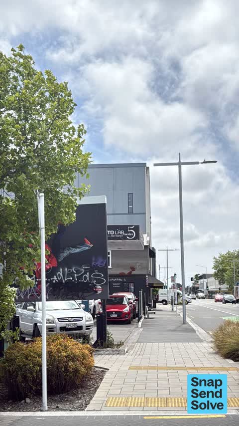
 Graffiti on a sign, mural or public art —
Graffiti on a sign
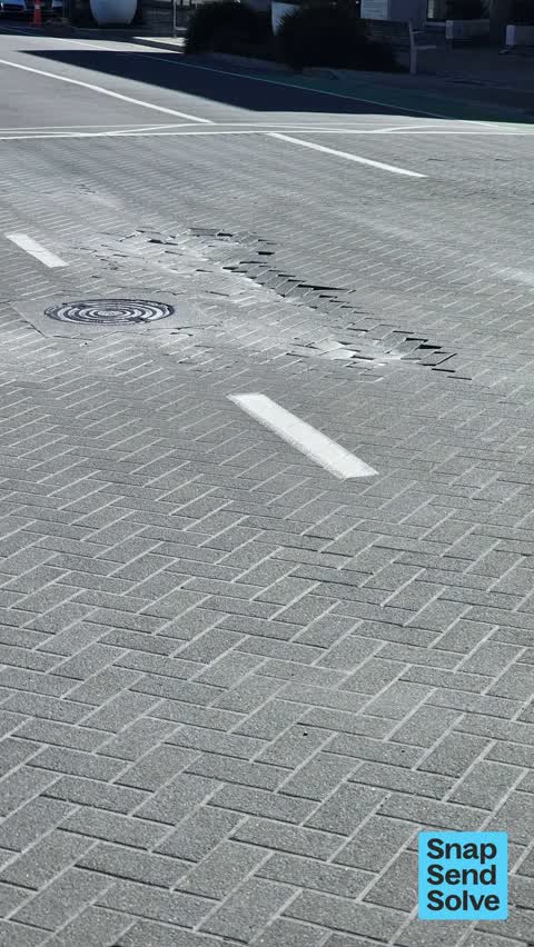
 Water Leak —
Water leak under pavement corner Dorset and Victoria Street. Cheers.
 Water Leak —
Water bubbling up through pavers on corner Victoria Street and Dorset, outside house of travel doors
 Water Leak —
 Damaged Road —
Paving seems to have sunken over pipes in road. Very loose and moving about under tirers
 Water Leak —
Water leak under pavement that is progressively getting worse. 155 Victoria Street, corner Dorset Street, by Mayfair Hotel.
 Pavement - Damaged —
Its been like this for atleast 2 mobths and council havnt done anything to fix it. Not very safe.
 Graffiti somewhere else —
On green utility box Victoria St at Dorset st
 Graffiti on a cabinet, pole or railway asset —
 Street Gutters / Storm Water —
Missing cover in footpath on council property Victoria St outside Munns
 Accessibility —
Signage from stores is blocking the footpath, particularly bad for visually impaired individuals as it is right in the cross walk area
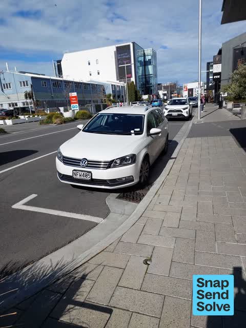
 Poles and Signage - General —
The front sign of this parking area p$60 Mon to Thurs 9am to 5pm Fri to sun 9am to 8.30pm is missing. There are about 7 spaces that can't b
 Graffiti on a fence, building or structure —
 Road Signage —
Signs do not match
- Water Leak —
- Water Leak —
- Water Leak —
- Pavement - Damaged —
- Flooding —
- Pavement - Damaged —
- Pavement - Damaged —
- Pavement - Damaged —
 Pavement - General —
Health and safety surely?
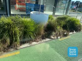 Rubbish/Recycling —
Rubbish and weeds
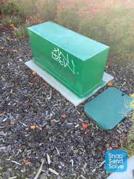 Graffiti —
White paint tag on green asset on the corner of Dorset and Victoria Streets.
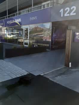 Water Leak —
toby box leaking
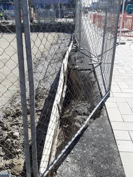 Roading/Streets —
need to be sent to building consent officer for hotel on corner and enforcement officer, footpath is now collapsing with live water sub main
Graffiti —
Didn't remove graffiti on spark
Also reported on Victoria Street
- 157 Victoria Street — 22 reports
- 40 Victoria Street — 16 reports
- 20 Victoria Street — 14 reports
- 91 Victoria Street — 13 reports
- 95 Victoria Street — 12 reports
- 92 Victoria Street — 11 reports
- 143 Victoria Street — 11 reports
- 108 Victoria Street — 11 reports
The street’s crash record
NZTA’s record names Victoria Street in 31 crashes that hurt somebody since 2006 — 8 seriously hurt, nobody killed.
The green nearby
- Hagley Park North — 189 m to the edge · Sports ground · 91 ha
- Carlton Mill Riverbank — 313 m to the edge
- Little Hagley Park — 321 m to the edge · Botanic · 7 ha
- Aldred Reserve — 403 m to the edge
- Victoria Triangles — 450 m to the edge
Parks within half a kilometre, measured to the boundary — the council’s open data.
On the doorstep
- House of Travel — 5 m away · Travel agents
- Mayfair Luxury Hotel — 8 m away · Cafés
- The Mayfair — 25 m away · Hotels
- Majestic at Mayfair — 35 m away · Restaurants
Businesses within four hundred metres, measured at the pin — OpenStreetMap and the council directories.
The bus nearby
- Victoria St near Dorset St — 48 m away · route 1, route 29, route 95
- Bealey Ave — 70 m away · route 1, route 29, route 95
The closest Metro stops, within four hundred and fifty metres.
The tracks through here
- Walk and bike track through Christchurch Central City — 6 m to the line · walk · bike
- Walk and bike track through Christchurch Central City — 181 m to the line · walk · bike
- Walk and bike track through Christchurch Central City — 197 m to the line · walk · bike
- Walk and bike track through Christchurch Central City — 237 m to the line · walk · bike
- Walk and bike track through Christchurch Central City — 260 m to the line · walk · bike
Tracks whose line passes within half a kilometre, measured to the line itself — the council’s open data.
The named ground
Named water within 500 m of this address, measured to the line or the edge; Named places within 1.5 km of this address; the council’s own structure register — bridges, boardwalks and steps standing nearby — the open map’s record.
Renting nearby
new bonds in Christchurch Central City ran about $508 a week — $42 below the city median of $550 — the suburb page keeps the rent record →.
What was here — Former Dwellings and Setting, Santa Barbara
95 m away · 169 Victoria Street · located to ±12 m · the place’s own record →
On the register. Nothing researched here yet.
What was here — Dwellings and Setting, Dorset Street Flats
106 m away · 8 Dorset Street · located to ±18 m · the place’s own record →
On the register. Nothing researched here yet.
What was here — Former Bishop's Chapel and Setting
107 m away · 100 Park Terrace · located to ±8 m · the place’s own record →
On the register. Nothing researched here yet.
What was here — Knox Church
136 m away · 28 Bealey Avenue · located to ±20 m · the place’s own record →
On the register. Nothing researched here yet.
What was here — Dwelling and Setting
144 m away · 1/2 Beveridge Street · located to ±5 m · the place’s own record →
On the register. Nothing researched here yet.
The civic layer
This ground votes in Central ward — the Papanui-Innes-Central community board. Ward lines don’t always follow suburb lines; this one is measured at the pin, not the suburb’s centre.
What stood on this ground → · On the map → · From the air — the Crown’s aerials back to 1936; search the address on RetroLens →
Questions, answered briefly
28 council reports on record since February 2016 — most often water leak (8), pavement - damaged (5), graffiti (2).
Christchurch Central City, Christchurch — on Victoria Street.
The heritage register names 5 places at or beside it — Former Dwellings and Setting, Santa Barbara, Dwellings and Setting, Dorset Street Flats.
Hagley Park North — 189 m to its edge, 91 ha.