40 Victoria Street, Christchurch Central City
16 reports on record since July 2020 · 9 with photographs. The street’s heaviest record is 155 Victoria Street, 28 reports on file. Indicative rating valuation and school zones, hazards, bin day and what stood here before.
What gets reported here
Photographed here 9 on record




Reported here
 Graffiti on a fence, building or structure,
Graffiti on a flower pot
 Street Gutters / Storm Water,
Gutter seems blocked by the Casino in Peterborough Street.
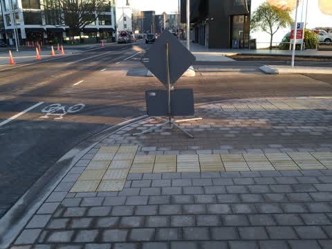
 Poles and Signage - General,
Road sign in garden behind the casino
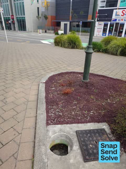
 Water General,
No drain cover outside casino
 Damaged Street Sign,
Was a give way sign
 Street Gutters / Storm Water,
Water leaking? Underneath the footpath on Peterborough Street a tad east of Victoria Street.
 Water Leak,
Garden has filled with water, looks more like a leak as recent rain water has drained elsewhere.
 Water Leak,
THIS LEAK HAS BEEN RUNNING 24/7 FOR SEVERAL YEARS. Estimating leak rate 5L/minute. Why is this unfixable?
- Street Gutters / Storm Water,
- Water Leak,
- Graffiti,
- Water Leak,
- Rubbish and Bins - General,
- Rubbish and Bins - General,
- Street Gutters / Storm Water,
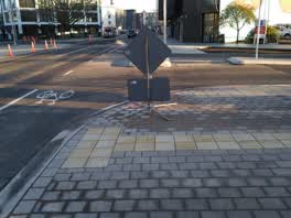 Roading/Streets,
For CTOC Another Fulton Hogan sign on footpath without cone delineating it for sight impaired pedestrians. Note Fulton Hogan TTM truck on ot
Also reported on Victoria Street
- 155 Victoria Street, 28 reports
- 157 Victoria Street, 22 reports
- 20 Victoria Street, 15 reports
- 91 Victoria Street, 13 reports
- 95 Victoria Street, 12 reports
- 92 Victoria Street, 11 reports
- 143 Victoria Street, 11 reports
- 108 Victoria Street, 11 reports
From the air, then
Sourced from Canterbury Maps and partners. LINZ, CC BY 3.0 NZ. Each frame is cut from Environment Canterbury’s historic imagery MapServer for that decade, only where the Footprints layer names a CC BY survey (NZAM-covered spots stay out). RetroLens holds more Crown aerials →
The street’s crash record
NZTA’s record names Victoria Street in 31 crashes that hurt somebody since 2006, 8 seriously hurt, nobody killed.
The green nearby
- Victoria Triangles, you are in it
- Cranmer Square, 170 m to the edge · Botanic · 2 ha
- Aldred Reserve, 215 m to the edge
- Victoria Square, 329 m to the edge · Botanic · 2 ha
- Canterbury Provincial Council Reserve, 371 m to the edge · Botanic
Parks within half a kilometre, measured to the boundary, the council’s open data.
The civic shelf nearby
- Aldersgate, 269 m away · Car park
- Armagh Street, 317 m away · Car park
Libraries, halls and the rest within half a kilometre, the council’s open data.
On the doorstep
- Monza Sports Bar - Christchurch Casino, 25 m away · Bars & pubs
- 71st Cafe & Bar, 32 m away · Restaurants
- Thirsty Liquor, 33 m away · Bottle stores
- Symrose's SuperFresh, 34 m away · Dairies & convenience
Businesses within four hundred metres, measured at the pin: OpenStreetMap and the council directories.
The bus nearby
- Victoria St near Peterborough St, 96 m away · route 1, route 29, route 95
- Salisbury St near Victoria St, 165 m away · route 1, route 29, route 95
The closest Metro stops, within four hundred and fifty metres.
The tracks through here
- Walk and bike track through Christchurch Central City, 18 m to the line · walk · bike
- Walk and bike track through Christchurch Central City, 138 m to the line · walk · bike
- Walk and bike track through Christchurch Central City, 351 m to the line · walk · bike
- Walk and bike track through Christchurch Central City, 358 m to the line · walk · bike
- Walk and bike track through Christchurch Central City, 371 m to the line · walk · bike
Tracks whose line passes within half a kilometre, measured to the line itself, the council’s open data.
The named ground
Named water within 500 m of this address, measured to the line or the edge; Named places within 1.5 km of this address; the council’s own structure register, bridges, boardwalks and steps standing nearby, the open map’s record.
The remembered names nearby
- Victoria Triangles plaque, 174 m away · 2014
- Diamondjubilee / 1837 - 1897, 176 m away ·
DiamondJubilee / 1837 - 1897
· 2009 - Victoria Triangles plaque, 176 m away · 2009
Inscribed plaques within two hundred and fifty metres, the register’s pins, not surveyed spots. The whole roll is at /plaques.
Renting nearby
new bonds in Christchurch Central City ran about $508 a week, $42 below the city median of $550, the suburb page keeps the rent record →.
What was here, Former Shop/Dwelling and Setting
157 m away · 40 Cranmer Square · located to ±6 m · the place’s own record →
On the register. Nothing researched here yet.
What was here, Victoria Mansions and Setting
158 m away · F/91 Victoria Street · located to ±21 m · the place’s own record →
On the register. Nothing researched here yet.
What was here, Dwelling and Setting
167 m away · 38 Cranmer Square · located to ±5 m · the place’s own record →
On the register. Nothing researched here yet.
What was here, Jubilee Clock Tower and Setting
178 m away · 95 Victoria Street · located to ±5 m · the place’s own record →
On the register. Nothing researched here yet.
What was here, Dwelling and Setting, Ironside House
212 m away · 32 Salisbury Street · located to ±15 m · the place’s own record →
On the register. Nothing researched here yet.
The civic layer
This ground votes in Central ward, the Papanui-Innes-Central community board. Ward lines don’t always follow suburb lines; this one is measured at the pin, not the suburb’s centre.
What stood on this ground → · On the map → · From the air, the Crown’s aerials back to 1936; search the address on RetroLens →
Questions, answered briefly
16 council reports on record since July 2020, most often water leak (4), street gutters / storm water (4), rubbish and bins - general (2).
Christchurch Central City, Christchurch, on Victoria Street.
The heritage register names 5 places at or beside it, Former Shop/Dwelling and Setting, Victoria Mansions and Setting.
Victoria Triangles, the address is inside it.