156 Oxford Terrace
9 council reports since July 2015, 9 carrying a photograph. The street’s heaviest record is 159 Oxford Terrace, 180 reports on file.
On the register here
- Mill Island and Setting, 71 Hereford Street (30m)
- Public Trust Building, 152 Oxford Terrace (31m)
- Hereford Street Bridge, 71 Hereford Street (47m)
- Captain Robert Falcon Scott Statue and Setting, 153 Oxford Terrace (61m)
- Worcester Street Bridge and Setting (101m)
From the air, then
Sourced from Canterbury Maps and partners. LINZ, CC BY 3.0 NZ. Each frame is cut from Environment Canterbury’s historic imagery MapServer for that decade, only where the Footprints layer names a CC BY survey (NZAM-covered spots stay out). RetroLens holds more Crown aerials →
The green nearby
- Scott Statue Reserve, 51 m to the edge · Botanic
- Bridge Of Remembrance, 152 m to the edge · Botanic
- Godley Statue Reserve, 171 m to the edge · Botanic
- Friendship Corner, 174 m to the edge · Botanic
- Canterbury Provincial Council Reserve, 209 m to the edge · Botanic
Parks within half a kilometre, measured to the boundary, the council’s open data. The whole roll is at /parks.
The civic shelf nearby
- Civic Offices, 175 m away · Council office
- Triangle, 289 m away · Car park
- Scales, 306 m away · Car park
- Turanga Library, 320 m away · Library
- Armagh Street, 368 m away · Car park
- Re:start - Lichfield Street, 397 m away · Car park
- Aldersgate, 414 m away · Car park
- Rolleston Avenue, 492 m away · Car park
Libraries, halls and the rest within half a kilometre, the council’s open data.
On the doorstep
- Mr Brightside Rooftop Bar, 15 m away · Bars & pubs
- Therapy, 27 m away · Cafés
- Mister Brightside, 36 m away · Bars & pubs
- Airborn Paddle Hire, 39 m away · Attractions
Businesses within four hundred metres, measured at the pin, OpenStreetMap and the council directories.
The bus nearby
- Hereford St near Montreal St, 234 m away · route 8
- Hereford St near Montreal St, 238 m away · route 8
The closest Metro stops, within four hundred and fifty metres.
The tracks through here
- Walk and bike track through Christchurch Central City, 22 m to the line · walk · bike
- Walk and bike track through Christchurch Central City, 45 m to the line · walk · bike
- Walk and bike track through Christchurch Central City, 64 m to the line · walk · bike
- Walk and bike track through Christchurch Central City, 87 m to the line · walk · bike
- Walk and bike track through Christchurch Central City, 88 m to the line · walk · bike
Tracks whose line passes within half a kilometre, the council’s open data.
The named ground
Named water within 500 m of this address, measured to the line or the edge; Named places within 1.5 km of this address; the council’s own structure register, bridges, boardwalks and steps standing nearby, the open map’s record.
The remembered names nearby
- Avon Riverbank Central City plaque, 18 m away ·
(illegible – tree plaque at base, distant)
- In Memory of the A‑bomb Victims of Hiroshima and Nagasaki, 48 m away ·
In memory of the A‑Bomb victims of Hiroshima and Nagasaki / He tohu whakamaumahara kite iw
· 2000 - Robert Falcon Scott — Memorial Base, 60 m away ·
ROBERT FALCON SCOTT — memorial base (duplicate of main pedestal)
· 2009
Inscribed plaques within two hundred and fifty metres, the register’s pins, not surveyed spots. The whole roll is at /plaques.
Renting nearby
new bonds in Christchurch Central City ran about $508 a week, $42 below the city median of $550, the suburb page keeps the rent record →.
What gets reported here
- Roading/Streets, 6
- Water Supply, 1
- Parks, 1
- Graffiti, 1
Photographed here 9 on record
What’s on record
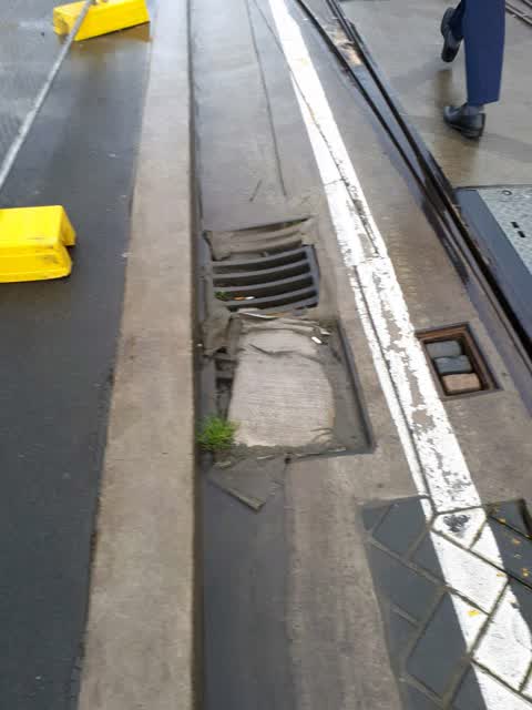
Roading/Streets, 4 Sept 2018
Blocked sump. Geofabric silt trap needs replacing - badly blocked
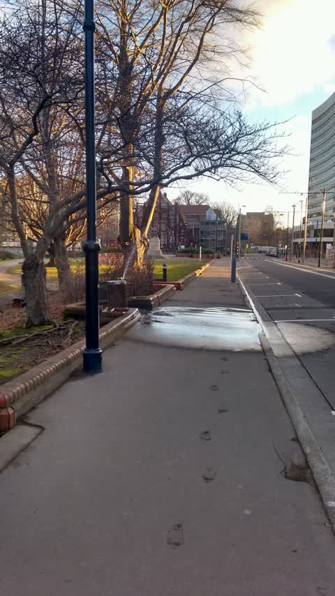
Roading/Streets, 10 Feb 2017
Trip hazard due to uneven footpath surface ..hard to judge contour when approaching from both ways .person I was with fell over heading east
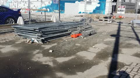
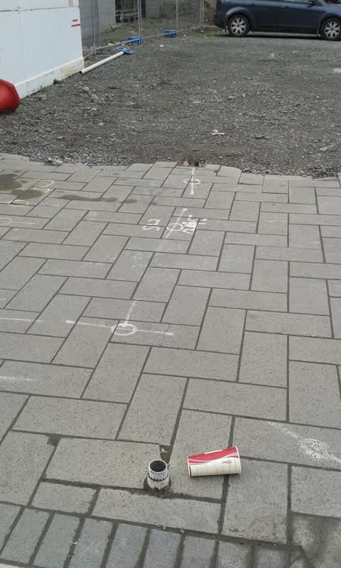
Roading/Streets, 9 Aug 2016
Collapsed road signs. Rubbish abandoned road cones trip hazards
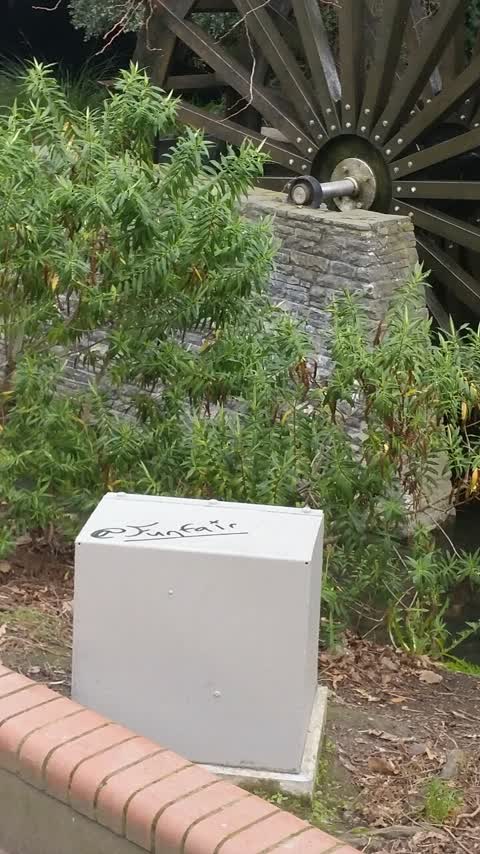
Graffiti, 8 Aug 2016
Next to mill island waterwheel
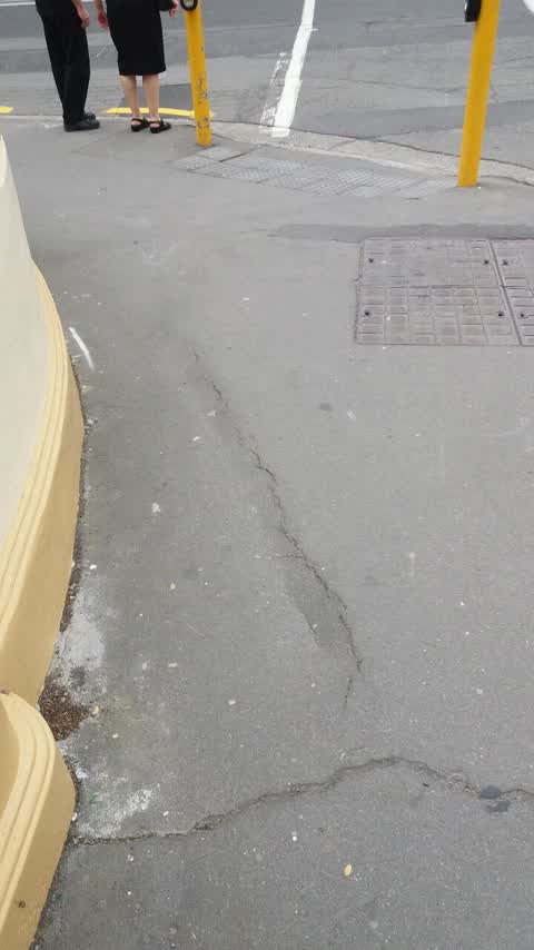
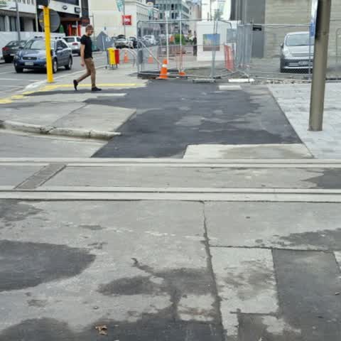
Roading/Streets, 30 Jun 2016
Poor definition here where asphalt seal repair spans footpath and roadway. It is now very unclear where the footpath ends and roadway begins
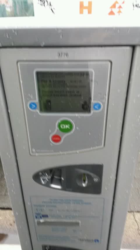
Roading/Streets, 28 Jan 2016
Meter not giving ticket for card payment. Today and Tuesday. OK yesterday for coins. Our rego djb33
Roading/Streets, 4 Sept 2015
Sign in car psrk
Parks, 13 Jul 2015
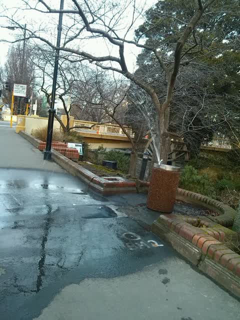
Water fountain overly excited
Water Supply, 13 Jul 2015
Water fountain is gushing water all over footpath and road. Wasteful and dangerous in these icy conditions
Elsewhere on Oxford Terrace
- 159 Oxford Terrace, 180 reports
- 153 Oxford Terrace, 174 reports
- 95 Oxford Terrace, 126 reports
- 211 Oxford Terrace, 126 reports
- 182 Oxford Terrace, 122 reports
- 184 Oxford Terrace, 109 reports
- 294 Oxford Terrace, 92 reports
- 152 Oxford Terrace, 87 reports
The street’s crash record
NZTA’s record names Oxford Terrace in 56 crashes that hurt somebody since 2006, 1 person killed, 11 seriously hurt.
The civic layer
This ground votes in Central ward, the Papanui-Innes-Central community board is its local layer. Ward lines don’t always follow suburb lines; this one is measured at the pin, not the suburb’s centre. The whole roll is at /wards.
Oxford Terrace, the whole record → · Everything about Christchurch Central City → · What stood on this ground → · On the map → · From the air, RetroLens holds the Crown’s aerials back to 1936; search the address there →
Questions, answered briefly
9 council reports on record since July 2015, most often roading/streets (6), water supply (1), parks (1).
Christchurch Central City, Christchurch, on Oxford Terrace.
The heritage register names 5 places at or beside it, Mill Island and Setting, Public Trust Building.
Scott Statue Reserve, 51 m to its edge.