158 High Street, Christchurch Central City
18 reports on record since December 2020 · 16 with photographs. The street’s heaviest record is 146 High Street — 57 reports on file. Indicative rating valuation and school zones, hazards, bin day and what stood here before.
What gets reported here
Photographed here 16 on record





Reported here
 Poles and Signage - General —
graffiti on light tram lamp post
 Graffiti on a fence, building or structure —
graffiti east side of this building
 Graffiti on a fence, building or structure —
Graffiti on ccc box
 Graffiti on a sign, mural or public art —
 Graffiti on a cabinet, pole or railway asset —
Black, white and yellow paint tags on anonymous padlocked asset at 158 High Street.
 Graffiti on a fence, building or structure —
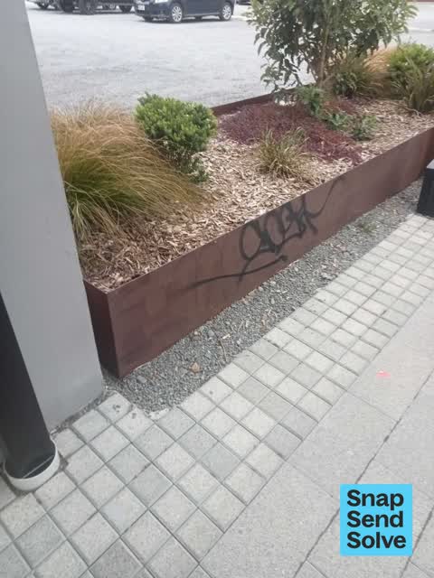
White paint tag on iron planter box facing the footpath at 158 High Street.
 Graffiti somewhere else —
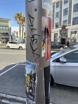 Graffiti on a cabinet, pole or railway asset —
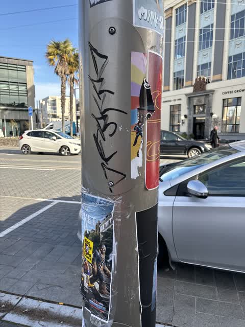
Black paint tag (plus sticky tags galore) on tramlines pole by 158 High Street.
 Graffiti on a fence, building or structure —
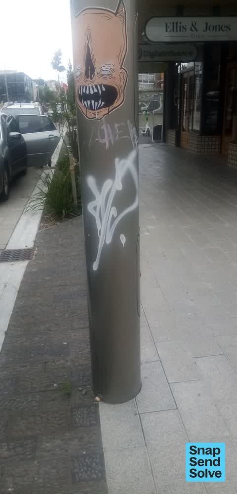
white graffiti on gutter pole
 Graffiti on a fence, building or structure —
graffiti on brick wall
 Graffiti —
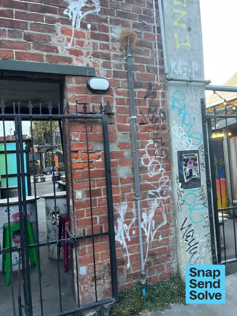
Multiple paint and sticky tags on anonymous padlocked asset by 158 High Street.
 Graffiti —
 Graffiti —
 Fallen Tree —
Landscape Fallen tree
- Graffiti —
- Graffiti —
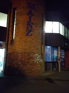 Graffiti —
next to C1 cafe
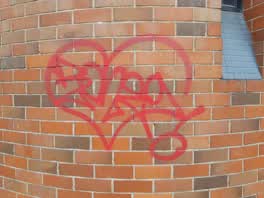 Graffiti —
at Mainz Southern institute of technology, Christchurch city areas. Next to one Espresso building.
Also reported on High Street
- 146 High Street — 57 reports
- 285 High Street — 42 reports
- 188 High Street — 41 reports
- 291F High Street — 35 reports
- 181 High Street — 34 reports
- 216 High Street — 28 reports
- 269 High Street — 26 reports
- 250 High Street — 26 reports
The street’s crash record
NZTA’s record names High Street in 8 crashes that hurt somebody since 2006 — 1 seriously hurt, nobody killed.
The green nearby
- Excelsior Hotel Reserve — 63 m to the edge · Botanic
- Wilson Park — 242 m to the edge
- City Mall — 285 m to the edge
- High Street Triangles — 313 m to the edge
- Latimer Square — 347 m to the edge · Botanic · 2 ha
Parks within half a kilometre, measured to the boundary — the council’s open data.
The civic shelf nearby
- St Asaph — 270 m away · Car park
- Re:start - Lichfield St — 373 m away · Car park
- Triangle — 376 m away · Car park
Libraries, halls and the rest within half a kilometre — the council’s open data.
On the doorstep
- Smash Palace — 26 m away · Bars & pubs
- Alice Cinematheque — 35 m away · Cinemas & theatres
- C1 Espresso — 35 m away · Cafés
- Brick Farm — 40 m away · Restaurants
Businesses within four hundred metres, measured at the pin — OpenStreetMap and the council directories.
The bus nearby
- Bus Interchange (Platform D) — 225 m away · route 1, route 7, route 8, route 27, route 44, route 91, route 92, route 95
- Tuam St near Madras St — 226 m away · route 1, route 3, route 5, route 80
The closest Metro stops, within four hundred and fifty metres.
The tracks through here
- Walk and bike track through Christchurch Central City — 45 m to the line · walk · bike
- Walk and bike track through Christchurch Central City — 55 m to the line · walk · bike
- Walk and bike track through Christchurch Central City — 90 m to the line · walk · bike
- Walk and bike track through Christchurch Central City — 228 m to the line · walk · bike
- Walk and bike track through Christchurch Central City — 440 m to the line · walk · bike
Tracks whose line passes within half a kilometre, measured to the line itself — the council’s open data.
The named ground
Named places within 1.5 km of this address; the council’s own structure register — bridges, boardwalks and steps standing nearby — the open map’s record.
The remembered names nearby
- The First Public Water Supply Well Was Drilled Near This — 27 m away ·
THE FIRST PUBLIC WATER SUPPLY WELL was drilled near this site on 10 February 1864 by the C
· 2009 - ‘corgis on High’ — Christchurch City Public Artwork — 31 m away ·
‘Corgis on High’ — Christchurch City public artwork, 6 December 2003
· 2009
Inscribed plaques within two hundred and fifty metres — the register’s pins, not surveyed spots. The whole roll is at /plaques.
Renting nearby
new bonds in Christchurch Central City ran about $508 a week — $42 below the city median of $550 — the suburb page keeps the rent record →.
What was here — 158 High Street
on this spot · G01/158 High Street · located to ±6 m · the place’s own record →
On the register. Nothing researched here yet.
What was here — Commercial Building and Setting, Former C F Cotter and Company
on this spot · 101/158 High Street · located to ±19 m · the place’s own record →
On the register. Nothing researched here yet.
What was here — Triangle Reserve and Setting
24 m away · 189F High Street · located to ±17 m · the place’s own record →
On the register. Nothing researched here yet.
What was here — Commercial Building Façade and Setting
42 m away · 201 High Street · located to ±5 m · the place’s own record →
On the register. Nothing researched here yet.
What was here — Former High Street Post Office and Setting
42 m away · 209 Tuam Street · located to ±21 m · the place’s own record →
On the register. Nothing researched here yet.
The civic layer
This ground votes in Central ward — the Papanui-Innes-Central community board. Ward lines don’t always follow suburb lines; this one is measured at the pin, not the suburb’s centre.
What stood on this ground → · On the map → · From the air — the Crown’s aerials back to 1936; search the address on RetroLens →
Questions, answered briefly
18 council reports on record since December 2020 — most often graffiti (7), graffiti on a fence, building or structure (5), graffiti on a cabinet, pole or railway asset (2).
Christchurch Central City, Christchurch — on High Street.
The heritage register names 5 places at or beside it — 158 High Street, Commercial Building and Setting, Former C F Cotter and Company.
Excelsior Hotel Reserve — 63 m to its edge.