176 Oxford Terrace, Christchurch Central City
65 reports on record since May 2019 · 45 with photographs. The street’s heaviest record is 159 Oxford Terrace — 180 reports on file. Indicative rating valuation and school zones, hazards, bin day and what stood here before.
What gets reported here
Photographed here 45 on record


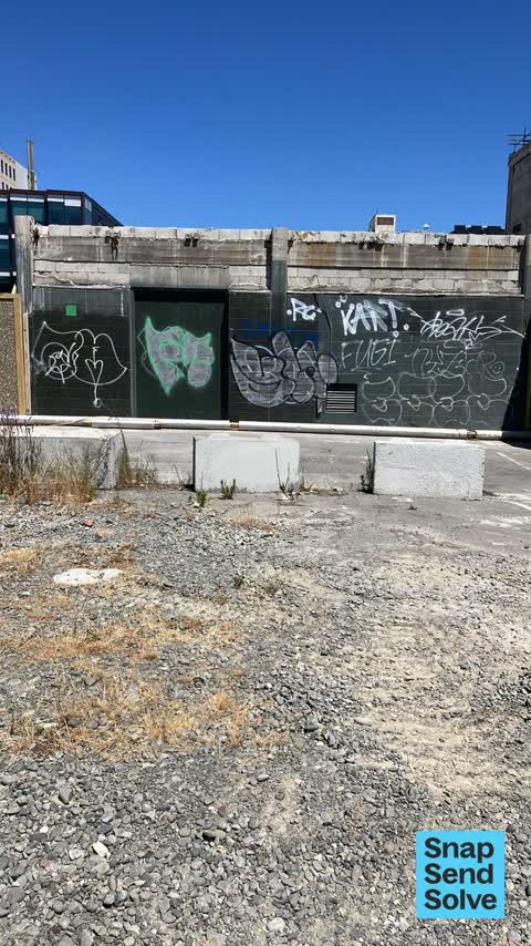


Reported here
 Graffiti on a fence, building or structure —
 Graffiti on a fence, building or structure —
Graffiti on concrete blocks across from the convention centre.
 Graffiti on a fence, building or structure —
Not really a graffiti or alike but don't you think our Avon river sculpture needs a cleanup please?
 Vandalism - General —
there is no category yet for ARLO SCOOTERS this is by the new bridge opposite otakaro orchard i’m out for my walk and saw this :(
 Graffiti somewhere else —
All within 25m of each lot of tags
 General Request —
Broken lock on door, needs replacing
 Street Gutters / Storm Water —
Stormwater sump potentially blocked, needs cleanout
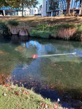
 Water General —
Dumped cones in Avon beside Gloucester St Bridge. Lime has been notified of their Scooter too.
 Hazard — vehicle —
Barrier got moved to create away out and vehicle parked on Club lane go out from that open space and the carpark is empty. Vehicles keep bei
 Graffiti somewhere else —
 Graffiti somewhere else —
 Graffiti somewhere else —
Blue graffiti next to the crane Brothers building on a concrete bench
 Graffiti somewhere else —
 Poles and Signage - General —
Sign has been pulled out of road on Oxford Terrace
 Graffiti on a fence, building or structure —
 Graffiti on a fence, building or structure —
Note,, this can be removed as the building now has anti graffiti paint
 Graffiti —
 Graffiti —
 Vandalism - General —
Public seat shifted.
 Graffiti —
- Vandalism - General —
- Vandalism - General —
- Graffiti —
- Graffiti —
- Pit and Equipment - General —
- Graffiti —
- Graffiti —
- Graffiti —
- Graffiti —
- Graffiti —
- Graffiti —
- General Request —
- Dumped Rubbish —
- General Request —
- General Request —
- Graffiti —
- Graffiti —
- Graffiti —
- Graffiti —
- Graffiti —
 Graffiti —
 Graffiti —
 Graffiti —
 Graffiti —
 Graffiti —
Graffiti on water infrastructure
 Graffiti —
 Graffiti —
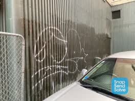 Graffiti —
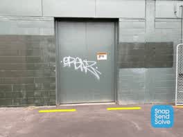 Graffiti —
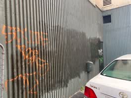 Graffiti —
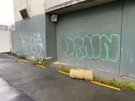 Graffiti —
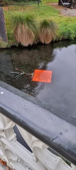 Roading/Streets —
Gloucester Street Bridge near Te Pae
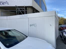 Graffiti —
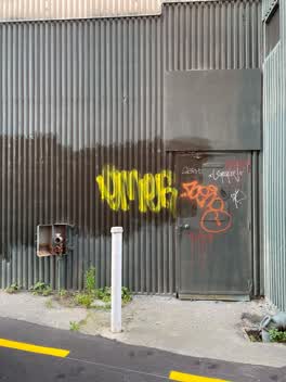 Graffiti —
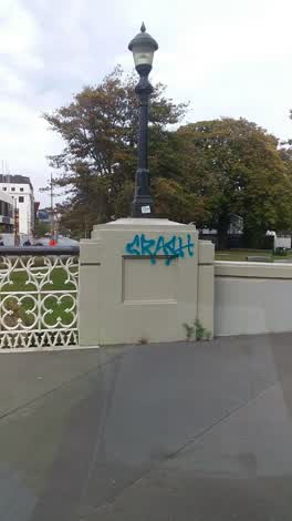 Graffiti —
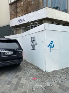 Graffiti —
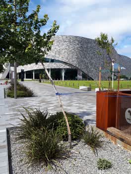 Parks —
Damaged tree
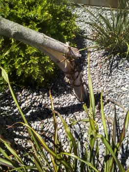 Roading/Streets —
This tree has been snapped off near the base in an actor vandalism and may yet be able to be saved to C arborist got on to it early enough i
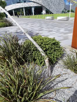 Roading/Streets —
Tree trunk has been snapped.
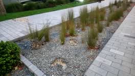 Parks —
Ran garden planting pulled out / vandelised opposite Miro cafe
 Roading/Streets —
near convention centre
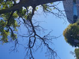 Parks —
Dead branches on tree. Myself and many other each lunch under these trees. Children also play here. This branch looks very brittle and could
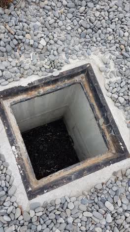 Wastewater/Stormwater —
grate missing
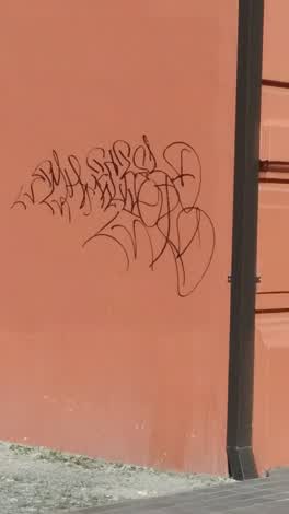 Graffiti —
Parks —
Vandalism
Also reported on Oxford Terrace
- 159 Oxford Terrace — 180 reports
- 153 Oxford Terrace — 174 reports
- 95 Oxford Terrace — 126 reports
- 211 Oxford Terrace — 125 reports
- 182 Oxford Terrace — 122 reports
- 184 Oxford Terrace — 109 reports
- 294 Oxford Terrace — 92 reports
- 152 Oxford Terrace — 87 reports
The street’s crash record
NZTA’s record names Oxford Terrace in 56 crashes that hurt somebody since 2006 — 1 person killed, 11 seriously hurt.
The green nearby
- Canterbury Provincial Council Reserve — 46 m to the edge · Botanic
- Scott Statue Reserve — 96 m to the edge · Botanic
- Godley Statue Reserve — 151 m to the edge · Botanic
- Victoria Square — 181 m to the edge · Botanic · 2 ha
- Cathedral Square — 193 m to the edge · Botanic
Parks within half a kilometre, measured to the boundary — the council’s open data.
The civic shelf nearby
- Armagh St — 220 m away · Car park
- Turanga Library — 248 m away · Library · Cathedral Square, Christchurch
- Aldersgate — 257 m away · Car park
- Civic Offices — 262 m away · Council office
- Triangle — 374 m away · Car park
- Scales — 440 m away · Car park
- Rolleston Avenue — 498 m away · Car park
Libraries, halls and the rest within half a kilometre — the council’s open data.
On the doorstep
- Miro — 11 m away · Restaurants
- Crane Brothers — 13 m away · Clothing
- Cafe Miro — 23 m away · Cafés
- Avon River Precinct — 42 m away · Attractions
Businesses within four hundred metres, measured at the pin — OpenStreetMap and the council directories.
The bus nearby
- Hereford St near Montreal St — 319 m away · route 8
- Hereford St near Montreal St — 330 m away · route 8
The closest Metro stops, within four hundred and fifty metres.
The tracks through here
- Walk and bike track through Christchurch Central City — 5 m to the line · walk · bike
- Walk and bike track through Christchurch Central City — 81 m to the line · walk · bike
- Walk and bike track through Christchurch Central City — 95 m to the line · walk · bike
- Walk and bike track through Christchurch Central City — 104 m to the line · walk · bike
- Walk and bike track through Christchurch Central City — 159 m to the line · walk · bike
Tracks whose line passes within half a kilometre, measured to the line itself — the council’s open data.
The named ground
Named water within 500 m of this address, measured to the line or the edge; Named places within 1.5 km of this address; the council’s own structure register — bridges, boardwalks and steps standing nearby — the open map’s record.
The remembered names nearby
- Antony Gormley / Stay 2015 — 35 m away ·
Antony Gormley / STAY 2015 / Commissioned by Christchurch City Council for integration int
- … Golden Jubilee / 1962 — 53 m away ·
… GOLDEN JUBILEE / 1962
· 2000 - Planted by / Miss R. Medlicott / Dominion President 1968–69 — 62 m away ·
PLANTED BY / Miss R. MEDLICOTT / DOMINION PRESIDENT 1968–69 / TO MARK THE / 21st ANNUAL GE
· 2000
Inscribed plaques within two hundred and fifty metres — the register’s pins, not surveyed spots. The whole roll is at /plaques.
Renting nearby
new bonds in Christchurch Central City ran about $508 a week — $42 below the city median of $550 — the suburb page keeps the rent record →.
What was here — Former Midland Club and Setting
on this spot · 176 Oxford Terrace · located to ±18 m · the place’s own record →
On the register. Nothing researched here yet.
What was here — Gloucester Street Bridge and Setting
38 m away · located to ±26 m · the place’s own record →
On the register. Nothing researched here yet.
What was here — Former Municipal Chambers and Setting
74 m away · 159 Oxford Terrace · located to ±15 m · the place’s own record →
On the register. Nothing researched here yet.
What was here — Canterbury Provincial Council Buildings Courtyard/Grounds
103 m away · 280 Durham Street North · located to ±64 m · the place’s own record →
On the register. Nothing researched here yet.
What was here — Canterbury Provincial Council Buildings
107 m away · 280 Durham Street North · located to ±51 m · the place’s own record →
On the register. Nothing researched here yet.
The civic layer
This ground votes in Central ward — the Papanui-Innes-Central community board. Ward lines don’t always follow suburb lines; this one is measured at the pin, not the suburb’s centre.
What stood on this ground → · On the map → · From the air — the Crown’s aerials back to 1936; search the address on RetroLens →
Questions, answered briefly
65 council reports on record since May 2019 — most often graffiti (32), graffiti somewhere else (5), graffiti on a fence, building or structure (5).
Christchurch Central City, Christchurch — on Oxford Terrace.
The heritage register names 5 places at or beside it — Former Midland Club and Setting, Gloucester Street Bridge and Setting.
Canterbury Provincial Council Reserve — 46 m to its edge.