2 Oxford Terrace, Christchurch Central City
37 reports on record since May 2019 · 32 with photographs. The street’s heaviest record is 159 Oxford Terrace, 181 reports on file. Indicative rating valuation and school zones, hazards, bin day and what stood here before.
What gets reported here
Photographed here 32 on record






Reported here
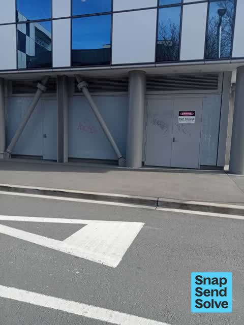
 Graffiti on a fence, building or structure,
On wall outside CH Hospital near Boatshed bridge/ entrance to old emergency department
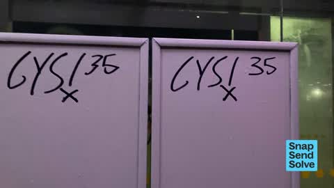
 Graffiti on a fence, building or structure,
graffiti on building
 Hazard, vehicle,
Cars parked in 5min zone some with people waiting other with no one. I stay there for 20 odd minutes watching the poor elderly trying to ge
 Hazard, vehicle,
So many cars parked in waiting 5min drop off zone outside CHCH Outpatients
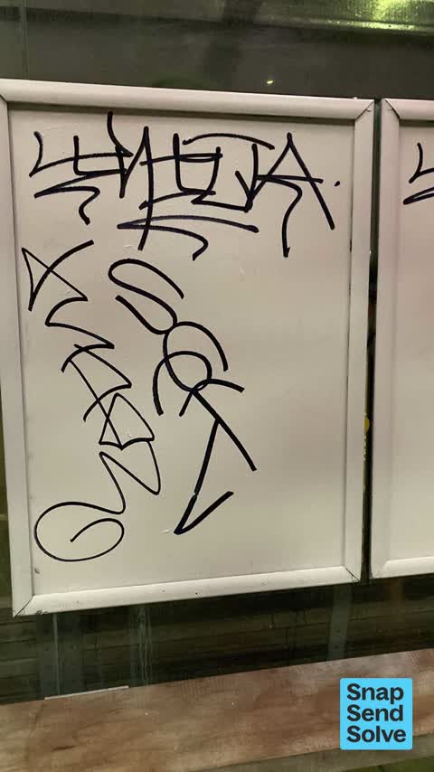
 Graffiti on a bus stop or public toilet,
Graffiti on bus shelter
 Hazard, vehicle,
People are parking their cars are for a lot longer than the permitted five minutes and it is making it difficult for others to find a park T
 Graffiti on a bus stop or public toilet,
Graffiti on bus shelter
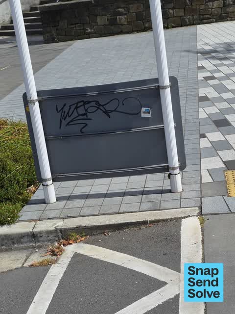
 Graffiti on a sign, mural or public art,
graffiti on ccc sign
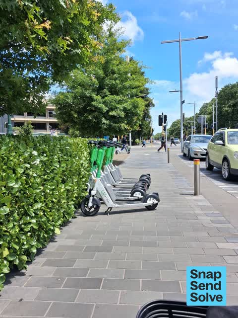
 Accessibility,
scooters outside out patient's Christchurch Hospital. Mobility Scooter user, difficult to get past.
 Graffiti on a bus stop or public toilet,
Graffiti at public bus stop outside Christchurch Hospital eastbound
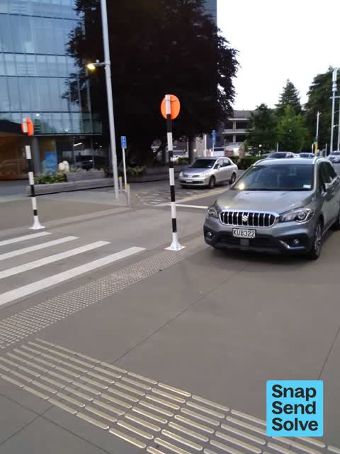
 Hazard, vehicle,
dear enforcement why are vehicles continually parked parked extremely dangerouslly on and beside these pedestrian crossings outside of all p
 Graffiti on a road, footpath or bridge,
graffiti on tile path
 Hazard, vehicle,
Car parking for hours each day in 5min car park outside Outpatients hospital building
 Graffiti on a bus stop or public toilet,
On bus shelter
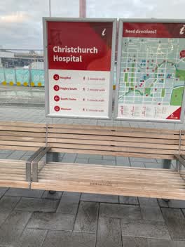
 General Request,
Not sure if this falls under CCC or Health NZ A bench outside the Christchurch Outpatients building has a screw sticking up through the seat
 Graffiti on a sign, mural or public art,
On two no smoking signs on retaining wall outside CH hospital by shuttle bus stop
 Poles and Signage - General,
Pedestrian pole on the ground
 Graffiti on a bus stop or public toilet,
On both bus shelters
 Hazard, vehicle,
It is almost impossible to see the markings for the individual for each car space on these tiles in the daylight. As a consequence, cars are
 Pavement - General,
One of the tactile surface bars has come loose. The location is outside the hospital. It would be good if this could be prioritised as it co
 Hazard, vehicle,
Two Blue Star cars parked in the P5 drop off/pick up area outside Outpatient Department, Christchurch Hosp today, 12.50pm, still there when
 Poles and Signage - General,
Both poles are bent
 Graffiti on a fence, building or structure,
 Hazard, vehicle,
Motorbikes parked on footpath in front of the hospital
- Hazard, vehicle,
- Overgrown Vegetation,
- Damaged Street Sign,
- Pavement - Damaged,
- Graffiti,
 Graffiti,
On SeaT and sign
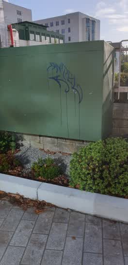 Graffiti,
large green utility box by exit from former ED. alongside seats on footpath
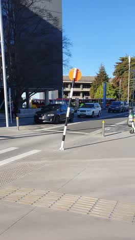 Damaged Street Sign,
Roading/Streets,
Graffiti,
Roading/Streets,
Car Parked in Tow away zone
Graffiti,
Graffiti,
Also reported on Oxford Terrace
- 159 Oxford Terrace, 181 reports
- 153 Oxford Terrace, 174 reports
- 95 Oxford Terrace, 126 reports
- 211 Oxford Terrace, 126 reports
- 182 Oxford Terrace, 122 reports
- 184 Oxford Terrace, 109 reports
- 294 Oxford Terrace, 92 reports
- 152 Oxford Terrace, 87 reports
From the air, then
Sourced from Canterbury Maps and partners. LINZ, CC BY 3.0 NZ. Each frame is cut from Environment Canterbury’s historic imagery MapServer for that decade, only where the Footprints layer names a CC BY survey (NZAM-covered spots stay out). RetroLens holds more Crown aerials →
The street’s crash record
NZTA’s record names Oxford Terrace in 56 crashes that hurt somebody since 2006, 1 person killed, 11 seriously hurt.
The green nearby
- Botanic Gardens, 167 m to the edge · Botanic · 21 ha
- Nurses Memorial Chapel, 203 m to the edge · Botanic
- Hagley Park North, 227 m to the edge · Sports ground · 91 ha
- Tiffany Reserve, 444 m to the edge
Parks within half a kilometre, measured to the boundary, the council’s open data.
The civic shelf nearby
- Christchurch Hospital Grounds, 255 m away · Car park
- Scales, 357 m away · Car park
- Rolleston Avenue, 476 m away · Car park
Libraries, halls and the rest within half a kilometre, the council’s open data.
On the doorstep
- Christchurch Outpatients, 26 m away · Hospital
- Kanuka, 29 m away · Cafés
- University of Otago, Department of Paediatrics, 78 m away · University
- University of Otago, Department of Psychological Medicine, 78 m away · University
Businesses within four hundred metres, measured at the pin: OpenStreetMap and the council directories.
The bus nearby
- Christchurch Hospital Main Stop WB, 52 m away · route 3, route 5, route 7, route 60, route 80, route 81, route 84, route 85, route 86, route 91, route 92
- Christchurch Hospital Main Stop EB, 70 m away · route 3, route 5, route 7, route 60, route 80, route 81, route 84, route 85, route 86, route 91, route 92
The closest Metro stops, within four hundred and fifty metres.
The tracks through here
- Walk and bike track through Christchurch Central City, 12 m to the line · walk · bike
- Walk and bike track through Christchurch Central City, 25 m to the line · walk · bike
- Walk and bike track through Christchurch Central City, 43 m to the line · walk · bike
- Walk and bike track through Christchurch Central City, 58 m to the line · walk · bike
- Walk and bike track through Christchurch Central City, 66 m to the line · walk · bike
Tracks whose line passes within half a kilometre, measured to the line itself, the council’s open data.
The named ground
Named water within 500 m of this address, measured to the line or the edge; Named places within 1.5 km of this address; the council’s own structure register, bridges, boardwalks and steps standing nearby, the open map’s record.
The remembered names nearby
- Hagley Park South plaque, 97 m away · 2009
- This Stone Was Laid by Her Royal Highness the Duchess, 218 m away ·
This stone was laid by Her Royal Highness The Duchess of York 15th March 1927
· 2000 - D Company (Canterbury) 2nd Battalion N.Z. Scottish Regiment, 219 m away ·
D COMPANY (CANTERBURY) 2ND BATTALION N.Z. SCOTTISH REGIMENT EX MEMBERS 1939–1943 TO THOSE
· 2000
Inscribed plaques within two hundred and fifty metres, the register’s pins, not surveyed spots. The whole roll is at /plaques.
Renting nearby
new bonds in Christchurch Central City ran about $508 a week, $42 below the city median of $550, the suburb page keeps the rent record →.
What was here, Former Dwelling and Setting
125 m away · 14 Oxford Terrace · located to ±15 m · the place’s own record →
On the register. Nothing researched here yet.
What was here, Antigua Boatsheds and Setting
129 m away · 2 Cambridge Terrace · located to ±22 m · the place’s own record →
On the register. Nothing researched here yet.
What was here, Fitzgerald Statue and Setting
186 m away · located to ±2 m · the place’s own record →
On the register. Nothing researched here yet.
What was here, Nurses' Memorial Chapel and Setting
221 m away · 2J Riccarton Avenue · located to ±14 m · the place’s own record →
On the register. Nothing researched here yet.
What was here, Curator's House and Setting
224 m away · 5 Rolleston Avenue · located to ±14 m · the place’s own record →
On the register. Nothing researched here yet.
The civic layer
This ground votes in Central ward, the Papanui-Innes-Central community board. Ward lines don’t always follow suburb lines; this one is measured at the pin, not the suburb’s centre.
What stood on this ground → · On the map → · From the air, the Crown’s aerials back to 1936; search the address on RetroLens →
Questions, answered briefly
37 council reports on record since May 2019, most often hazard, vehicle (9), graffiti (6), graffiti on a bus stop or public toilet (5).
Christchurch Central City, Christchurch, on Oxford Terrace.
The heritage register names 5 places at or beside it, Former Dwelling and Setting, Antigua Boatsheds and Setting.
Botanic Gardens, 167 m to its edge, 21 ha.