200 Tuam Street, Christchurch Central City
28 reports on record since October 2020 · 22 with photographs. The street’s heaviest record is 278 Tuam Street — 89 reports on file. Indicative rating valuation and school zones, hazards, bin day and what stood here before.
What gets reported here
Photographed here 22 on record






Reported here
 Graffiti on a fence, building or structure —
graffiti on light lamp post pole
 Graffiti on a fence, building or structure —
On steel uprights along walkway immediately behind Environment Canterbury.
 Graffiti on a road, footpath or bridge —
grafitti
 Roads - General —
Big pieces of flass on footpath, bike path, and road. Been there for a long time. Opposite Ecan
 Rubbish and Bins - General —
These bins require emptying. These bins are NOT checked OR emptied on a regular basis.
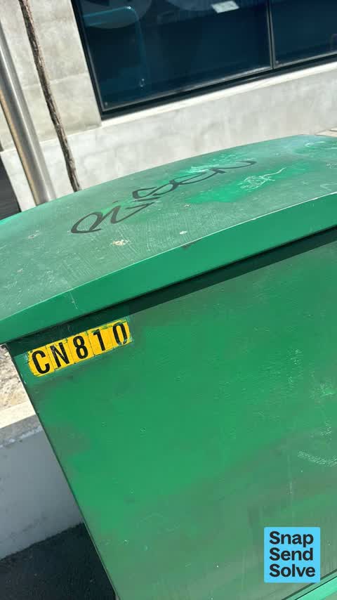
 Graffiti on a cabinet, pole or railway asset —
Black paint tag on Enable asset CN810 by 200 Tuam Street.
 Graffiti somewhere else —
 Graffiti somewhere else —
Green utility box near Peter scolar park.
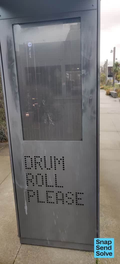
 Graffiti on a sign, mural or public art —
Graffiti and vandalism on public art behind Environment Canterbury. Drum Roll/Gift digital art display: Damaged Wish You Were Here Art Boa
 Graffiti on a fence, building or structure —
Black, blue and yellow paint tags on padlocked door recess on old building near 200 Tuam Street facing the footpath.
 General Request —
Is there a possibility this is being updated soon? It’s been managed for some time and is a shame it’s not working correctly.
 Graffiti on a fence, building or structure —
multiiple
 Graffiti somewhere else —
 Water Leak —
Burst water pipe?
 Damaged Road —
Looks like a sink hole is starting to open up every time a bus or heavy traffic goes over it a bit more falls away. I’m hoping that I’m wron
 Graffiti —
- Graffiti —
- Graffiti —
- Graffiti —
- Facility - General Request —
- Graffiti —
- Graffiti —
 Graffiti —
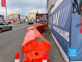 Roading/Streets —
How on earth is this making adequate and safe provision for pedestrians?
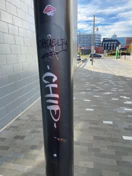 Graffiti —
Black and silver paint tags on floodlight pole on laneway between St Asaph and Tuam Streets by Ford building.
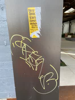 Graffiti —
Anti vax misinformation sticky tag plus a yellow paint tag on floodlight pole on laneway by ECan between St Asaph and Tuam Streets.
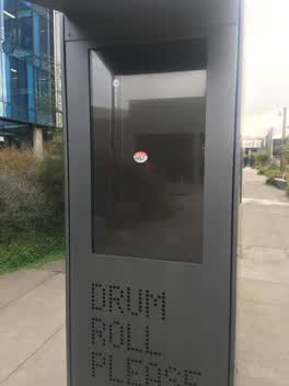 Parks —
This feature on the South Frame hasnt been working for several months. Its supposed to display an image of a drummer but only has an error m
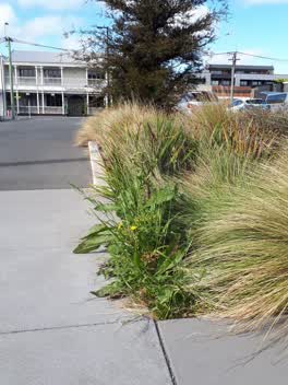 Overgrown Vegetation —
weeds in native plantings haven't been maintained for a while, risk going to seed and ruining a real asset, this is the best planting in tow
Also reported on Tuam Street
- 278 Tuam Street — 89 reports
- 286 Tuam Street — 52 reports
- 16 Tuam Street — 52 reports
- 94 Tuam Street — 47 reports
- 189 Tuam Street — 38 reports
- 322 Tuam Street — 31 reports
- 284 Tuam Street — 29 reports
- 290 Tuam Street — 28 reports
The street’s crash record
NZTA’s record names Tuam Street in 144 crashes that hurt somebody since 2006 — 18 seriously hurt, nobody killed.
The green nearby
- Excelsior Hotel Reserve — 142 m to the edge · Botanic
- City Mall — 272 m to the edge
- High Street Triangles — 295 m to the edge
- Wilson Park — 349 m to the edge
- The Stewart Plaza — 373 m to the edge
Parks within half a kilometre, measured to the boundary — the council’s open data.
The civic shelf nearby
- Re:start - Lichfield St — 218 m away · Car park
- Triangle — 338 m away · Car park
- St Asaph — 408 m away · Car park
Libraries, halls and the rest within half a kilometre — the council’s open data.
On the doorstep
- Environment Canterbury Regional Council — 12 m away · Government
- Caravan, Camping and Marine — 87 m away · Business
- Team Hutchinson Ford — 97 m away · Car dealers
- Coriander's Indian Restaurant - City — 98 m away · Restaurants
Businesses within four hundred metres, measured at the pin — OpenStreetMap and the council directories.
The bus nearby
- Bus Interchange (Platform D) — 138 m away · route 1, route 7, route 8, route 27, route 44, route 91, route 92, route 95
- Bus Interchange (Platform C) — 150 m away · route 3, route 5, route 29, route 60, route 80, route 81, route 84, route 85, route 86
The closest Metro stops, within four hundred and fifty metres.
The tracks through here
- Walk and bike track through Christchurch Central City — 35 m to the line · walk · bike
- Walk and bike track through Christchurch Central City — 82 m to the line · walk · bike
- Walk and bike track through Christchurch Central City — 206 m to the line · walk · bike
- Walk and bike track through Christchurch Central City — 338 m to the line · walk · bike
- Walk and bike track through Christchurch Central City — 444 m to the line · walk · bike
Tracks whose line passes within half a kilometre, measured to the line itself — the council’s open data.
The named ground
Named places within 1.5 km of this address; the council’s own structure register — bridges, boardwalks and steps standing nearby — the open map’s record.
The remembered names nearby
- The First Public Water Supply Well Was Drilled Near This — 178 m away ·
THE FIRST PUBLIC WATER SUPPLY WELL was drilled near this site on 10 February 1864 by the C
· 2009 - ‘corgis on High’ — Christchurch City Public Artwork — 181 m away ·
‘Corgis on High’ — Christchurch City public artwork, 6 December 2003
· 2009
Inscribed plaques within two hundred and fifty metres — the register’s pins, not surveyed spots. The whole roll is at /plaques.
Renting nearby
new bonds in Christchurch Central City ran about $508 a week — $42 below the city median of $550 — the suburb page keeps the rent record →.
What was here — Commercial Building and Setting, Lawrie and Wilson Auctioneers
29 m away · 210 Tuam Street · located to ±14 m · the place’s own record →
On the register. Nothing researched here yet.
What was here — Former Tuam Street Hall and Setting
47 m away · 214 Tuam Street · located to ±12 m · the place’s own record →
On the register. Nothing researched here yet.
What was here — Colonial Motor Company Garage and Setting
94 m away · 201 St Asaph Street · located to ±40 m · the place’s own record →
On the register. Nothing researched here yet.
What was here — Former R. Buchanan & Sons' City Foundry and Setting
107 m away · 2/210 St Asaph Street · located to ±14 m · the place’s own record →
On the register. Nothing researched here yet.
What was here — Former P & D Duncan Ltd Building and Setting
115 m away · 7/204 St Asaph Street · located to ±18 m · the place’s own record →
On the register. Nothing researched here yet.
The civic layer
This ground votes in Central ward — the Papanui-Innes-Central community board. Ward lines don’t always follow suburb lines; this one is measured at the pin, not the suburb’s centre.
What stood on this ground → · On the map → · From the air — the Crown’s aerials back to 1936; search the address on RetroLens →
Questions, answered briefly
28 council reports on record since October 2020 — most often graffiti (9), graffiti on a fence, building or structure (4), graffiti somewhere else (3).
Christchurch Central City, Christchurch — on Tuam Street.
The heritage register names 5 places at or beside it — Commercial Building and Setting, Lawrie and Wilson Auctioneers, Former Tuam Street Hall and Setting.
Excelsior Hotel Reserve — 142 m to its edge.