Environment Canterbury Regional Council
Environment Canterbury Regional Council is a government office at 200 Tuam Street, Christchurch Central City.
Checked 25 Oct 2026
200 Tuam Street
Opening hours
| Monday – Friday | 8 am to 5 pm |
|---|---|
| Saturday – Sunday | Closed |
Hours change, especially over holidays: confirm with the business before a special trip. About 45 hours a week, by the map’s count.
Reviews
Getting there
The map loads only when you ask for it.
Straight-line distances from the pin, not walking routes.
Nearby
More nearby places 7
Environment Canterbury’s Canterbury Maps Parks layer, refreshed 2026-10-10. Distances are straight-line from the business pin, not walking routes.
The nearest other government
More nearby government 5
All 5 government in Christchurch Central City → · Every one in the city →
Also in Christchurch Central City
More businesses in Christchurch Central City 7
What the record holds
| Fact | What the source says | Source |
|---|---|---|
| Address | 200 Tuam Street, Christchurch 8011 | OpenStreetMap |
| Kind | Government | OpenStreetMap |
| Website | ecan.govt.nz | OpenStreetMap |
Is this your business? Send hours, menu or photos, free and this page updates.
The ground it stands on
| Fact | What the source says | Source |
|---|---|---|
| District Plan zone | Central City Mixed Use Zone (South Frame) | District Plan |
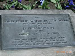 The First Public Water Supply Well Was Drilled Near This
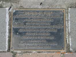 ‘corgis on High’ — Christchurch City Public Artwork
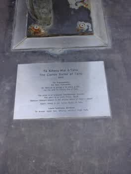 Te Kiheru Wai o Tahu / the Canoe Bailer of Tahu / 2015
What stood on Tuam Street
From Canterbury Stories. This photograph names the street, not this business. The street page pairs it with a Street View pose verified outside Tony's Tyre Service, 2025-03. The street’s then and now →
The reports nearby
5,862 council reports pinned within 250 m of the premises, most often Graffiti & vandalism and Roads & footpaths, 4,914 with a photograph. A pin is where a reporter stood, not a claim about the place itself.
The 5,862 reports on file
 Pavement - Damaged
 Graffiti on a fence, building or structure
 Water Fountain
 Street Gutters / Storm Water
 Facility - General Request
 Graffiti on a sign, mural or public art
 Graffiti on a fence, building or structure
 Poles and Signage - General
 Graffiti on a fence, building or structure
 Public Toilet
 Street Gutters / Storm Water
 Park - General Request
Questions, answered briefly
Read answers 8
A government office in Christchurch Central City, Christchurch.
200 Tuam Street, Christchurch Central City, on Tuam Street. On the map →
On OpenStreetMap.
its website.
Monday – Friday: 8 am to 5 pm; Saturday – Sunday: Closed, as mapped on OpenStreetMap.
Oranga Tamariki (312 m), Ministry of Education (601 m), Ministry of Health (628 m), every one in the city.
the address’s own record holds 29 reports; 6 other premises within a short walk, nearest Team Hutchinson Ford (86 m); the Bus Interchange (Platform D) bus stop is 137 m away: routes 1, 7, 8, 27, 44, 91, 92, 95; a shared zone passes the door; nearest park: Excelsior Hotel Reserve (163 m).
The record behind this
This page is the union of what these public sources say, each fact above names the one it came from. A listing is a lead, not a promise the business still trades:
Sources: OpenStreetMap · Christchurch District Plan layers · Christchurch City Council off-street parking layer (CC BY 4.0) · Environment Canterbury’s Metro stop record · Christchurch City Council’s cycleway layer
Read source notes 5
- OpenStreetMap, named premises drawn and kept current by its contributors (ODbL)
- Christchurch District Plan layers, zones, commercial centres and scheduled heritage items, from the council’s open data (CC BY 4.0)
- Christchurch City Council off-street parking layer (CC BY 4.0),
- Environment Canterbury’s Metro stop record, distances measured here from the pin
- Christchurch City Council’s cycleway layer, lanes, separated paths and the named Major Cycle Routes (CC BY 4.0)
Map data © OpenStreetMap contributors (ODbL); council and ECan data under CC BY 4.0; Wikidata CC0. Something wrong? Fix it on OpenStreetMap or tell us. The whole directory lives at /businesses. This page as markdown: /business/environment-canterbury-regional-council-christchurch-central-city.md.