218 Durham Street South, Christchurch Central City
12 reports on record since August 2015 · 10 with photographs. The street’s heaviest record is 214 Durham Street South — 33 reports on file. Indicative rating valuation and school zones, hazards, bin day and what stood here before.
What gets reported here
Photographed here 10 on record


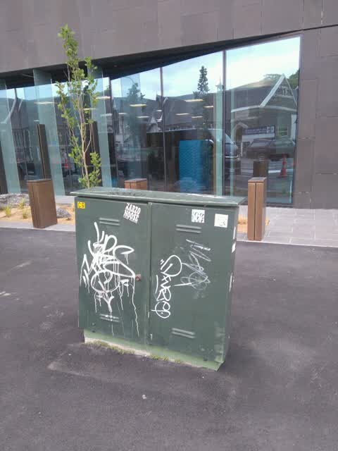
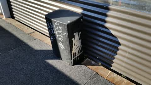
Reported here
 Graffiti on a traffic light pole or cabinet, or wa —
  Traffic Signals —
  Graffiti on a cabinet, pole or railway asset —
 Black paint tags on traffic controller at the corner of Tuam and Durham Street South.
 Graffiti on a fence, building or structure —
  Graffiti somewhere else —
  Graffiti somewhere else —
  Graffiti on a fence, building or structure —
  Graffiti somewhere else —
 - Graffiti —
- Graffiti —
Graffiti —
Graffiti —
Graffiti reported by a Community Patrol
Also reported on Durham Street South
- 214 Durham Street South — 33 reports
- 176 Durham Street South — 30 reports
- 175 Durham Street South — 25 reports
- 241 Durham Street South — 22 reports
- 227 Durham Street South — 19 reports
- 158F Durham Street South — 19 reports
- 158 Durham Street South — 19 reports
- 188 Durham Street South — 18 reports
The street’s crash record
NZTA’s record names Durham Street South in 20 crashes that hurt somebody since 2006 — 4 seriously hurt, nobody killed.
The green nearby
- Friendship Corner — 137 m to the edge · Botanic
- Tiffany Reserve — 139 m to the edge
- Bridge Of Remembrance — 211 m to the edge · Botanic
- City Mall — 324 m to the edge
- The Stewart Plaza — 385 m to the edge
Parks within half a kilometre, measured to the boundary — the council’s open data.
The civic shelf nearby
- Re:start - Lichfield St — 196 m away · Car park
- Scales — 298 m away · Car park
- Triangle — 378 m away · Car park
- Civic Offices — 409 m away · Council office
Libraries, halls and the rest within half a kilometre — the council’s open data.
On the doorstep
- Armstrong's Opel — 71 m away · Car dealers
- The Anglican Centre — 83 m away · Religion
- Armstrong Motor Group — 112 m away · Car dealers
- Golden Homes — 113 m away · Carpenters
Businesses within four hundred metres, measured at the pin — OpenStreetMap and the council directories.
The bus nearby
- St Asaph St near Colombo St — 214 m away · route 3, route 5, route 7, route 60, route 80, route 81, route 84, route 85, route 86
- Bus Interchange (Platform A) — 272 m away · route 3, route 5, route 60, route 80, route 81, route 84, route 85, route 86
The closest Metro stops, within four hundred and fifty metres.
The tracks through here
- Walk and bike track through Christchurch Central City — 18 m to the line · walk · bike
- Walk and bike track through Christchurch Central City — 124 m to the line · walk · bike
- Walk and bike track through Christchurch Central City — 124 m to the line · walk · bike
- Walk and bike track through Christchurch Central City — 163 m to the line · walk · bike
- Walk and bike track through Christchurch Central City — 407 m to the line · walk · bike
Tracks whose line passes within half a kilometre, measured to the line itself — the council’s open data.
The named ground
Named water within 500 m of this address, measured to the line or the edge; Named places within 1.5 km of this address; the council’s own structure register — bridges, boardwalks and steps standing nearby — the open map’s record.
The remembered names nearby
- Rose — 180 m away ·
Rose. Soroptimist International Donated and planted by Soroptimists of Christchurch To cel
· 2009 - The Chapel Is Open 1 Pm to 4 Pm Daily Closed Sundays — 182 m away ·
THE CHAPEL IS OPEN 1 PM TO 4 PM DAILY CLOSED SUNDAYS & CHRISTMAS DAY
· 2009 - Planted on 14th April 1983 by His Excellency Premier Zhao — 186 m away ·
PLANTED ON 14TH APRIL 1983 BY HIS EXCELLENCY PREMIER ZHAO ZIYANG OF THE PEOPLE'S REPUBLIC
· 2009
Inscribed plaques within two hundred and fifty metres — the register’s pins, not surveyed spots. The whole roll is at /plaques.
Renting nearby
new bonds in Christchurch Central City ran about $508 a week — $42 below the city median of $550 — the suburb page keeps the rent record →.
What was here — St Michael's School Hall and Setting
26 m away · 243 Durham Street South · located to ±14 m · the place’s own record →
On the register. Nothing researched here yet.
What was here — St Michael's School Stone Building and Setting
59 m away · located to ±16 m · the place’s own record →
On the register. Nothing researched here yet.
What was here — St. Michael and All Angels Church & Setting
92 m away · 90 Oxford Terrace · located to ±25 m · the place’s own record →
On the register. Nothing researched here yet.
What was here — St Michael and All Angels Church Belfry and Setting
120 m away · 90 Oxford Terrace · located to ±5 m · the place’s own record →
On the register. Nothing researched here yet.
What was here — Former Dwelling and Setting
141 m away · 95 Oxford Terrace · located to ±18 m · the place’s own record →
On the register. Nothing researched here yet.
The civic layer
This ground votes in Central ward — the Papanui-Innes-Central community board. Ward lines don’t always follow suburb lines; this one is measured at the pin, not the suburb’s centre.
What stood on this ground → · On the map → · From the air — the Crown’s aerials back to 1936; search the address on RetroLens →
Questions, answered briefly
12 council reports on record since August 2015 — most often graffiti (4), graffiti somewhere else (3), graffiti on a fence, building or structure (2).
Christchurch Central City, Christchurch — on Durham Street South.
The heritage register names 5 places at or beside it — St Michael's School Hall and Setting, St Michael's School Stone Building and Setting.
Friendship Corner — 137 m to its edge.