233 Gloucester Street, Christchurch Central City
11 reports on record since November 2015 · 9 with photographs. The street’s heaviest record is 267 Gloucester Street — 108 reports on file. Indicative rating valuation and school zones, hazards, bin day and what stood here before.
What gets reported here
Photographed here 9 on record


Reported here
 Graffiti on a traffic light pole or cabinet, or wa —
graffiti on traffic light pole nearby
 Road Signage —
On st Albans road sign at Gloucester/ Madras St.
 Graffiti on a fence, building or structure —
Dark brown paint tag on traffic light pole by 233 Gloucester Street.
 Graffiti somewhere else —
Building site
 Graffiti somewhere else —
 Graffiti on a sign, mural or public art —
Gray paint tag on road sign by 233 Gloucester Street.
 Graffiti somewhere else —
Building site
 Graffiti —
Signage
- Graffiti —
- Vandalism - General —
Roading/Streets —
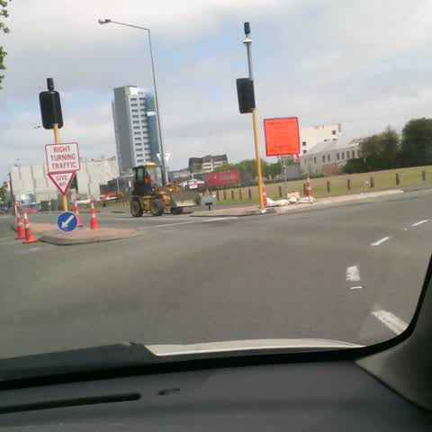
The give way road sign shouldn't be there unless you put give way markings on the road. I have seen right turning cars (on a green light) st
Also reported on Gloucester Street
- 267 Gloucester Street — 108 reports
- 89 Gloucester Street — 88 reports
- 278 Gloucester Street — 69 reports
- 194 Gloucester Street — 64 reports
- 146 Gloucester Street — 60 reports
- 195 Gloucester Street — 53 reports
- 332 Gloucester Street — 50 reports
- 192 Gloucester Street — 44 reports
The street’s crash record
NZTA’s record names Gloucester Street in 111 crashes that hurt somebody since 2006 — 4 people killed, 18 seriously hurt.
The green nearby
- Latimer Square — 26 m to the edge · Botanic · 2 ha
- Poplars Reserve — 250 m to the edge · Botanic
- Fire Fighters Reserve — 311 m to the edge
- Cambridge Reserve — 315 m to the edge
- Chester Street East Reserve — 360 m to the edge
Parks within half a kilometre, measured to the boundary — the council’s open data.
The civic shelf nearby
- Turanga Library — 500 m away · Library · Cathedral Square, Christchurch
Libraries, halls and the rest within half a kilometre — the council’s open data.
On the doorstep
- Rydges Latimer — 91 m away · Hotels
- Bloody Mary's — 101 m away · Bars & pubs
- City Putt and Cruise — 117 m away · Attractions
- Table at Monks — 138 m away · Restaurants
Businesses within four hundred metres, measured at the pin — OpenStreetMap and the council directories.
The bus nearby
- Gloucester St near Barbadoes St — 88 m away · route 5, route 7
- Gloucester St near Barbadoes St — 111 m away · route 5, route 7
The closest Metro stops, within four hundred and fifty metres.
The tracks through here
- Walk and bike track through Christchurch Central City — 111 m to the line · walk · bike
- Walk and bike track through Christchurch Central City — 125 m to the line · walk · bike
- Walk and bike track through Christchurch Central City — 171 m to the line · walk · bike
- Walk and bike track through Christchurch Central City — 244 m to the line · walk · bike
- Walk and bike track through Christchurch Central City — 282 m to the line · walk · bike
Tracks whose line passes within half a kilometre, measured to the line itself — the council’s open data.
The named ground
Named water within 500 m of this address, measured to the line or the edge; Named places within 1.5 km of this address; the council’s own structure register — bridges, boardwalks and steps standing nearby — the open map’s record.
The remembered names nearby
- Afac — 34 m away ·
afac / (dedication text illegible – backlit)
· 2013 - ANZCO Foods — 250 m away ·
ANZCO FOODS / Donated for the people of Canterbury to enjoy, following fundraising by ANZC
· 2017
Inscribed plaques within two hundred and fifty metres — the register’s pins, not surveyed spots. The whole roll is at /plaques.
Renting nearby
new bonds in Christchurch Central City ran about $508 a week — $42 below the city median of $550 — the suburb page keeps the rent record →.
What was here — Latimer Square and Setting
143 m away · located to ±119 m · the place’s own record →
On the register. Nothing researched here yet.
What was here — Dwellings and Setting
204 m away · 100 Chester Street East · located to ±13 m · the place’s own record →
On the register. Nothing researched here yet.
What was here — Dwellings and Setting
206 m away · 86 Chester Street East · located to ±15 m · the place’s own record →
On the register. Nothing researched here yet.
What was here — Christchurch Club and Setting
215 m away · 154 Worcester Street · located to ±16 m · the place’s own record →
On the register. Nothing researched here yet.
What was here — Former MED Converter Station and Substation
235 m away · 102/210 Armagh Street · located to ±30 m · the place’s own record →
On the register. Nothing researched here yet.
The civic layer
This ground votes in Central ward — the Papanui-Innes-Central community board. Ward lines don’t always follow suburb lines; this one is measured at the pin, not the suburb’s centre.
What stood on this ground → · On the map → · From the air — the Crown’s aerials back to 1936; search the address on RetroLens →
Questions, answered briefly
11 council reports on record since November 2015 — most often graffiti somewhere else (3), graffiti (2), vandalism - general (1).
Christchurch Central City, Christchurch — on Gloucester Street.
The heritage register names 5 places at or beside it — Latimer Square and Setting, Dwellings and Setting.
Latimer Square — 26 m to its edge, 2 ha.