26 Hereford Street, Christchurch Central City
20 reports on record since May 2022 · 4 with photographs. The street’s heaviest record is 53 Hereford Street — 125 reports on file. Indicative rating valuation and school zones, hazards, bin day and what stood here before.
What gets reported here
Photographed here 4 on record


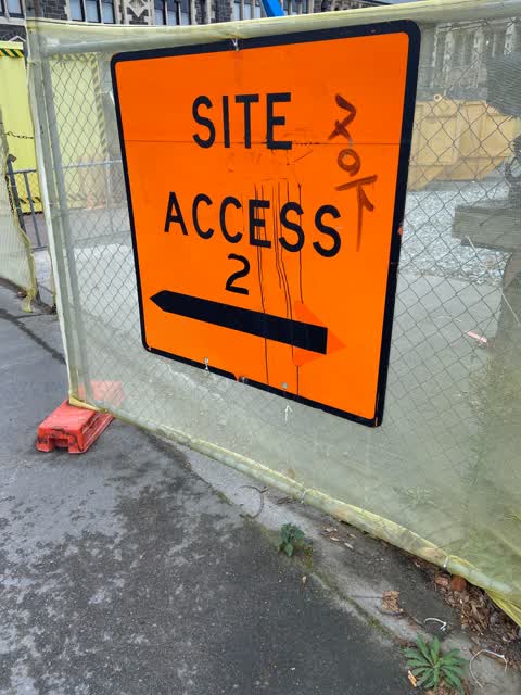
Reported here
 Pavement - Damaged —
Cover is broken leaving hole in footpath
 Hazard — vehicle —
Car parked in front of driveway, stopping vehicles entering
 Water Leak —
Leak in driveway at arts centre
- Water Leak —
- Water Leak —
- Damaged Street Sign —
- General Request —
- Street Gutters / Storm Water —
- Pavement - Damaged —
- Graffiti —
- Overgrown Vegetation —
- Hazard — vehicle —
- Pavement - Damaged —
- Water Leak —
- Water Leak —
- Water Leak —
- Water Leak —
- Damaged Street Sign —
- Graffiti —
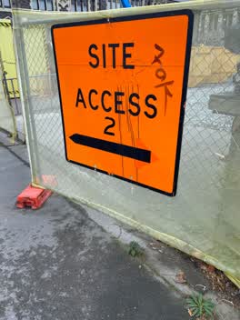 Graffiti —
Black paint tag on sign by large construction site on Hereford Street.
Also reported on Hereford Street
- 53 Hereford Street — 125 reports
- 71 Hereford Street — 91 reports
- 48 Hereford Street — 76 reports
- 197 Hereford Street — 62 reports
- 141 Hereford Street — 62 reports
- 262 Hereford Street — 59 reports
- 214 Hereford Street — 53 reports
- 147 Hereford Street — 46 reports
The street’s crash record
NZTA’s record names Hereford Street in 154 crashes that hurt somebody since 2006 — 1 person killed, 25 seriously hurt.
The green nearby
- Botanic Gardens — 143 m to the edge · Botanic · 21 ha
- Bridge Of Remembrance — 318 m to the edge · Botanic
- Hagley Park North — 323 m to the edge · Sports ground · 91 ha
- Tiffany Reserve — 333 m to the edge
- Friendship Corner — 340 m to the edge · Botanic
Parks within half a kilometre, measured to the boundary — the council’s open data.
The civic shelf nearby
- Scales — 199 m away · Car park
- Rolleston Avenue — 202 m away · Car park
- Civic Offices — 202 m away · Council office
- Christchurch Hospital Grounds — 409 m away · Car park
- Armagh St — 499 m away · Car park
Libraries, halls and the rest within half a kilometre — the council’s open data.
On the doorstep
- YHA Christchurch — 52 m away · Hotels
- The Observatory Hotel — 57 m away · Hotels
- Haka House Christchurch — 59 m away · Hostels
- Altiora Performing Arts Venue — 68 m away · Business
Businesses within four hundred metres, measured at the pin — OpenStreetMap and the council directories.
The bus nearby
- Hereford St near Montreal St — 140 m away · route 8
- Hereford St near Montreal St — 143 m away · route 8
The closest Metro stops, within four hundred and fifty metres.
The tracks through here
- Walk and bike track through Christchurch Central City — 129 m to the line · walk · bike
- Walk and bike track through Christchurch Central City — 177 m to the line · walk · bike
- Walk and bike track through Christchurch Central City — 188 m to the line · walk · bike
- Walk and bike track through Christchurch Central City — 194 m to the line · walk · bike
- Walk and bike track through Christchurch Central City — 294 m to the line · walk · bike
Tracks whose line passes within half a kilometre, measured to the line itself — the council’s open data.
The named ground
Named water within 500 m of this address, measured to the line or the edge; Named places within 1.5 km of this address; the council’s own structure register — bridges, boardwalks and steps standing nearby — the open map’s record.
The remembered names nearby
- In Loving Memory of / Laurence K. Mitchell — 169 m away ·
In Loving Memory of / LAURENCE K. MITCHELL (Laurie) / 15-10-1941 to 21-10-2006 / A lifetim
· 2017 - Botanic Gardens plaque — 172 m away · 2007
- Christchurch Botanic Gardens - Donated by Llewellyn — 175 m away ·
CHRISTCHURCH BOTANIC GARDENS - DONATED BY LLEWELLYN J MITCHELL
· 1998
Inscribed plaques within two hundred and fifty metres — the register’s pins, not surveyed spots. The whole roll is at /plaques.
Renting nearby
new bonds in Christchurch Central City ran about $508 a week — $42 below the city median of $550 — the suburb page keeps the rent record →.
What was here — Biology and Observatory Block and Setting
53 m away · 7 Hereford Street · located to ±19 m · the place’s own record →
On the register. Nothing researched here yet.
What was here — Physics Building and Setting
57 m away · 7 Hereford Street · located to ±13 m · the place’s own record →
On the register. Nothing researched here yet.
What was here — Christchurch Boys' High School Gymnasium and Setting
67 m away · 2B Worcester Street · located to ±15 m · the place’s own record →
On the register. Nothing researched here yet.
What was here — Electrical Engineering Extension, School of Engineering, and Setting
77 m away · 15 Hereford Street · located to ±21 m · the place’s own record →
On the register. Nothing researched here yet.
What was here — Men's Common Room and Setting
78 m away · 7 Hereford Street · located to ±9 m · the place’s own record →
On the register. Nothing researched here yet.
The civic layer
This ground votes in Central ward — the Papanui-Innes-Central community board. Ward lines don’t always follow suburb lines; this one is measured at the pin, not the suburb’s centre.
What stood on this ground → · On the map → · From the air — the Crown’s aerials back to 1936; search the address on RetroLens →
Questions, answered briefly
20 council reports on record since May 2022 — most often water leak (7), pavement - damaged (3), graffiti (3).
Christchurch Central City, Christchurch — on Hereford Street.
The heritage register names 5 places at or beside it — Biology and Observatory Block and Setting, Physics Building and Setting.
Botanic Gardens — 143 m to its edge, 21 ha.