48 Hereford Street, Christchurch Central City
76 reports on record since September 2015 · 62 with photographs. The street’s heaviest record is 53 Hereford Street — 125 reports on file. Indicative rating valuation and school zones, hazards, bin day and what stood here before.
What gets reported here
Photographed here 62 on record


Reported here
 Graffiti on a fence, building or structure —
 graffiti on grey wall
 Damaged Asset – CCC contractor —
 This is an IT smoke test ticket please do not action
 Traffic Signals —
 Bike crossing button lights don't illuminate at the Hereford St crossing in either direction
 Dumped Rubbish —
 dumped rubbish is Cashel side stairwell of Westend carpark
 Graffiti on a road, footpath or bridge —
 graffiti on concrete cashel st
 Accessibility —
 Temporary crossing has been mangled. Generally, this has been looking better since my last report.
 Graffiti on a fence, building or structure —
 Graffiti on a fence
 Facility - General Request —
 metal fittings on this seat are either loose or missing
 Pavement - Damaged —
  Overgrown Vegetation —
 Flaxes growing over footpath, tripping hazard.
 Pavement - General —
 There is a tree and the footpath has a step in it. I have seen 3 people tripping on the lip of asphalt
 Graffiti on a bus stop or public toilet —
 graffiti on ooh media bus shelter glass
 Road Signage —
 Parking sign facing away from traffic. Cars can't see what the parking it when approaching.
 Damaged Street Sign —
 Pole is broken at the base.
 Graffiti on a fence, building or structure —
  Road Signage —
 Building site next main council office hereford street TMP saying no right turn . Question cars are still turning right .
 Graffiti on a fence, building or structure —
 Graffiti on side of car park building
 Graffiti on a traffic light pole or cabinet, or wa —
  Poles and Signage - General —
 Top of shared path sign is loose
 Trees - General —
 Tree in rain garden is on a lean. It appears to be its root structure has lifted. Help it please!
 Road Signage —
 Kia ora ano, Further to the other Shared Path sign issue I just submitted, can the shared path sign on the opposite side of the road please
 Road Signage —
 Kia ora, Could we please get this shared path sign fixed? Thanks ?? Anne
 Graffiti on a cabinet, pole or railway asset —
 Black paint (& sticky) tags on anonymous asset by the 48 Hereford Street corner of Cambridge Terrace.
 Roads - General —
 The stormwater drain looks like it's full of material. So it won't drain properly if at all.
 Graffiti somewhere else —
 Graffiti on side Orion cabinet near here
 Graffiti somewhere else —
  Graffiti on a cabinet, pole or railway asset —
 Black paint tag on anonymous asset by 48 Hereford Street.
 Graffiti somewhere else —
 Corner of Hereford
 Pavement - General —
 Loose grade 6 chip in centre of road right where bicycles turn right into CCC building, potentially hazardous for turning/braking bikes
 Graffiti on a road, footpath or bridge —
 Graffiti on rubbish bin on Hereford opposite Te Hononga
 Accessibility —
 The crossing point on the temporary traffic management point people directly into the worksite rather than connect an accessible route and t
 Graffiti somewhere else —
  Graffiti on a bus stop or public toilet —
  Graffiti on a fence, building or structure —
  Fallen Tree —
 Hi there is just a broken branch in danger of falling on the footpath outside Westend carpark on cashel st. As per photos. Thanks
 General Request —
 I wanted to make a complaint. I was leaving the west end carpark yesterday, exiting to turn right onto Hereford street and there was traffic
- Animal - Deceased —
Dead pigeon
 Roads - General —
 Please add a yellow cross hatch box to indicate the space isn't meant to occupied and vehicles have to keep moving through the box rather th
 Graffiti somewhere else —
  Damaged Street Sign —
 There are two parking poles that's been lifted out of the ground and left on the side of the building.
 Graffiti on a sign, mural or public art —
 Black paint tag on FFP door sign facing the footpath on Cashel Street east of Montreal Street.
 Graffiti somewhere else —
  Hazard — vehicle —
 Hi. Can never get a park in front of Council building as there are always two Parks vehicles in parking space!!!
 Graffiti somewhere else —
  Bus Shelter Issue —
  Damaged Street Sign —
 Leaning toward the road
 Graffiti —
  Vandalism - General —
 Rockgas asset on Cambridge Terrace near West End Express Mart has door lock broken: vandalism?
 Graffiti —
 WEAK black paint tag (plus sticky tags) on concrete lamp pole opposite 48 Hereford Street by West End
 Damaged Street Sign —
 Shared path sign flipped upside down! Thank you, Anne
 Road Signage —
 Damaged Road sign
 Poles and Signage - General —
 Op council building sign damaged
- Graffiti —
- Rubbish and Bins - General —
- Vandalism - General —
- Rubbish and Bins - General —
- Rubbish and Bins - General —
- Graffiti —
- General Request —
- Vandalism - General —
- Graffiti —
- Abandoned Vehicle —
- Abandoned Vehicle —
- Graffiti —
- Hazard — vehicle —
 Pothole —
  Pothole —
 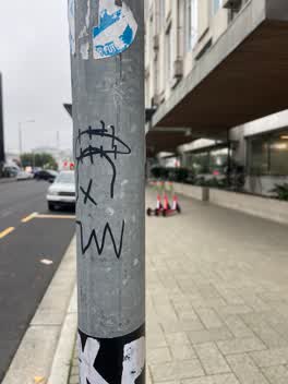 Graffiti —
 Black paint tag on parking pole sign by CCC building on Hereford Street.
Roading/Streets —
P10 sign 53 Hereford St has a sticker on it. Please remove
Roading/Streets —
Colin Chaney Testing SSS.
Graffiti —
power box
Graffiti —
Roading/Streets —
Roading/Streets —
P 30 rear sign missing Rear p 30 sign missing outside 496 sparks rd Sent from Samsung Mobile
Roading/Streets —
Byl needs repainted. .trucks having problems to get in and out
Roading/Streets —
Also reported on Hereford Street
- 53 Hereford Street — 125 reports
- 71 Hereford Street — 91 reports
- 197 Hereford Street — 62 reports
- 141 Hereford Street — 62 reports
- 262 Hereford Street — 59 reports
- 214 Hereford Street — 53 reports
- 147 Hereford Street — 46 reports
- 12 Hereford Street — 43 reports
The street’s crash record
NZTA’s record names Hereford Street in 154 crashes that hurt somebody since 2006 — 1 person killed, 25 seriously hurt.
The green nearby
- Bridge Of Remembrance — 104 m to the edge · Botanic
- Friendship Corner — 132 m to the edge · Botanic
- Scott Statue Reserve — 142 m to the edge · Botanic
- Tiffany Reserve — 163 m to the edge
- Canterbury Provincial Council Reserve — 293 m to the edge · Botanic
Parks within half a kilometre, measured to the boundary — the council’s open data.
The civic shelf nearby
- Civic Offices — 69 m away · Council office
- Scales — 176 m away · Car park
- Triangle — 393 m away · Car park
- Rolleston Avenue — 396 m away · Car park
- Armagh St — 418 m away · Car park
- Re:start - Lichfield St — 427 m away · Car park
- Turanga Library — 456 m away · Library · Cathedral Square, Christchurch
- Aldersgate — 474 m away · Car park
Libraries, halls and the rest within half a kilometre — the council’s open data.
On the doorstep
- Ministry of Health — 5 m away · Government
- Inati — 22 m away · Restaurants
- Koha Fitness and Health Club — 28 m away · Gyms & fitness
- Ministry of Education — 28 m away · Government
Businesses within four hundred metres, measured at the pin — OpenStreetMap and the council directories.
The bus nearby
- Hereford St near Montreal St — 109 m away · route 8
- Hereford St near Montreal St — 109 m away · route 8
The closest Metro stops, within four hundred and fifty metres.
The tracks through here
- Walk and bike track through Christchurch Central City — 120 m to the line · walk · bike
- Walk and bike track through Christchurch Central City — 125 m to the line · walk · bike
- Walk and bike track through Christchurch Central City — 126 m to the line · walk · bike
- Walk and bike track through Christchurch Central City — 140 m to the line · walk · bike
- Walk and bike track through Christchurch Central City — 149 m to the line · walk · bike
Tracks whose line passes within half a kilometre, measured to the line itself — the council’s open data.
The named ground
Named water within 500 m of this address, measured to the line or the edge; Named places within 1.5 km of this address; the council’s own structure register — bridges, boardwalks and steps standing nearby — the open map’s record.
The remembered names nearby
- International Federation of University Women 22nd Triennial — 80 m away ·
INTERNATIONAL FEDERATION OF UNIVERSITY WOMEN 22ND TRIENNIAL CONFERENCE CHRISTCHURCH 1986 /
· 2000 - Citation for the Victoria Cross — 81 m away ·
Citation for the Victoria Cross / 24213 Pte Henry James Nicholas
· 2016 - 2835 Sergeant Henry James Nicholas VC MM — 83 m away ·
2835 Sergeant Henry James Nicholas VC MM / 1st Battalion, Canterbury Regiment / (biographi
· 2016
Inscribed plaques within two hundred and fifty metres — the register’s pins, not surveyed spots. The whole roll is at /plaques.
Renting nearby
new bonds in Christchurch Central City ran about $508 a week — $42 below the city median of $550 — the suburb page keeps the rent record →.
What was here — Hereford Street Bridge
100 m away · 71 Hereford Street · located to ±24 m · the place’s own record →
On the register. Nothing researched here yet.
What was here — Mill Island and Setting
108 m away · 71 Hereford Street · located to ±19 m · the place’s own record →
On the register. Nothing researched here yet.
What was here — Canterbury Club and Setting
114 m away · 129 Cambridge Terrace · located to ±28 m · the place’s own record →
On the register. Nothing researched here yet.
What was here — Canterbury Club Gas Lamp and Setting
122 m away · the place’s own record →
On the register. Nothing researched here yet.
What was here — Canterbury Club Hitching Post and Setting
124 m away · the place’s own record →
On the register. Nothing researched here yet.
The civic layer
This ground votes in Central ward — the Papanui-Innes-Central community board. Ward lines don’t always follow suburb lines; this one is measured at the pin, not the suburb’s centre.
What stood on this ground → · On the map → · From the air — the Crown’s aerials back to 1936; search the address on RetroLens →
Questions, answered briefly
76 council reports on record since September 2015 — most often graffiti (9), graffiti somewhere else (7), roading/streets (6).
Christchurch Central City, Christchurch — on Hereford Street.
The heritage register names 5 places at or beside it — Hereford Street Bridge, Mill Island and Setting.
Bridge Of Remembrance — 104 m to its edge.