291 Barbadoes St Christchurch 8011 Canterbury New Zealand
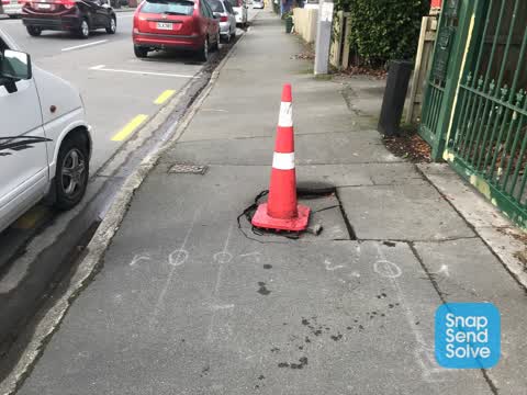
1 council report since July 2022, 1 carrying a photograph.
On the register here
- Dwelling and Setting, 229 Worcester Street (68m)
- St Luke's Chapel and Setting, 272 Hereford Street (212m)
- Latimer Square and Setting (248m)
The green nearby
- Latimer Square, 203 m to the edge · Botanic · 2 ha
- Chester Street East Reserve, 272 m to the edge
- Poplars Reserve, 393 m to the edge · Botanic
- Fire Fighters Reserve, 436 m to the edge
- Cambridge Reserve, 462 m to the edge
Parks within half a kilometre, measured to the boundary, the council’s open data. The whole roll is at /parks.
On the doorstep
- 298 Youth Health Centre, 24 m away · Doctors & clinics
- Urban Rooms, 39 m away · Apartments
- Luxury Without Limits in CBD, 98 m away · Hostels
- Christchurch Bowling Club, 100 m away · Sports centres
Businesses within four hundred metres, measured at the pin, OpenStreetMap and the council directories.
The bus nearby
- Gloucester St near Barbadoes St, 93 m away · route 5, route 7
- Gloucester St near Barbadoes St, 105 m away · route 5, route 7
The closest Metro stops, within four hundred and fifty metres.
The tracks through here
- Walk and bike track through Christchurch Central City, 176 m to the line · walk · bike
- Walk and bike track through Christchurch Central City, 296 m to the line · walk · bike
- Walk and bike track through Christchurch Central City, 297 m to the line · walk · bike
- Walk and bike track through Christchurch Central City, 384 m to the line · walk · bike
- Walk and bike track through Christchurch Central City, 399 m to the line · walk · bike
Tracks whose line passes within half a kilometre, the council’s open data.
The named ground
Named water within 500 m of this address, measured to the line or the edge; Named places within 1.5 km of this address; the council’s own structure register, bridges, boardwalks and steps standing nearby, the open map’s record.
The remembered names nearby
- Afac, 210 m away ·
afac / (dedication text illegible – backlit)
· 2013 - Thanks to / Kāinga ORA / for Their Contribution to This Seat, 223 m away ·
Thanks to / Kāinga Ora / for their contribution to this seat / and the local community
Inscribed plaques within two hundred and fifty metres, the register’s pins, not surveyed spots. The whole roll is at /plaques.
Renting nearby
new bonds in Christchurch Central City ran about $508 a week, $42 below the city median of $550, the suburb page keeps the rent record →.
What gets reported here
Photographed here 1 on record
What’s on record
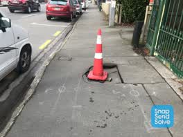 Pavement - Damaged, 31 Jul 2022
Footpath has collapsed. It’s hollow under the asphalt
The civic layer
This ground votes in Central ward, the Papanui-Innes-Central community board is its local layer. Ward lines don’t always follow suburb lines; this one is measured at the pin, not the suburb’s centre. The whole roll is at /wards.
Barbadoes St Christchurch 8011 Canterbury New Zealand, the whole record → · Everything about Christchurch Central City → · What stood on this ground → · On the map → · Street View → · From the air, RetroLens holds the Crown’s aerials back to 1936; search the address there →
Questions, answered briefly
1 council report on record since July 2022, most often pavement - damaged (1).
Christchurch Central City, Christchurch, on Barbadoes St Christchurch 8011 Canterbury New Zealand.
The heritage register names 3 places at or beside it, Dwelling and Setting, St Luke's Chapel and Setting.
Latimer Square, 203 m to its edge, 2 ha.