320B Oxford Terrace
12 council reports since April 2022, 10 carrying a photograph. The street’s heaviest record is 159 Oxford Terrace, 181 reports on file.
On the register here
- The Bricks Site, Cairn and Setting, 311 Oxford Terrace (58m)
- Commercial Building and Setting, 228 Kilmore Street (110m)
- Dwelling and Setting, 250 Kilmore Street (215m)
- Dwellings and Setting, 100 Chester Street East (250m)
From the air, then
Sourced from Canterbury Maps and partners. LINZ, CC BY 3.0 NZ. Each frame is cut from Environment Canterbury’s historic imagery MapServer for that decade, only where the Footprints layer names a CC BY survey (NZAM-covered spots stay out). RetroLens holds more Crown aerials →
The green nearby
- Avon Riverbank Central City, 102 m to the edge · 6 ha
- Cambridge Green, 119 m to the edge
- Fire Fighters Reserve, 142 m to the edge
- Barbadoes Cemetery, 198 m to the edge · Botanic · 3 ha
- Cambridge Reserve, 213 m to the edge
Parks within half a kilometre, measured to the boundary, the council’s open data. The whole roll is at /parks.
On the doorstep
- Piko Whole Foods, 58 m away · Dairies & convenience
- The Herb Centre Cafe, 60 m away · Cafés
- Piko Wholefoods, 76 m away · Delis
- Foley Towers, 89 m away · Hostels
Businesses within four hundred metres, measured at the pin, OpenStreetMap and the council directories.
The bus nearby
- Gloucester St near Barbadoes St, 424 m away · route 5, route 7
- Gloucester St near Barbadoes St, 441 m away · route 5, route 7
The closest Metro stops, within four hundred and fifty metres.
The tracks through here
- Walk and bike track through Christchurch Central City, 3 m to the line · walk · bike
- Walk and bike track through Christchurch Central City, 54 m to the line · walk · bike
- Walk and bike track through Christchurch Central City, 68 m to the line · walk · bike
- Walk and bike track through Christchurch Central City, 83 m to the line · walk · bike
- Walk and bike track through Christchurch Central City, 161 m to the line · walk · bike
Tracks whose line passes within half a kilometre, the council’s open data.
The named ground
Named water within 500 m of this address, measured to the line or the edge; Named places within 1.5 km of this address; the council’s own structure register, bridges, boardwalks and steps standing nearby, the open map’s record.
The remembered names nearby
- Plaque no. 310899, 42 m away
- Plaque no. 310900, 42 m away
- Plaque no. 310901, 42 m away
Inscribed plaques within two hundred and fifty metres, the register’s pins, not surveyed spots. The whole roll is at /plaques.
Renting nearby
new bonds in Christchurch Central City ran about $508 a week, $42 below the city median of $550, the suburb page keeps the rent record →.
What gets reported here
Photographed here 10 on record


What’s on record
 Graffiti on a fence, building or structure, 18 Nov 2025
graffiti on lamp post pole
 Graffiti on a fence, building or structure, 23 Aug 2025
 Hazard, vehicle, 6 Nov 2024
The section of Oxford tce between Kilmore and Barbadoes st is being used for overnight camping. This vehicle has been parked here numerous t
 Graffiti on a fence, building or structure, 3 Jun 2024
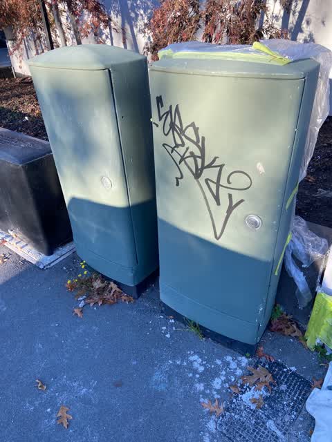
Graffiti on black water services cabinet, and top of green cabinets.
 Graffiti, 25 Feb 2024
 Graffiti, 13 Dec 2023
 Graffiti, 13 Dec 2023
- Graffiti, 7 Nov 2023
- Graffiti, 7 Nov 2023
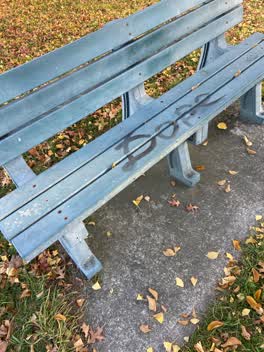 Graffiti, 2 May 2022
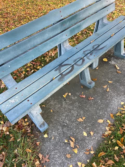
DOPE black paint tag plus another on riverside bench opposite large block of flats on Oxford Terrace.
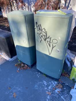 Graffiti, 2 May 2022
Black paint tag on anonymous gray padlocked asset by large block of flats east of 314 Oxford Terrace.
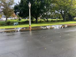 Roading/Streets, 7 Apr 2022
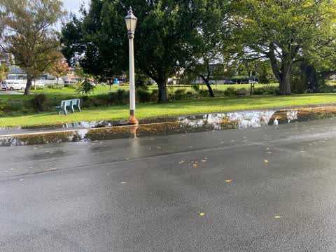
Flooding due to blocked gutters.
Elsewhere on Oxford Terrace
- 159 Oxford Terrace, 181 reports
- 153 Oxford Terrace, 174 reports
- 95 Oxford Terrace, 126 reports
- 211 Oxford Terrace, 126 reports
- 182 Oxford Terrace, 122 reports
- 184 Oxford Terrace, 109 reports
- 294 Oxford Terrace, 92 reports
- 152 Oxford Terrace, 87 reports
The street’s crash record
NZTA’s record names Oxford Terrace in 56 crashes that hurt somebody since 2006, 1 person killed, 11 seriously hurt.
The civic layer
This ground votes in Central ward, the Papanui-Innes-Central community board is its local layer. Ward lines don’t always follow suburb lines; this one is measured at the pin, not the suburb’s centre. The whole roll is at /wards.
Oxford Terrace, the whole record → · Everything about Christchurch Central City → · What stood on this ground → · On the map → · From the air, RetroLens holds the Crown’s aerials back to 1936; search the address there →
Questions, answered briefly
12 council reports on record since April 2022, most often graffiti (7), graffiti on a fence, building or structure (3), roading/streets (1).
Christchurch Central City, Christchurch, on Oxford Terrace.
The heritage register names 4 places at or beside it, The Bricks Site, Cairn and Setting, Commercial Building and Setting.
Avon Riverbank Central City, 102 m to its edge, 6 ha.