338 Montreal Street, Christchurch Central City
30 reports on record since April 2022 · 21 with photographs. The street’s heaviest record is 310 Montreal Street — 49 reports on file. Indicative rating valuation and school zones, hazards, bin day and what stood here before.
What gets reported here
- Graffiti — 10
- Graffiti on a fence, building or structure — 9
- General Request — 3
- Roads - General — 2
- Overgrown Vegetation — 2
- Vandalism - General — 1
Photographed here 21 on record


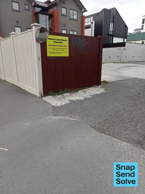

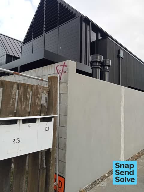


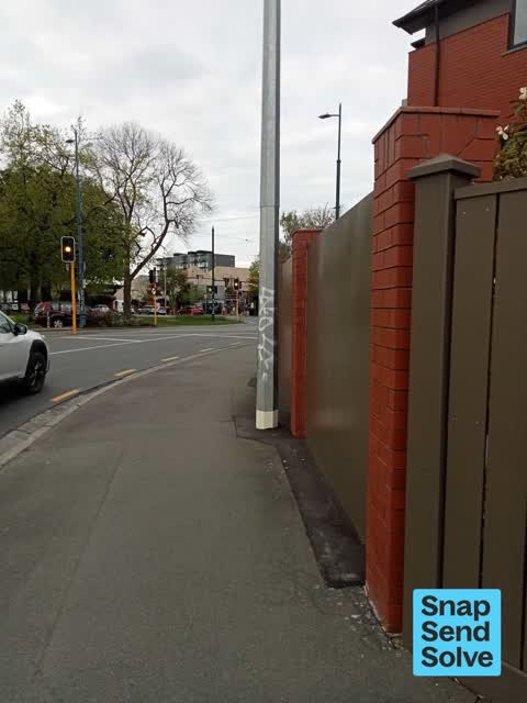
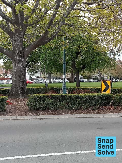


Reported here
 General Request —
Graffiti
 General Request —
Repetitive Grafitti on poles… being on the tram stop area with tourists not a good look for the city more surveillance required concerned r
 Graffiti on a fence, building or structure —
graffiti on concrete bin
 Graffiti on a fence, building or structure —
graffiti on brown fence
 Graffiti on a fence, building or structure —
graffiti on brown fence empty section
 Graffiti on a fence, building or structure —
graffiti on concrete fence top corner
 Graffiti on a fence, building or structure —
graffiti on light lamp post pole nearby
 Graffiti on a fence, building or structure —
graffiti on p5 signage structure
 Graffiti on a fence, building or structure —
graffiti on light lamp post pole nearby
 Graffiti on a fence, building or structure —
graffiti on light lamp post /tram lines
 Graffiti on a fence, building or structure —
graffiti on tram pole /light pole
 Roads - General —
We live at #52 Armagh. Several times a day we witness near miss incidents on the intersection of Armagh and Montreal. Mostly they relate to
 Graffiti —
Both sides of street lamp plus builders container
 Damaged Road —
Sink hole forming.
 Graffiti —
 General Request —
Empty section a large fire hazard. Lots of long dry areas of grass. Also an eyesore for passing trams
 Overgrown Vegetation —
- Overgrown Vegetation —
The grass verge on the corner of Armagh St and Montreal St is excessively overgrown. Cranmer Sq is looking fantastic after being re-sown wit
- Graffiti —
- Poles and Signage - General —
- Graffiti —
- Vandalism - General —
- Graffiti —
- Graffiti —
- Graffiti —
- Graffiti —
 Graffiti —
Anti vax misinformation sticky tag on tramlines pole 112 on the corner of Montreal and Armagh Streets needs removal.
 Graffiti —
Blue paint tag on CH AQ asset on the corner of Montreal and Armagh Streets.
 Roads - General —
This impromptu pathway is used by almost everyone parking around Cranmer square and beyond. It would be excellent to have it sealed so as to
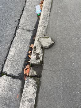 Roading/Streets —
Lump of concrete dislodged by the gutter on the corner of Armagh and Montreal Streets by Cranmer Square needs removal and gutter repair as w
Also reported on Montreal Street
- 310 Montreal Street — 49 reports
- 262 Montreal Street — 48 reports
- 245 Montreal Street — 43 reports
- 325 Montreal Street — 39 reports
- 248 Montreal Street — 35 reports
- 327 Montreal Street — 34 reports
- 208 Montreal Street — 32 reports
- 290 Montreal Street — 30 reports
The street’s crash record
NZTA’s record names Montreal Street in 118 crashes that hurt somebody since 2006 — 18 seriously hurt, nobody killed.
The green nearby
- Cranmer Square — 49 m to the edge · Botanic · 2 ha
- Armagh Reserve — 200 m to the edge
- Hagley Park North — 240 m to the edge · Sports ground · 91 ha
- Botanic Gardens — 254 m to the edge · Botanic · 21 ha
- Canterbury Provincial Council Reserve — 255 m to the edge · Botanic
Parks within half a kilometre, measured to the boundary — the council’s open data.
The civic shelf nearby
- Armagh St — 192 m away · Car park
- Aldersgate — 239 m away · Car park
- Rolleston Avenue — 275 m away · Car park
- Civic Offices — 327 m away · Council office
- Scales — 498 m away · Car park
Libraries, halls and the rest within half a kilometre — the council’s open data.
On the doorstep
- The Grange Boutique Bed & Breakfast — 63 m away · B&Bs
- Curtis Vision Optometrists — 82 m away · Business
- The Grange Motel — 90 m away · Motels
- West Fitzroy Apartments — 110 m away · Motels
Businesses within four hundred metres, measured at the pin — OpenStreetMap and the council directories.
The bus nearby
- Park Tce near Chester St W — 233 m away · route 8
- Rolleston Ave near Gloucester St — 252 m away · route 8
The closest Metro stops, within four hundred and fifty metres.
The tracks through here
- Walk and bike track through Christchurch Central City — 17 m to the line · walk · bike
- Walk and bike track through Christchurch Central City — 30 m to the line · walk · bike
- Walk and bike track through Christchurch Central City — 226 m to the line · walk · bike
- Walk and bike track through Christchurch Central City — 226 m to the line · walk · bike
- Walk and bike track through Christchurch Central City — 232 m to the line · walk · bike
Tracks whose line passes within half a kilometre, measured to the line itself — the council’s open data.
The named ground
Named water within 500 m of this address, measured to the line or the edge; Named places within 1.5 km of this address; the council’s own structure register — bridges, boardwalks and steps standing nearby — the open map’s record.
The remembered names nearby
- Rugby Football Was First Played in Cranmer Square — 36 m away ·
Rugby football was first played in Cranmer Square by the Christchurch Football Club in 186
· 2003 - Mischa Kuball / Solidarity Grid, 2013 / Dáœsseldorf — 244 m away ·
Mischa Kuball / Solidarity Grid, 2013 / DÁœSSELDORF
· 2013 - Mischa Kuball / Solidarity Grid, 2014 / Graz — 247 m away ·
Mischa Kuball / Solidarity Grid, 2014 / GRAZ
· 2013
Inscribed plaques within two hundred and fifty metres — the register’s pins, not surveyed spots. The whole roll is at /plaques.
Renting nearby
new bonds in Christchurch Central City ran about $508 a week — $42 below the city median of $550 — the suburb page keeps the rent record →.
What was here — Dwelling and Setting
66 m away · 56 Armagh Street · located to ±14 m · the place’s own record →
On the register. Nothing researched here yet.
What was here — Dwelling and Setting, Red House
87 m away · 25 Armagh Street · located to ±10 m · the place’s own record →
On the register. Nothing researched here yet.
What was here — Dwellings and Setting, Mildenhall
95 m away · 7/53 Gloucester Street · located to ±23 m · the place’s own record →
On the register. Nothing researched here yet.
What was here — Former Dwelling and Setting, Inveresk
130 m away · 17 Armagh Street · located to ±15 m · the place’s own record →
On the register. Nothing researched here yet.
What was here — Dwelling and Setting, Orari
132 m away · 40 Gloucester Street · located to ±19 m · the place’s own record →
On the register. Nothing researched here yet.
The civic layer
This ground votes in Central ward — the Papanui-Innes-Central community board. Ward lines don’t always follow suburb lines; this one is measured at the pin, not the suburb’s centre.
What stood on this ground → · On the map → · From the air — the Crown’s aerials back to 1936; search the address on RetroLens →
Questions, answered briefly
30 council reports on record since April 2022 — most often graffiti (10), graffiti on a fence, building or structure (9), general request (3).
Christchurch Central City, Christchurch — on Montreal Street.
The heritage register names 5 places at or beside it — Dwelling and Setting, Dwelling and Setting, Red House.
Cranmer Square — 49 m to its edge, 2 ha.