4 Oxford Terrace, Christchurch Central City
39 reports on record since January 2016 · 30 with photographs. The street’s heaviest record is 159 Oxford Terrace — 180 reports on file. Indicative rating valuation and school zones, hazards, bin day and what stood here before.
What gets reported here
Photographed here 30 on record


Reported here
 Graffiti on a road, footpath or bridge —
 Graffiti on roundabout between boatsheds and hospital outpatients.
 Poles and Signage - General —
 broken sign
 Hazard — vehicle —
 vehicle parked in a disabled car park in excess of half an hour with no visible disa led parking permit.
 Pavement - General —
 Kia ora, Could we please get this damaged Bike Security pavement decal removed? Many thanks, Anne
 Graffiti on a fence, building or structure —
 graffiti on light lamp post pole
 Graffiti on a fence, building or structure —
 graffiti on light lamp post pole
 Graffiti on a fence, building or structure —
 On all three stone seats
 General Request —
  Graffiti on a sign, mural or public art —
  Road Signage —
 Give way signage has been rotated. You need to bolt these things in properly, vandals are rotating them in many places
 Graffiti somewhere else —
 On orange direction sign Oxford tce
 Graffiti on a sign, mural or public art —
 Noticed this graffiti on one of the pieces of art along the boardwalk in Oxford terrace
 Graffiti somewhere else —
  Graffiti somewhere else —
  Graffiti on a fence, building or structure —
  Hazard — vehicle —
 Parked for 1 hour illegaly
 Graffiti somewhere else —
 Opposite out patients roundabout
 Graffiti on a fence, building or structure —
  Damaged Street Sign —
 Tipping street sign
- Road Signage —
- Graffiti —
- Graffiti —
- Graffiti —
- Hazard — vehicle —
- Graffiti —
- Graffiti —
- Street Gutters / Storm Water —
- Road Signage —
 Pavement - Damaged —
 Cover for water meter(?) broken and hole exposed next to shared footpath cycle way on Oxford Tce near hospital It used to have a cone to war
 Poles and Signage - General —
 Unnecessary signage on bothe sides of the road. Complaints from residents... it's just like any other intersection crossing.
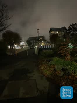 Street Light Outage —
 Boat shes bridge lights are not working, incredibly dangerous for walkers/bikers
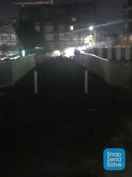 Street Light Outage —
 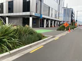 Roading/Streets —
 Plantings obstruct view for drivers, particularly those travelling southbound along Antigua St, turning left into driveway alongside Manawa.
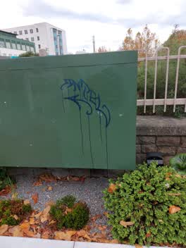 Graffiti —
 graffiti on Orion box
Graffiti —
Lamp post
Graffiti —
Graffiti —
outside hospital on street footpath
Roading/Streets —
Appalling levels of rubbish in gutters round the hospital. 1000s of butts ready to go down the storm water
Roading/Streets —
Both lights opposite go green at the same time on Oxford Terrence but turn into a single lane which could cause an accident compliant came f
Also reported on Oxford Terrace
- 159 Oxford Terrace — 180 reports
- 153 Oxford Terrace — 174 reports
- 95 Oxford Terrace — 126 reports
- 211 Oxford Terrace — 125 reports
- 182 Oxford Terrace — 122 reports
- 184 Oxford Terrace — 109 reports
- 294 Oxford Terrace — 92 reports
- 152 Oxford Terrace — 87 reports
The street’s crash record
NZTA’s record names Oxford Terrace in 56 crashes that hurt somebody since 2006 — 1 person killed, 11 seriously hurt.
The green nearby
- Botanic Gardens — 137 m to the edge · Botanic · 21 ha
- Nurses Memorial Chapel — 252 m to the edge · Botanic
- Hagley Park North — 260 m to the edge · Sports ground · 91 ha
- Tiffany Reserve — 386 m to the edge
- Friendship Corner — 455 m to the edge · Botanic
Parks within half a kilometre, measured to the boundary — the council’s open data.
The civic shelf nearby
- Christchurch Hospital Grounds — 288 m away · Car park
- Scales — 297 m away · Car park
- Rolleston Avenue — 446 m away · Car park
- Civic Offices — 453 m away · Council office
Libraries, halls and the rest within half a kilometre — the council’s open data.
On the doorstep
- University of Otago, Department of Paediatrics — 26 m away · University
- Kanuka — 32 m away · Cafés
- University of Otago, Department of Psychological Medicine — 33 m away · University
- Flora — 49 m away · Cafés
Businesses within four hundred metres, measured at the pin — OpenStreetMap and the council directories.
The bus nearby
- Christchurch Hospital Main Stop EB — 78 m away · route 3, route 5, route 7, route 60, route 80, route 81, route 84, route 85, route 86, route 91, route 92
- Christchurch Hospital Main Stop WB — 101 m away · route 3, route 5, route 7, route 60, route 80, route 81, route 84, route 85, route 86, route 91, route 92
The closest Metro stops, within four hundred and fifty metres.
The tracks through here
- Walk and bike track through Christchurch Central City — 3 m to the line · walk · bike
- Walk and bike track through Christchurch Central City — 9 m to the line · walk · bike
- Walk and bike track through Christchurch Central City — 15 m to the line · walk · bike
- Walk and bike track through Christchurch Central City — 51 m to the line · walk · bike
- Walk and bike track through Christchurch Central City — 82 m to the line · walk · bike
Tracks whose line passes within half a kilometre, measured to the line itself — the council’s open data.
The named ground
Named water within 500 m of this address, measured to the line or the edge; Named places within 1.5 km of this address; the council’s own structure register — bridges, boardwalks and steps standing nearby — the open map’s record.
The remembered names nearby
- Hagley Park South plaque — 156 m away · 2009
- Botanic Gardens plaque — 209 m away · 2004
- Botanic Gardens plaque — 241 m away · 1998
Inscribed plaques within two hundred and fifty metres — the register’s pins, not surveyed spots. The whole roll is at /plaques.
Renting nearby
new bonds in Christchurch Central City ran about $508 a week — $42 below the city median of $550 — the suburb page keeps the rent record →.
What was here — Former Dwelling and Setting
75 m away · 14 Oxford Terrace · located to ±15 m · the place’s own record →
On the register. Nothing researched here yet.
What was here — Antigua Boatsheds and Setting
78 m away · 2 Cambridge Terrace · located to ±22 m · the place’s own record →
On the register. Nothing researched here yet.
What was here — Fitzgerald Statue and Setting
157 m away · located to ±2 m · the place’s own record →
On the register. Nothing researched here yet.
What was here — Curator's House and Setting
204 m away · 5 Rolleston Avenue · located to ±14 m · the place’s own record →
On the register. Nothing researched here yet.
What was here — Dwelling and Setting
221 m away · 23 Cashel Street · located to ±11 m · the place’s own record →
On the register. Nothing researched here yet.
The civic layer
This ground votes in Central ward — the Papanui-Innes-Central community board. Ward lines don’t always follow suburb lines; this one is measured at the pin, not the suburb’s centre.
What stood on this ground → · On the map → · From the air — the Crown’s aerials back to 1936; search the address on RetroLens →
Questions, answered briefly
39 council reports on record since January 2016 — most often graffiti (9), graffiti on a fence, building or structure (5), graffiti somewhere else (4).
Christchurch Central City, Christchurch — on Oxford Terrace.
The heritage register names 5 places at or beside it — Former Dwelling and Setting, Antigua Boatsheds and Setting.
Botanic Gardens — 137 m to its edge, 21 ha.