41 Hereford Street, Christchurch Central City
17 reports on record since August 2020 · 11 with photographs. The street’s heaviest record is 53 Hereford Street — 125 reports on file. Indicative rating valuation and school zones, hazards, bin day and what stood here before.
What gets reported here
Photographed here 11 on record


Reported here
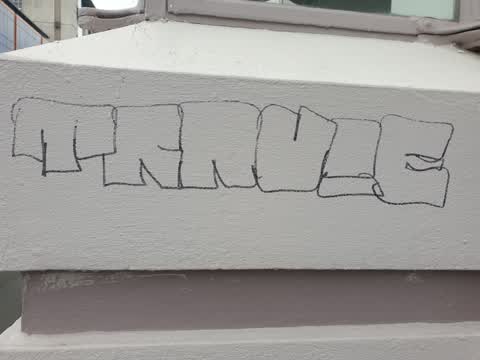
 Graffiti on a fence, building or structure —
graffiti on light lamp post pole nearby
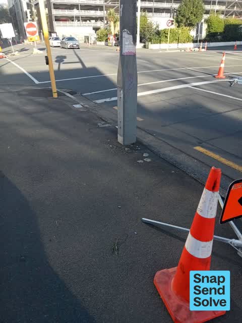
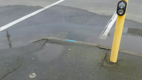
 Roads - General —
Kerb here has been run over and is lifting, needs repair as has messed up the adjacent footpath
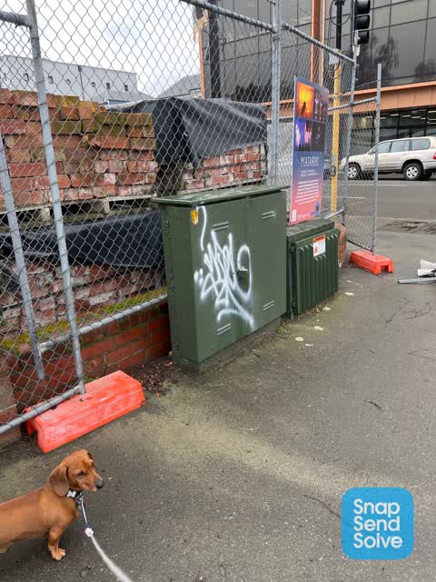
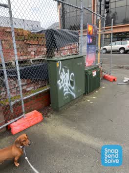
 Graffiti on a fence, building or structure —
41 Hereford St, northwest corner of Montreal - Green utility box
 Graffiti somewhere else —
 Graffiti on a fence, building or structure —
Graffiti on service box at Dux
 Sewer - Leak / Blockage —
 Graffiti —
- General Request —
- Pavement - General —
- Graffiti —
- Road Signage —
- Pavement - General —
 Graffiti —
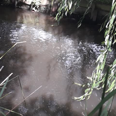
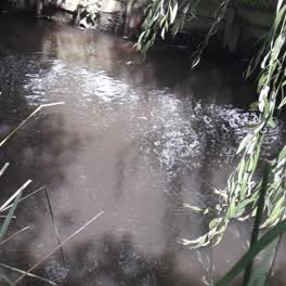 Wastewater/Stormwater —
This is a photo of the upper Heathcote River. The discoloured dirty water has been flowing for quite a considerable time with no improvemen
- Graffiti —
Fence graffiti on qe2 drive shirley
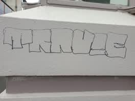 Graffiti —
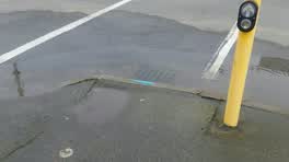 Wastewater/Stormwater —
Blocked sump?? Thanks, Anne :)
Also reported on Hereford Street
- 53 Hereford Street — 125 reports
- 71 Hereford Street — 91 reports
- 48 Hereford Street — 76 reports
- 197 Hereford Street — 62 reports
- 141 Hereford Street — 62 reports
- 262 Hereford Street — 59 reports
- 214 Hereford Street — 53 reports
- 147 Hereford Street — 46 reports
The street’s crash record
NZTA’s record names Hereford Street in 154 crashes that hurt somebody since 2006 — 1 person killed, 25 seriously hurt.
The green nearby
- Bridge Of Remembrance — 237 m to the edge · Botanic
- Botanic Gardens — 239 m to the edge · Botanic · 21 ha
- Scott Statue Reserve — 259 m to the edge · Botanic
- Friendship Corner — 264 m to the edge · Botanic
- Tiffany Reserve — 269 m to the edge
Parks within half a kilometre, measured to the boundary — the council’s open data.
The civic shelf nearby
- Civic Offices — 104 m away · Council office
- Scales — 167 m away · Car park
- Rolleston Avenue — 254 m away · Car park
- Armagh St — 436 m away · Car park
- Aldersgate — 496 m away · Car park
Libraries, halls and the rest within half a kilometre — the council’s open data.
On the doorstep
- NMG Gallery — 30 m away · Galleries
- YHA Christchurch — 51 m away · Hotels
- Jacobs — 54 m away · Company
- Rent Right Property Management — 63 m away · Business
Businesses within four hundred metres, measured at the pin — OpenStreetMap and the council directories.
The bus nearby
- Hereford St near Montreal St — 46 m away · route 8
- Hereford St near Montreal St — 46 m away · route 8
The closest Metro stops, within four hundred and fifty metres.
The tracks through here
- Walk and bike track through Christchurch Central City — 116 m to the line · walk · bike
- Walk and bike track through Christchurch Central City — 123 m to the line · walk · bike
- Walk and bike track through Christchurch Central City — 240 m to the line · walk · bike
- Walk and bike track through Christchurch Central City — 247 m to the line · walk · bike
- Walk and bike track through Christchurch Central City — 273 m to the line · walk · bike
Tracks whose line passes within half a kilometre, measured to the line itself — the council’s open data.
The named ground
Named water within 500 m of this address, measured to the line or the edge; Named places within 1.5 km of this address; the council’s own structure register — bridges, boardwalks and steps standing nearby — the open map’s record.
The remembered names nearby
- International Federation of University Women 22nd Triennial — 210 m away ·
INTERNATIONAL FEDERATION OF UNIVERSITY WOMEN 22ND TRIENNIAL CONFERENCE CHRISTCHURCH 1986 /
· 2000 - The Citizens of Christchurch / Proudly Recognise — 228 m away ·
THE CITIZENS OF CHRISTCHURCH / PROUDLY RECOGNISE THE / ANNIVERSARY OF 150 YEARS / OF DEDIC
· 2017 - The Bridge of Remembrance / Re-Opened As a Pedestrian Area — 228 m away ·
THE BRIDGE OF REMEMBRANCE / RE-OPENED AS A PEDESTRIAN AREA / BY / CAPT. CHARLES H. UPHAM V
· 2017
Inscribed plaques within two hundred and fifty metres — the register’s pins, not surveyed spots. The whole roll is at /plaques.
Renting nearby
new bonds in Christchurch Central City ran about $508 a week — $42 below the city median of $550 — the suburb page keeps the rent record →.
What was here — Dwellings and Setting, West Avon Flats
31 m away · 279 Montreal Street · located to ±15 m · the place’s own record →
On the register. Nothing researched here yet.
What was here — Students' Union and Setting
32 m away · 39 Hereford Street · located to ±30 m · the place’s own record →
On the register. Nothing researched here yet.
What was here — Christchurch Boys' High School Gymnasium and Setting
84 m away · 2B Worcester Street · located to ±15 m · the place’s own record →
On the register. Nothing researched here yet.
What was here — Registry and Setting
94 m away · 40 Worcester Street · located to ±13 m · the place’s own record →
On the register. Nothing researched here yet.
What was here — Christchurch Boys' High School and Setting
112 m away · located to ±25 m · the place’s own record →
On the register. Nothing researched here yet.
The civic layer
This ground votes in Central ward — the Papanui-Innes-Central community board. Ward lines don’t always follow suburb lines; this one is measured at the pin, not the suburb’s centre.
What stood on this ground → · On the map → · From the air — the Crown’s aerials back to 1936; search the address on RetroLens →
Questions, answered briefly
17 council reports on record since August 2020 — most often graffiti (5), graffiti on a fence, building or structure (3), wastewater/stormwater (2).
Christchurch Central City, Christchurch — on Hereford Street.
The heritage register names 5 places at or beside it — Dwellings and Setting, West Avon Flats, Students' Union and Setting.
Bridge Of Remembrance — 237 m to its edge.