420 Hagley Avenue, Christchurch Central City
35 reports on record since December 2018 · 31 with photographs. The street’s heaviest record is 550 Hagley Avenue — 140 reports on file. Indicative rating valuation and school zones, hazards, bin day and what stood here before.
What gets reported here
Photographed here 31 on record


Reported here
 Graffiti on a fence, building or structure —
Tagged street light (fence, building or structure)
 Graffiti on a traffic light pole or cabinet, or wa —
 Graffiti on a traffic light pole or cabinet, or wa —
 Graffiti on a fence, building or structure —
graffiti on light lamp post pole
 Graffiti on a fence, building or structure —
graffiti on light lamp post pole
 Hazard — vehicle —
 Graffiti somewhere else —
Graffiti blue cabinet
 Graffiti on a fence, building or structure —
 Facility - General Request —
7 to 10 cars keep parking on the grass during events at the Hagley park by driving from the Moorhouse Ave traffic light bicycle pedestrian p
 Hazard — vehicle —
Illegal parked
 Graffiti somewhere else —
 Graffiti somewhere else —
 Graffiti somewhere else —
 Overgrown Vegetation —
Tree branch snapped and fell into the pathway in South Hagley Park
 Fallen Tree —
Blocking cycle and walking path in hagley park
 Park - General Request —
Large trunk broken off tree lying on walkway. Location near old netball pavilion
 Fallen Tree —
A massive tree branch fell on the last night in south Hagley park near moorhouse ave netball courts corner. A very close call for a runner a
 Fallen Tree —
Blocking walkway
 Graffiti —
 Dumped Rubbish —
 Pavement - General —
Litter accumulation of dirt, general rubbish and vegetation in the gutter along Hagley Avenue
- Graffiti —
- Pavement - General —
- Hazard — vehicle —
- Hazard — vehicle —
 Hazard — vehicle —
Illegal parking at intersection
 Pavement - General —
Please can the kerbs be cleaned. They are full of dirt leaves and rubbish. Thanks
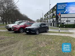 Roading/Streets —
Cars parked over foot path block access
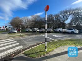 Roading/Streets —
Cars parked over foot paths, creating muddy mess over paths
 Parks —
22 possums in the park today! No wonder there are no birds in the park anymore
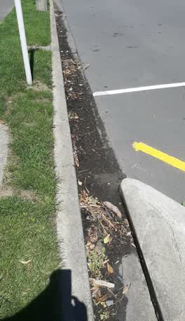 Roading/Streets —
The gutter on the street needs cleaning. It is not cleaned regularly
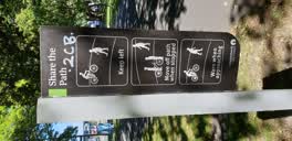 Graffiti —
opposite Paul kelly motor co. on walkway
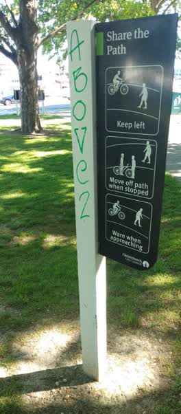 Graffiti —
sign at corner with Moorhouse
Graffiti —
Roading/Streets —
This is a major pedestrian access to Hagley Pk. It's now a disgrace of neglect. Pls get someone to clean and weed this for us
Also reported on Hagley Avenue
- 550 Hagley Avenue — 140 reports
- 510 Hagley Avenue — 100 reports
- 455 Hagley Avenue — 53 reports
- 445 Hagley Avenue — 34 reports
- 510A Hagley Avenue — 31 reports
- 480–488 Hagley Avenue — 29 reports
- 478 Hagley Avenue — 24 reports
- 447 Hagley Avenue — 19 reports
The street’s crash record
NZTA’s record names Hagley Avenue in 51 crashes that hurt somebody since 2006 — 13 seriously hurt, nobody killed.
The green nearby
- Hagley Park South — 42 m to the edge · Sports ground · 71 ha
- Cornelius O'connor Reserve — 314 m to the edge
- Disraeli Reserve — 425 m to the edge
- Mountfort Park — 467 m to the edge · Botanic
- Addington Cemetery — 474 m to the edge · Botanic · 2 ha
Parks within half a kilometre, measured to the boundary — the council’s open data.
On the doorstep
- Gothic Heights Motel — 81 m away · Motels
- The Atrium — 96 m away · Venues & events
- Espresso Car Wash Cafe - Addington — 102 m away · Cafés
- Paul Kelly Motor Company — 104 m away · Car dealers
Businesses within four hundred metres, measured at the pin — OpenStreetMap and the council directories.
The bus nearby
- Moorhouse Ave near Hagley Ave — 62 m away · route 7, route 140
- Lincoln Rd near Lincoln Ln — 139 m away · route 7
The closest Metro stops, within four hundred and fifty metres.
The tracks through here
- Walk and bike track through Christchurch Central City — 2 m to the line · walk · bike
- Walk and bike track through Christchurch Central City — 31 m to the line · walk · bike
- Walk and bike track through Christchurch Central City — 31 m to the line · walk · bike
- Walk and bike track through Christchurch Central City — 56 m to the line · walk · bike
- Walk and bike track through Christchurch Central City — 64 m to the line · walk · bike
Tracks whose line passes within half a kilometre, measured to the line itself — the council’s open data.
The named ground
Named water within 500 m of this address, measured to the line or the edge; Named places within 1.5 km of this address; the council’s own structure register — bridges, boardwalks and steps standing nearby — the open map’s record.
Renting nearby
new bonds in Christchurch Central City ran about $508 a week — $42 below the city median of $550 — the suburb page keeps the rent record →.
The civic layer
This ground votes in Central ward — the Papanui-Innes-Central community board. Ward lines don’t always follow suburb lines; this one is measured at the pin, not the suburb’s centre.
What stood on this ground → · On the map → · From the air — the Crown’s aerials back to 1936; search the address on RetroLens →
Questions, answered briefly
35 council reports on record since December 2018 — most often hazard — vehicle (5), graffiti (5), roading/streets (4).
Christchurch Central City, Christchurch — on Hagley Avenue.
Nothing on the heritage register at this exact spot — the record around this ground →
Hagley Park South — 42 m to its edge, 71 ha.