424 Oxford Terrace, Christchurch Central City
16 reports on record since February 2016 · 15 with photographs. The street’s heaviest record is 159 Oxford Terrace — 180 reports on file. Indicative rating valuation and school zones, hazards, bin day and what stood here before.
What gets reported here
Photographed here 15 on record






Reported here
 Graffiti on a fence, building or structure —
 Graffiti on a fence, building or structure —
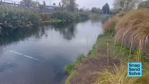
 Park - General Request —
Whitebaiter has pulled up and squashed native Juncus plants along the riverbank. Bamboo stakes have been pulled up and dumped in surrounding
 Graffiti on a road, footpath or bridge —
Graffiti on path of Avon Loop - really bad look
 Graffiti on a fence, building or structure —
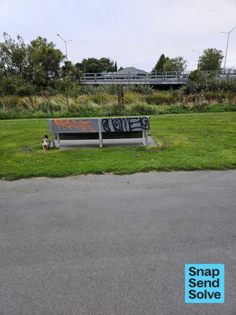
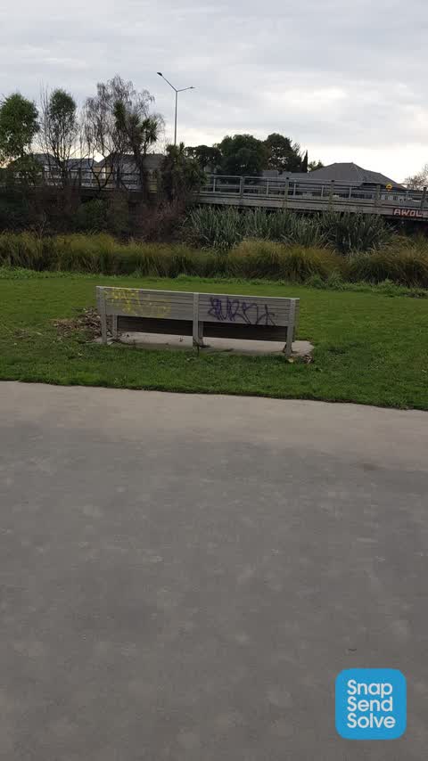
Avon Loop seat
 Graffiti on a fence, building or structure —
 Graffiti on a fence, building or structure —
 Pavement - General —
Poo everywhere
 Graffiti somewhere else —
Graffiti on ccc light pole
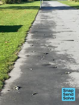 Pest / Vermin —
Excessive amount of poo from Canada geese. Would be good if council could clean the path and most importantly control the numbers of this in
- Graffiti —
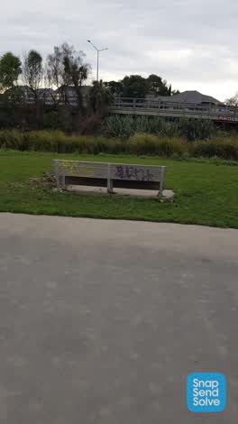 Graffiti —
Also on abit on footpath and light posts
 Graffiti —
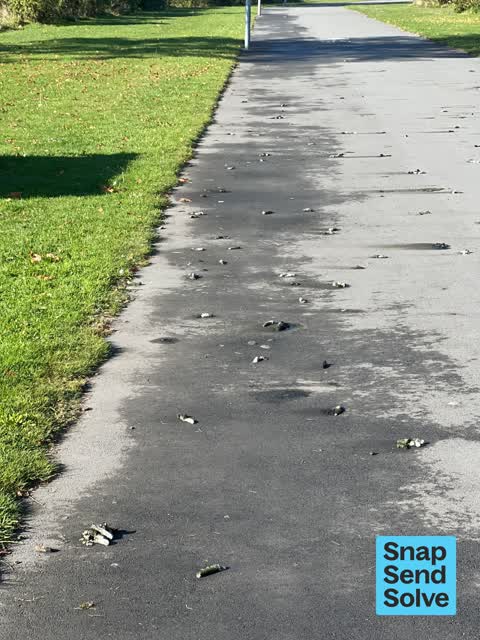
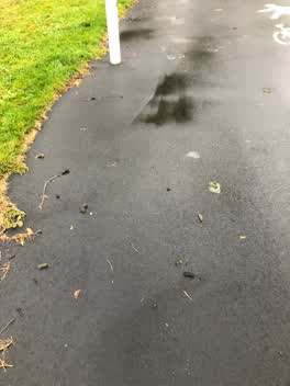 Parks —
Walkway covered in Canada geese shit. Makes the pathway dangerous and slippery to navigate.
Roading/Streets —
Street light out
Water Supply —
This pipe in the fenced off red zone on Avon Loop is gushing water.
Also reported on Oxford Terrace
- 159 Oxford Terrace — 180 reports
- 153 Oxford Terrace — 174 reports
- 95 Oxford Terrace — 126 reports
- 211 Oxford Terrace — 125 reports
- 182 Oxford Terrace — 122 reports
- 184 Oxford Terrace — 109 reports
- 294 Oxford Terrace — 92 reports
- 152 Oxford Terrace — 87 reports
The street’s crash record
NZTA’s record names Oxford Terrace in 56 crashes that hurt somebody since 2006 — 1 person killed, 11 seriously hurt.
The green nearby
- Avon Riverbank Central City — 6 m to the edge · 6 ha
- Walnut Tree Park — 105 m to the edge
- Barbadoes Cemetery — 174 m to the edge · Botanic · 3 ha
- Cambridge Green — 292 m to the edge
- William Brittan — 323 m to the edge
Parks within half a kilometre, measured to the boundary — the council’s open data.
On the doorstep
- Gourmet Grub Food Truck — 230 m away · Fast food
- Scott Base Motors — 240 m away · Car dealers
- Christchurch Bridge Club — 309 m away · Clubs
- Pomeroys Old Brewery Inn — 310 m away · Restaurants
Businesses within four hundred metres, measured at the pin — OpenStreetMap and the council directories.
The bus nearby
- Fitzgerald Ave near Alexandra St — 120 m away · route 7
- Fitzgerald Ave near Alexandra St — 162 m away · route 7
The closest Metro stops, within four hundred and fifty metres.
The tracks through here
- Walk and bike track through Christchurch Central City — 71 m to the line · walk · bike
- Walk and bike track through Christchurch Central City — 113 m to the line · walk · bike
- Walk and bike track through Christchurch Central City — 131 m to the line · walk · bike
- Walk and bike track through Christchurch Central City — 288 m to the line · walk · bike
- Walk and bike track through Christchurch Central City — 302 m to the line · walk · bike
Tracks whose line passes within half a kilometre, measured to the line itself — the council’s open data.
The named ground
Named water within 500 m of this address, measured to the line or the edge; the council’s own structure register — bridges, boardwalks and steps standing nearby — the open map’s record.
Renting nearby
new bonds in Christchurch Central City ran about $508 a week — $42 below the city median of $550 — the suburb page keeps the rent record →.
What was here — Bangor Street No. 3 Pumphouse and Setting
109 m away · located to ±4 m · the place’s own record →
On the register. Nothing researched here yet.
What was here — Dwelling and Setting
183 m away · 361 Cambridge Terrace · located to ±10 m · the place’s own record →
On the register. Nothing researched here yet.
The civic layer
This ground votes in Central ward — the Papanui-Innes-Central community board. Ward lines don’t always follow suburb lines; this one is measured at the pin, not the suburb’s centre.
What stood on this ground → · On the map → · From the air — the Crown’s aerials back to 1936; search the address on RetroLens →
Questions, answered briefly
16 council reports on record since February 2016 — most often graffiti on a fence, building or structure (5), graffiti (3), water supply (1).
Christchurch Central City, Christchurch — on Oxford Terrace.
The heritage register names 2 places at or beside it — Bangor Street No. 3 Pumphouse and Setting, Dwelling and Setting.
Avon Riverbank Central City — 6 m to its edge, 6 ha.