5 Millbank Lane, Christchurch Central City
21 reports on record since June 2021 · 13 with photographs. The most-reported address on Millbank Lane. Indicative rating valuation and school zones, hazards, bin day and what stood here before.
What gets reported here
Photographed here 13 on record




Reported here
 Dumped Rubbish,
 Traffic Signals,
tree foliage is beginning to block view of traffic light
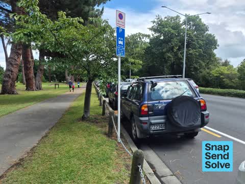
 Road Signage,
Can the council change the sign near the traffic lights that says "No parking 11pm-5am" to "NO PARKING 24/7"? The poor tourists infront of u
 Graffiti on a playground or in a park,
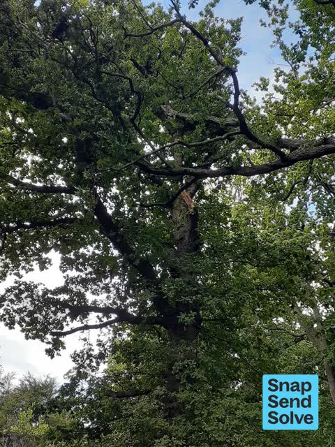
 Fallen Tree,
Big branch down & another big one torn & looking dangerous above it, same tree
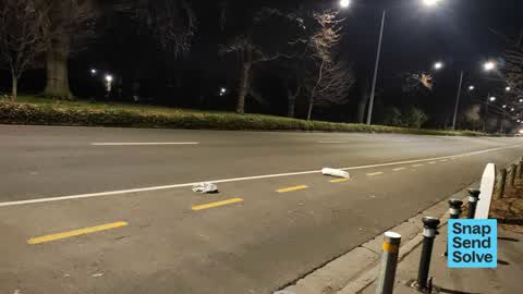
 Dumped Rubbish,
rubbish dumped
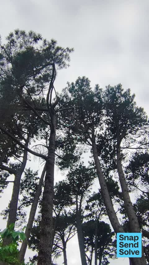
 Trees - General,
High branch on old, large pine tree is broken and dangling
 Park - General Request,
Signage covered in green lichen or something, but probably ignored by lost people anyway. Would be good to have something more visible
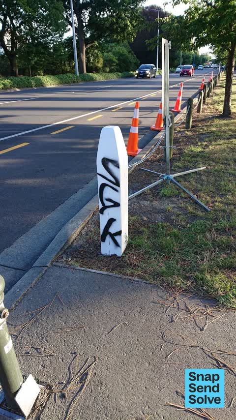
 Graffiti on a fence, building or structure,
On white post by access into Hagley park
 Graffiti,
Hello Council Person Tag 1 when walking through Little Hagley this morning I came across two tags on the footpath, could consideration be
 Trees - General,
4 new radiata pines seem to be dying
- Park - General Request,
- Trees - General,
- Graffiti,
- Trees - General,
- Animal - Deceased,
- Vandalism - General,
- Park - General Request,
- Graffiti,
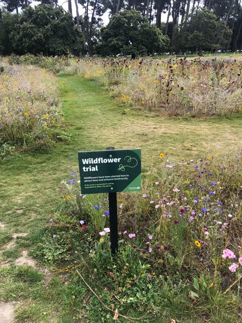
 Parks,
Excellent, great move. Please do again next year
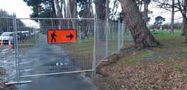 Roading/Streets,
Bizarre blocking of the footpath sending everyone onto the wet grass and mud for no reason!!!!???? very dangerous in this weather.
Also reported on Millbank Lane
- 3 Millbank Lane, 7 reports
- 4 Millbank Lane, 1 report
From the air, then
Sourced from Canterbury Maps and partners. LINZ, CC BY 3.0 NZ. Each frame is cut from Environment Canterbury’s historic imagery MapServer for that decade, only where the Footprints layer names a CC BY survey (NZAM-covered spots stay out). RetroLens holds more Crown aerials →
The green nearby
- Hagley Park North, you are in it · Sports ground · 91 ha
- Little Hagley Park, 42 m to the edge · Botanic · 7 ha
- Carlton Mill Riverbank, 82 m to the edge
- Millbrook Reserve, 388 m to the edge · Botanic
Parks within half a kilometre, measured to the boundary, the council’s open data.
On the doorstep
- North Hagley Community Sports & Recreation Trust, 260 m away · Clubs
- Dorset House Backpacker Hostel, 372 m away · Hostels
- Hagley Golf Club, 400 m away · Golf courses
- Strawberry Fare, 400 m away · Restaurants
Businesses within four hundred metres, measured at the pin: OpenStreetMap and the council directories.
The bus nearby
- Carlton Mill Rd near Cheltenham St, 202 m away · route 8
- Carlton Mill Rd near Hewitts Rd, 206 m away · route 8
The closest Metro stops, within four hundred and fifty metres.
The tracks through here
- Walk and bike track through Christchurch Central City, 33 m to the line · walk · bike
- Walk and bike track through Christchurch Central City, 44 m to the line · walk · bike
- Walk and bike track through Christchurch Central City, 65 m to the line · walk · bike
- Walk and bike track through Christchurch Central City, 70 m to the line · walk · bike
- Walk and bike track through Christchurch Central City, 140 m to the line · walk · bike
Tracks whose line passes within half a kilometre, measured to the line itself, the council’s open data.
The named ground
Named water within 500 m of this address, measured to the line or the edge; Named places within 1.5 km of this address; the council’s own structure register, bridges, boardwalks and steps standing nearby, the open map’s record.
The remembered names nearby
- Little Hagley Park plaque, 112 m away · 1998
Inscribed plaques within two hundred and fifty metres, the register’s pins, not surveyed spots. The whole roll is at /plaques.
Renting nearby
new bonds in Christchurch Central City ran about $508 a week, $42 below the city median of $550, the suburb page keeps the rent record →.
The civic layer
This ground votes in Central ward, the Papanui-Innes-Central community board. Ward lines don’t always follow suburb lines; this one is measured at the pin, not the suburb’s centre.
What stood on this ground → · On the map → · From the air, the Crown’s aerials back to 1936; search the address on RetroLens →
Questions, answered briefly
21 council reports on record since June 2021, most often trees - general (4), park - general request (3), graffiti (3).
Christchurch Central City, Christchurch, on Millbank Lane.
Nothing on the heritage register at this exact spot, the record around this ground →
Hagley Park North, the address is inside it, 91 ha.