896 Colombo Street, Christchurch Central City
33 reports on record since January 2016 · 22 with photographs. The street’s heaviest record is 794 Colombo Street — 159 reports on file. Indicative rating valuation and school zones, hazards, bin day and what stood here before.
What gets reported here
Photographed here 22 on record




Reported here
 Graffiti on a fence, building or structure —
Graffiti on fence
 Graffiti on a fence, building or structure —
 Graffiti on a fence, building or structure —
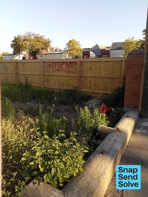
Black and white paint tags on fibro wall at 896 Colombo Street.
 Graffiti on a fence, building or structure —
 Graffiti on a fence, building or structure —
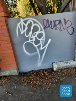
Black and purple paint tags on brick wall facing the footpath at 896 Colombo Street.
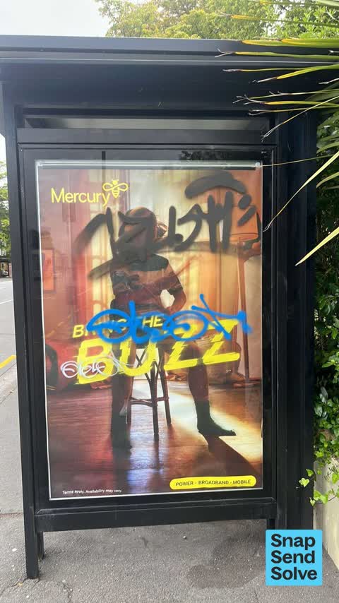
 Graffiti on a bus stop or public toilet —
 Graffiti somewhere else —
 Graffiti somewhere else —
 Graffiti somewhere else —
 Graffiti somewhere else —
 Dumped Rubbish —
 Graffiti on a fence, building or structure —
Black paint tags on CN630 asset by 896 Colombo Street.
- Graffiti —
- Graffiti —
- Graffiti —
- Graffiti —
- Graffiti —
- Graffiti —
- Graffiti —
- Graffiti —
- Graffiti —
- Graffiti —
- Graffiti —
 Graffiti —
White tag on wall
 Graffiti —
2 tags on wall
 Graffiti —
 Rubbish/Recycling —
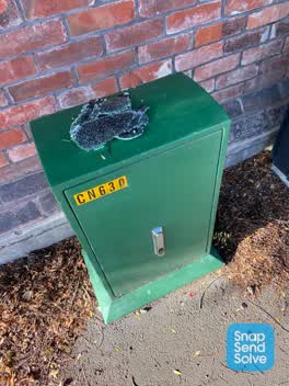 Rubbish/Recycling —
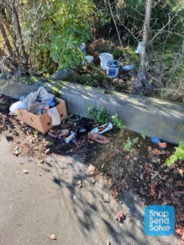
Broken plate glass dumped on the top of CN630 asset on Colombo Street needs removal.
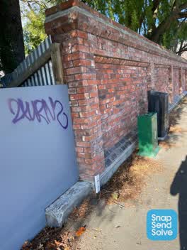 Graffiti —
Purple paint tag on wall facing the footpath opposite a bus stop on Colombo Street. Wall fronts an empty section.
Graffiti —
Graffiti —
Graffiti —
Next too 902 columbo st
Graffiti —
Enable
Also reported on Colombo Street
- 794 Colombo Street — 159 reports
- 673 Colombo Street — 102 reports
- 781 Colombo Street — 55 reports
- 521 Colombo Street — 46 reports
- 722 Colombo Street — 45 reports
- 569 Colombo Street — 45 reports
- 527 Colombo Street — 41 reports
- 711 Colombo Street — 38 reports
The street’s crash record
NZTA’s record names Colombo Street in 177 crashes that hurt somebody since 2006 — 1 person killed, 32 seriously hurt.
The green nearby
- Rose Historic Chapel Reserve — 107 m to the edge · Botanic
- Aldred Reserve — 265 m to the edge
Parks within half a kilometre, measured to the boundary — the council’s open data.
On the doorstep
- City Centre Motel — 64 m away · Motels
- The Christchurch Doctors — 84 m away · Centre
- Menz Medical Centre — 86 m away · Doctors & clinics
- Salerno Motel — 107 m away · Motels
Businesses within four hundred metres, measured at the pin — OpenStreetMap and the council directories.
The bus nearby
The closest Metro stops, within four hundred and fifty metres.
The tracks through here
- Walk and bike track through Christchurch Central City — 159 m to the line · walk · bike
- Walk and bike track through Christchurch Central City — 236 m to the line · walk · bike
- Walk and bike track through Christchurch Central City — 308 m to the line · walk · bike
Tracks whose line passes within half a kilometre, measured to the line itself — the council’s open data.
The named ground
Named places within 1.5 km of this address — the open map’s record.
The remembered names nearby
- A.M.D.G. Hic Lapis a Rr Dd J.J. Grimes S.M . — 113 m away ·
A.M.D.G. Hic Lapis A RR DD J.J. Grimes S.M ... Latin dedication
· 2009 - Heritage Christchurch Former St Mary’S Convent Chapel Built — 115 m away ·
HERITAGE CHRISTCHURCH Former St Mary’s Convent Chapel Built 1910 Architect Luttrell Brothe
· 2009
Inscribed plaques within two hundred and fifty metres — the register’s pins, not surveyed spots. The whole roll is at /plaques.
Renting nearby
new bonds in Christchurch Central City ran about $508 a week — $42 below the city median of $550 — the suburb page keeps the rent record →.
What was here — Former St Mary's Convent Chapel and Setting
121 m away · 67/868 Colombo Street · located to ±12 m · the place’s own record →
On the register. Nothing researched here yet.
What was here — Former Dwelling and Setting, Holly Lea/McLean's Mansion
152 m away · 387 Manchester Street · located to ±28 m · the place’s own record →
On the register. Nothing researched here yet.
The civic layer
This ground votes in Central ward — the Papanui-Innes-Central community board. Ward lines don’t always follow suburb lines; this one is measured at the pin, not the suburb’s centre.
What stood on this ground → · On the map → · From the air — the Crown’s aerials back to 1936; search the address on RetroLens →
Questions, answered briefly
33 council reports on record since January 2016 — most often graffiti (19), graffiti on a fence, building or structure (6), graffiti somewhere else (4).
Christchurch Central City, Christchurch — on Colombo Street.
The heritage register names 2 places at or beside it — Former St Mary's Convent Chapel and Setting, Former Dwelling and Setting, Holly Lea/McLean's Mansion.
Rose Historic Chapel Reserve — 107 m to its edge.