93 Cashel Street, Christchurch Central City
14 reports on record since July 2018 · 13 with photographs. The street’s heaviest record is 210 Cashel Street — 53 reports on file. Indicative rating valuation and school zones, hazards, bin day and what stood here before.
What gets reported here
Photographed here 13 on record


Reported here
 Graffiti on a sign, mural or public art —
Blue paint tag (plus sticky tags galore) on sign near 93 Cashel Street.
 Pavement - General —
Water spilling onto footpath from down pipe side of building like waterfall potential hazard for pedestrians
 Graffiti on a fence, building or structure —
Illegally placed stickers which is the new form of graffiti placed on council bollard corner of Cambridge Terrace & Cashel St.
 Graffiti somewhere else —
 Graffiti somewhere else —
 Graffiti somewhere else —
 Facility - General Request —
Bridge of Remembrance looks a bit shabby?
 Graffiti on a cabinet, pole or railway asset —
 Graffiti somewhere else —
- Graffiti —
 Graffiti —
Black paint tag on glass advertising sign on the corner of Plymouth Ln and Cashel Street.
 Parks —
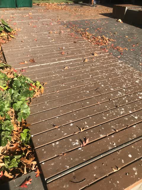
The seating in city mall is covered in bird droppings so no one uses it. Could the weekly clean of the stairs to the river on the terrace be
Flooding —
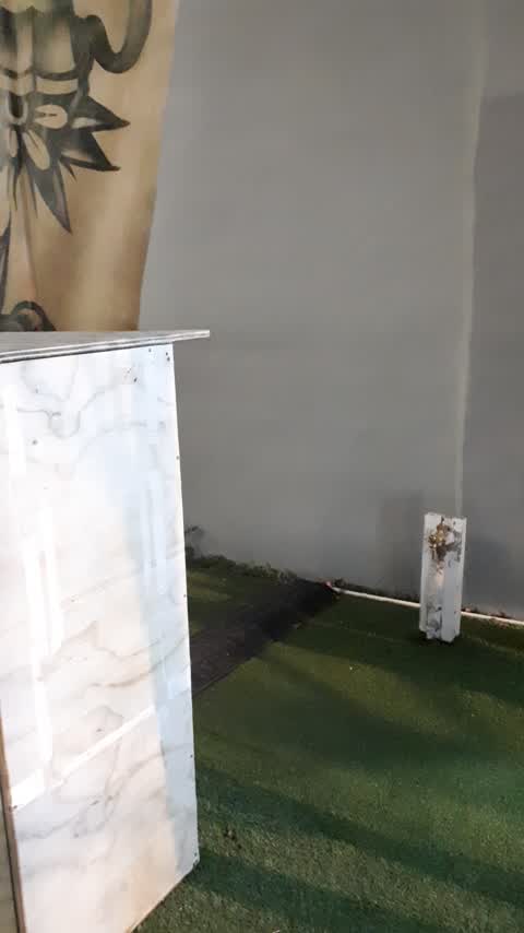
tap without turning bits has been running at least 24 hours coz I saw it last night but didnt have time to stop. super soggy fake grass unde
Rubbish/Recycling —
Rubbish bins overflow in tourist area
Also reported on Cashel Street
- 210 Cashel Street — 53 reports
- 219 Cashel Street — 46 reports
- 202 Cashel Street — 42 reports
- 208 Cashel Street — 41 reports
- 76 Cashel Street — 39 reports
- 7 Cashel Street — 37 reports
- 135 Cashel Street — 37 reports
- 75 Cashel Street — 34 reports
The street’s crash record
NZTA’s record names Cashel Street in 103 crashes that hurt somebody since 2006 — 1 person killed, 9 seriously hurt.
The green nearby
- Bridge Of Remembrance — you are in it · Botanic
- Friendship Corner — 10 m to the edge · Botanic
- Tiffany Reserve — 65 m to the edge
- Scott Statue Reserve — 207 m to the edge · Botanic
- City Mall — 286 m to the edge
Parks within half a kilometre, measured to the boundary — the council’s open data.
The civic shelf nearby
- Scales — 188 m away · Car park
- Civic Offices — 191 m away · Council office
- Re:start - Lichfield St — 307 m away · Car park
- Triangle — 317 m away · Car park
- Turanga Library — 461 m away · Library · Cathedral Square, Christchurch
Libraries, halls and the rest within half a kilometre — the council’s open data.
On the doorstep
- South Island Moon Festival locations — 41 m away · Venues & events
- EY — 48 m away · Business
- Tiki Taco Food Truck — 50 m away · Fast food
- Hugo Boss — 52 m away · Clothing
Businesses within four hundred metres, measured at the pin — OpenStreetMap and the council directories.
The bus nearby
- Hereford St near Montreal St — 212 m away · route 8
- Hereford St near Montreal St — 218 m away · route 8
The closest Metro stops, within four hundred and fifty metres.
The tracks through here
- Walk and bike track through Christchurch Central City — 31 m to the line · walk · bike
- Walk and bike track through Christchurch Central City — 37 m to the line · walk · bike
- Walk and bike track through Christchurch Central City — 37 m to the line · walk · bike
- Walk and bike track through Christchurch Central City — 187 m to the line · walk · bike
- Walk and bike track through Christchurch Central City — 240 m to the line · walk · bike
Tracks whose line passes within half a kilometre, measured to the line itself — the council’s open data.
The named ground
Named water within 500 m of this address, measured to the line or the edge; Named places within 1.5 km of this address; the council’s own structure register — bridges, boardwalks and steps standing nearby — the open map’s record.
The remembered names nearby
- World War Ii / 1939 – 1945 / in Memory of Members — 10 m away ·
WORLD WAR II / 1939 – 1945 / IN MEMORY OF MEMBERS OF THE / 23rd N.Z. BATTALION / WHO GAVE
· 2017 - Qvid Non Pro Patria — 13 m away ·
QVID NON PRO PATRIA
· 2009 - Bridge Of Remembrance plaque — 14 m away ·
(Bronze soldier profile medallion – no text)
· 2009
Inscribed plaques within two hundred and fifty metres — the register’s pins, not surveyed spots. The whole roll is at /plaques.
Renting nearby
new bonds in Christchurch Central City ran about $508 a week — $42 below the city median of $550 — the suburb page keeps the rent record →.
What was here — Bridge of Remembrance and Setting
on this spot · 88 Cambridge Terrace · located to ±27 m · the place’s own record →
On the register. Nothing researched here yet.
What was here — Former Dwelling and Setting
105 m away · 95 Oxford Terrace · located to ±18 m · the place’s own record →
On the register. Nothing researched here yet.
What was here — Hereford Street Bridge
120 m away · 71 Hereford Street · located to ±24 m · the place’s own record →
On the register. Nothing researched here yet.
What was here — Rhododendron Island and Setting
121 m away · 78 Cambridge Terrace · located to ±37 m · the place’s own record →
On the register. Nothing researched here yet.
What was here — St Michael and All Angels Church Belfry and Setting
144 m away · 90 Oxford Terrace · located to ±5 m · the place’s own record →
On the register. Nothing researched here yet.
The civic layer
This ground votes in Central ward — the Papanui-Innes-Central community board. Ward lines don’t always follow suburb lines; this one is measured at the pin, not the suburb’s centre.
What stood on this ground → · On the map → · From the air — the Crown’s aerials back to 1936; search the address on RetroLens →
Questions, answered briefly
14 council reports on record since July 2018 — most often graffiti somewhere else (4), graffiti (2), rubbish/recycling (1).
Christchurch Central City, Christchurch — on Cashel Street.
The heritage register names 5 places at or beside it — Bridge of Remembrance and Setting, Former Dwelling and Setting.
Bridge Of Remembrance — the address is inside it.