286 Main Road, Clifton
46 reports on record since November 2018 · 38 with photographs. The street’s heaviest record is 301 Main Road — 55 reports on file. Indicative rating valuation and school zones, hazards, bin day and what stood here before.
What gets reported here
Photographed here 38 on record


Reported here
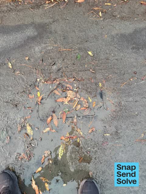
 Street Gutters / Storm Water —
 Drain overflow
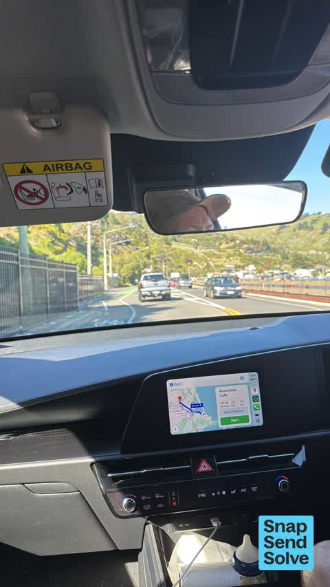
 Traffic Signals —
 Redcliffs traffic signal rotating too quickly. Traffic backed up way back to sumner
 Graffiti on a fence, building or structure —
 On wooden fence fence by shag rock
 Graffiti on a fence, building or structure —
 More graffiti being added to wooden bollards opposite Shag Rock. I first reported this three months ago!
 Roads - General —
 Lamppost oscillating in resonance with wind. Potential for fatigue and failure?
 Overgrown Vegetation —
 The steps to the beach at shag rock and very very hard to use as the vegetation is covering half of them. These hasn't been any clearing don
 Graffiti somewhere else —
 Still Graffiti on road side of crash barrier on corner at Shag Rock. Been there a number of weeks.
 Graffiti somewhere else —
 Tagging on the rocks
 Graffiti somewhere else —
 Please can you arrange removal of this tag? Many thanks!
 Graffiti somewhere else —
 Please can you arrange removal of this ‘unsightly’ tag? Many thanks!
 Graffiti somewhere else —
 On rocks by famous Shag rock. Looks terrible
 Graffiti on a fence, building or structure —
 Looks terrible
 Graffiti on a fence, building or structure —
 Main road after Monks bay at Shag Rock corner going into Sumner. Tagging on back of wooden fence structure alongside road. Susan Sumner
 Graffiti on a fence, building or structure —
 Ugly tagging SHARK and other on Shag Rock corner fence by main road after Monks Bay into Sumner. Susan Sumner
 Graffiti somewhere else —
 Graffitti on stonework above the roadway at Shag rock corner Redcliffs
 Graffiti on a road, footpath or bridge —
 Along the barrier fence between Sumner and Monks Bay
 Graffiti somewhere else —
 Near Shag Rock Can you please clean up, looks terrible
 Graffiti on a fence, building or structure —
  Graffiti on a sign, mural or public art —
 Tags popping up on timber safety barriers near shag rock
 Graffiti on a fence, building or structure —
 Graffiti on road barriers on Coastal Pathway near Shag Rock corner
 Graffiti on a fence, building or structure —
  Graffiti somewhere else —
 Graffiti on iconic rocks on Sumner beach.
 Vandalism - General —
 Black paint vandalism on wooden barrier
 Graffiti on a fence, building or structure —
 Tagging on the safety barrier on the bend overlooking Shag Rock.
 Graffiti somewhere else —
 Graffiti on rocks at Shag Rock
 Graffiti on a fence, building or structure —
 Graffiti on costal pathway wooden fence all along the bend
 Graffiti on a fence, building or structure —
  Graffiti on a fence, building or structure —
 More appearing every day.
 Graffiti on a fence, building or structure —
  Graffiti on a fence, building or structure —
  Graffiti somewhere else —
 Graffiti on natural rocks at Shag Rock
 Graffiti on a road, footpath or bridge —
 On coastal pathway
 Graffiti on a bus stop or public toilet —
  Graffiti on a sign, mural or public art —
 On several roadside signs.
- Graffiti —
- Street Light Outage —
- Graffiti —
- Graffiti —
- Graffiti —
- Graffiti —
- Road Blockage —
Hi, traffic control for the coastal pathway has been put in place this Saturday with no warning to the local community who only expected it
- Road Blockage —
Hi, traffic control for the coastal pathway has been put in place this Saturday with no warning to the local community who only expected it
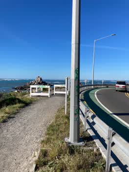 Graffiti —
 On lamp post and wooden barrier
Graffiti —
on road sign
Parks —
This area of the beach was never rocky and rough like this before the recent pathway works. We could walk barefoot from the road before. The
Roading/Streets —
Lighting column on worsening lean. Is this on a planned repair programme for the near future? An 'urgent' unplanned repair here could cause
Also reported on Main Road
- 301 Main Road — 55 reports
- 300 Main Road — 43 reports
- 305 Main Road — 30 reports
- 288 Main Road — 30 reports
- 258–296 Main Road — 24 reports
- 264A Main Road — 14 reports
- 266A Main Road — 10 reports
- 262 Main Road — 10 reports
The street’s crash record
NZTA’s record names Main Road in 18 crashes that hurt somebody since 2006 — 1 person killed, 9 seriously hurt.
The green nearby
- Shag Rock — 11 m to the edge · Regional
- Sumner Beach — 25 m to the edge · Regional · 8 ha
- Shag Rock Reserve — 26 m to the edge
- Spit Reserve — 200 m to the edge · Regional · 27 ha
- Yacht Club Reserve — 406 m to the edge
Parks within half a kilometre, measured to the boundary — the council’s open data.
On the doorstep
- Casamassima Italian Fare — 273 m away · Bottle stores
Businesses within four hundred metres, measured at the pin — OpenStreetMap and the council directories.
The bus nearby
The closest Metro stops, within four hundred and fifty metres.
The tracks through here
- Walk and bike track through Clifton — the line crosses here · walk · bike
Tracks whose line passes within half a kilometre, measured to the line itself — the council’s open data.
The named ground
Named places within 1.5 km of this address; the council’s own structure register — bridges, boardwalks and steps standing nearby — the open map’s record.
The remembered names nearby
- These Three Stone Lampstandards Were Built in 1939 — 96 m away ·
THESE THREE STONE LAMPSTANDARDS WERE BUILT IN 1939 BY THE SUMNER BOROUGH COUNCIL... RENEWE
· 2009 - This Plaque Placed by the Sumner-Redcliffs Historical — 199 m away ·
This plaque placed by the Sumner-Redcliffs Historical Society in memory of Sir Terence McC
· 2009
Inscribed plaques within two hundred and fifty metres — the register’s pins, not surveyed spots. The whole roll is at /plaques.
Renting nearby
new bonds in Clifton ran about $820 a week — $270 above the city median of $550 — the suburb page keeps the rent record →.
The civic layer
This ground votes in Heathcote ward — the Spreydon-Cashmere-Heathcote community board. Ward lines don’t always follow suburb lines; this one is measured at the pin, not the suburb’s centre.
What stood on this ground → · On the map → · From the air — the Crown’s aerials back to 1936; search the address on RetroLens →
Questions, answered briefly
46 council reports on record since November 2018 — most often graffiti on a fence, building or structure (14), graffiti somewhere else (10), graffiti (7).
Clifton, Christchurch — on Main Road.
Nothing on the heritage register at this exact spot — the record around this ground →
Shag Rock — 11 m to its edge.