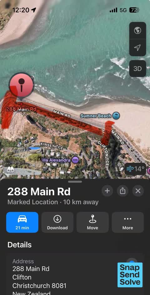
300 Main Road, Clifton
43 reports on record since April 2017 · 22 with photographs. The street’s heaviest record is 301 Main Road — 55 reports on file. Indicative rating valuation and school zones, hazards, bin day and what stood here before.
What gets reported here
Photographed here 22 on record




Reported here
- Street Cleaning —
Broken bus shelter with plenty of glass all over the footpath and cycles lanes on both sides. It does appear to be intentionally placed in l
 Street Gutters / Storm Water —
 Stormwater drain on Sumner beach near shag rock blocked with rocks and soil
 Road Blockage —
 Box Thorne and broom growing out into cycle lane, forcing cyclists into traffic lane
 Overgrown Vegetation —
 The planting here was complete overkill and blocks the rocks featured behind after the earthquake works. The fence was enough, the planting
 Overgrown Vegetation —
 Overgrown flax and vegetation impinging onto cycle lane creating hazard for road users I accidentally closed my previous snap send and solv
 Overgrown Vegetation —
 Vegetation is impinging into the cycle lane including flax which could make a Cyclist fall off their bike if trying to avoid a car Probably
 Graffiti on a sign, mural or public art —
 Graffiti on health warning sign.
 Graffiti on a fence, building or structure —
  Graffiti somewhere else —
 Please can you arrange removal of this tag? Thanks!
 Graffiti on a fence, building or structure —
 Graffiti on concrete road barrier, cliffside start peacock gallop
- Damaged Road —
Recent asphalt repair in road has dropped. As it was just over asphalted. Still bump in the road. Repairs need to excavated and the area
 Road Blockage —
 This is a common occurrence on a fine day weekend day in sumner. Painfully slow traffic due to the traffic lights which were installed for t
 Graffiti on a sign, mural or public art —
  Graffiti on a sign, mural or public art —
 Also tagging nearer to Shag Rock on roadside signs
 Damaged Road —
 This road is getting bad with sink holes. Tar seal hasn’t broken yet but a large dip in the new road
 Damaged Road —
 There appears to be a significant developing unevenness in the road surface where I have indicated on the map along peacocks gallop.
- Damaged Road —
No photo sorry, but the main road between Sumner and Redcliffs below Peacocks Gallop has two significant dips developing roughly halfway alo
 Damaged Road —
 Sink holes forming getting bad. You can see the dark marks on road.
 Animal - General —
 Seal on Sumner beach at shag rock end.
 Facility - General Request —
 The black iron fence on the Peacocks Gallop side of the ain road has two sections that have fallen away and are only held up by vegetation (
- Road Signage —
- Overgrown Vegetation —
- Overgrown Vegetation —
- Damaged Road —
- Overgrown Vegetation —
- Overgrown Vegetation —
- Dumped Rubbish —
- Dumped Rubbish —
- Dumped Rubbish —
- Vandalism - General —
- Dumped Rubbish —
- Street Light Outage —
- Overgrown Vegetation —
- Overgrown Vegetation —
- Overgrown Vegetation —
- Overgrown Vegetation —
- Overgrown Vegetation —
- Road Signage —
 Accessibility —
 Bottom of steps onto beach are covered with rocks making accessibilty difficult/unsafe.
 Graffiti —
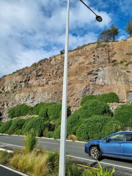
 Graffiti on street light pole
 Parks —
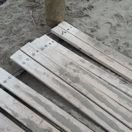
 wooden walkway needs attention
Parks —
further to my previous snap, there are quite a few pockets and single large rocks scattered along the beach as well. Please remove these as
Roading/Streets —
This big hole is at least 200mm deep. Enough to kill a cyclist. Location is at the Clifton Bay end of Peacocks Gallop where Mr Whipple used
Also reported on Main Road
- 301 Main Road — 55 reports
- 286 Main Road — 46 reports
- 305 Main Road — 30 reports
- 288 Main Road — 30 reports
- 258–296 Main Road — 24 reports
- 264A Main Road — 14 reports
- 266A Main Road — 10 reports
- 262 Main Road — 10 reports
The street’s crash record
NZTA’s record names Main Road in 18 crashes that hurt somebody since 2006 — 1 person killed, 9 seriously hurt.
The green nearby
- Sumner Beach — 19 m to the edge · Regional · 8 ha
- Shag Rock Reserve — 43 m to the edge
- Shag Rock — 167 m to the edge · Regional
- Sumner Coronation Garden — 273 m to the edge
- Spit Reserve — 351 m to the edge · Regional · 27 ha
Parks within half a kilometre, measured to the boundary — the council’s open data.
On the doorstep
- Sumner Surf Life Saving Club — 274 m away · Clubs
- Casamassima Italian Fare — 288 m away · Bottle stores
- Sumner Coronation Garden — 314 m away · Attractions
Businesses within four hundred metres, measured at the pin — OpenStreetMap and the council directories.
The bus nearby
The closest Metro stops, within four hundred and fifty metres.
The tracks through here
- Walk and bike track through Clifton — 2 m to the line · walk · bike
Tracks whose line passes within half a kilometre, measured to the line itself — the council’s open data.
The named ground
Named places within 1.5 km of this address; the council’s own structure register — bridges, boardwalks and steps standing nearby — the open map’s record.
The remembered names nearby
- This Plaque Placed by the Sumner-Redcliffs Historical — 17 m away ·
This plaque placed by the Sumner-Redcliffs Historical Society in memory of Sir Terence McC
· 2009 - These Three Stone Lampstandards Were Built in 1939 — 118 m away ·
THESE THREE STONE LAMPSTANDARDS WERE BUILT IN 1939 BY THE SUMNER BOROUGH COUNCIL... RENEWE
· 2009
Inscribed plaques within two hundred and fifty metres — the register’s pins, not surveyed spots. The whole roll is at /plaques.
Renting nearby
new bonds in Clifton ran about $820 a week — $270 above the city median of $550 — the suburb page keeps the rent record →.
The civic layer
This ground votes in Heathcote ward — the Spreydon-Cashmere-Heathcote community board. Ward lines don’t always follow suburb lines; this one is measured at the pin, not the suburb’s centre.
What stood on this ground → · On the map → · From the air — the Crown’s aerials back to 1936; search the address on RetroLens →
Questions, answered briefly
43 council reports on record since April 2017 — most often overgrown vegetation (12), damaged road (6), dumped rubbish (4).
Clifton, Christchurch — on Main Road.
Nothing on the heritage register at this exact spot — the record around this ground →
Sumner Beach — 19 m to its edge, 8 ha.