144 Milns Road
9 council reports since February 2016, 9 carrying a photograph. The street’s heaviest record is 168 Milns Road, 36 reports on file.
From the air, then
Sourced from Canterbury Maps and partners. RNZAF, CC BY 3.0 NZ. Each frame is cut from Environment Canterbury’s historic imagery MapServer for that decade, only where the Footprints layer names a CC BY survey (NZAM-covered spots stay out). RetroLens holds more Crown aerials →
The green nearby
- Milns Reserve, 4 m to the edge
- Milns Drainage Reserve, 32 m to the edge · 1 ha
- John Olliver Reserve, 75 m to the edge · 2 ha
- Six Silvers Reserve, 206 m to the edge · playground, 3 pieces
- Shield Reserve, 252 m to the edge
Parks within half a kilometre, measured to the boundary, the council’s open data. The whole roll is at /parks.
On the doorstep
- Banbury Park Village, 378 m away · Business
Businesses within four hundred metres, measured at the pin, OpenStreetMap and the council directories.
The tracks through here
- Walk and bike track through Halswell, 105 m to the line · walk · bike
Tracks whose line passes within half a kilometre, the council’s open data.
The named ground
Named water within 500 m of this address, measured to the line or the edge; the council’s own structure register, bridges, boardwalks and steps standing nearby, the open map’s record.
Renting nearby
new bonds in Halswell ran about $697 a week, $147 above the city median of $550, the suburb page keeps the rent record →.
What gets reported here
- Roading/Streets, 2
- Pothole, 2
- General Request, 2
- Pavement - Damaged, 1
- Parks, 1
- Overgrown Vegetation, 1
Photographed here 9 on record


What’s on record
 General Request, 10 Jul 2026
 Gas bottle substation gate left propped open
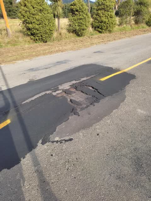
 Pavement - Damaged, 19 Mar 2026
 Broken asphalt pavement unsure how it occurred but is a pretty big safety hazard for small vehicles. Needs to be fixed before it blows out m
 General Request, 26 Jan 2026
 Elgas Gas bottle station gate open, normally it’s locked
 Pothole, 3 Dec 2025
 Patch has failed again. No tack coat
 Overgrown Vegetation, 16 Sept 2025
 Please herbicide spray the long grass and weeds in the Council berm between Milns Rd and a new Recreation Reserve to be vested with CCC. The
 Pothole, 5 Oct 2024
 With Sparks Rd now one way the detour is onto Milns Rd using an unfinished unsealed road. Big pot holes have opened up with the massive incr
 Roading/Streets, 4 Mar 2022
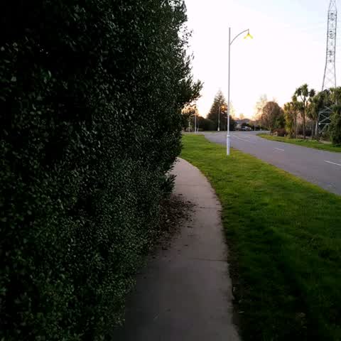
Parks, 19 Jul 2018
Vegetation significantly overgrowing adjacent footpath. Path floods in wet weather so cannot afford to loose any path width.
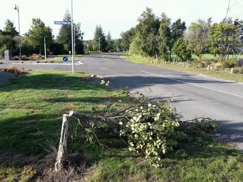
Roading/Streets, 11 Feb 2016
Intensionally cut down. Heart breaking sight. My neighbor saw 3 people in the area with a pruning saw at similar time, 530 pm thurs. They co
Elsewhere on Milns Road
- 168 Milns Road, 36 reports
- 98 Milns Road, 21 reports
- 53 Milns Road, 13 reports
- 149 Milns Road, 8 reports
- 146 Milns Road, 7 reports
- 70 Milns Road, 5 reports
- 58 Milns Road, 5 reports
- 93 Milns Road, 4 reports
The street’s crash record
NZTA’s record names Milns Road in 16 crashes that hurt somebody since 2006, 1 person killed, 1 seriously hurt.
The civic layer
This ground votes in Halswell ward, the Halswell-Hornby-Riccarton community board is its local layer. Ward lines don’t always follow suburb lines; this one is measured at the pin, not the suburb’s centre. The whole roll is at /wards.
Milns Road, the whole record → · Everything about Halswell → · What stood on this ground → · On the map → · From the air, RetroLens holds the Crown’s aerials back to 1936; search the address there →
Questions, answered briefly
9 council reports on record since February 2016, most often roading/streets (2), pothole (2), general request (2).
Halswell, Christchurch, on Milns Road.
Nothing on the heritage register at this exact spot, the record around this ground →
Milns Reserve, 4 m to its edge.