329 Halswell Road, Halswell
13 reports on record since October 2019 · 10 with photographs. The street’s heaviest record is 305 Halswell Road — 57 reports on file. Indicative rating valuation and school zones, hazards, bin day and what stood here before.
What gets reported here
- Water Leak — 3
- Park - General Request — 2
- Graffiti — 2
- Vandalism - General — 1
- Roads - General — 1
- Pothole — 1
Photographed here 10 on record


Reported here
 Pavement - Damaged —
 potholes need repair on footpath
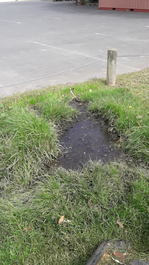
 Water Leak —
 Water coming / seaping out of ground outside The Old Vicarge Cafe, surrounding area very wet.
 Pothole —
 pothole in driveway entrance to supermarket. other areas showing signs of deterioration. as it is a high traffic area, need the whole area t
 Park - General Request —
 Jammed rubbish bin. Needs fixing. Thanks
 Roads - General —
 Another barrier wrecked
 Dumped Rubbish —
 Drink cans left by rubbish bin. Could a recycling bin could be set up here for beer bottles and cans? Thanks
- Water Leak —
- Park - General Request —
- Vandalism - General —
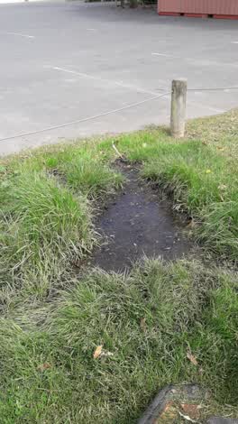 Water Leak —
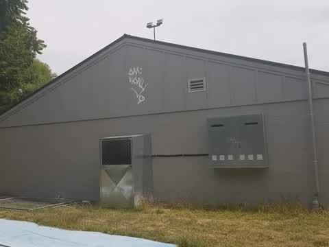
 Graffiti —
hi there could you please revove this grafiiti there is also some on the yellow league club rooms as well
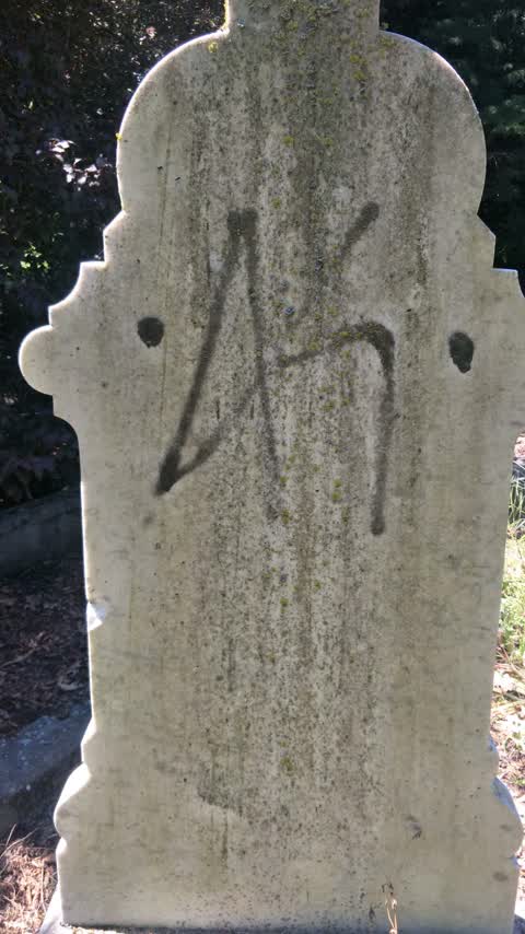
Graffiti —
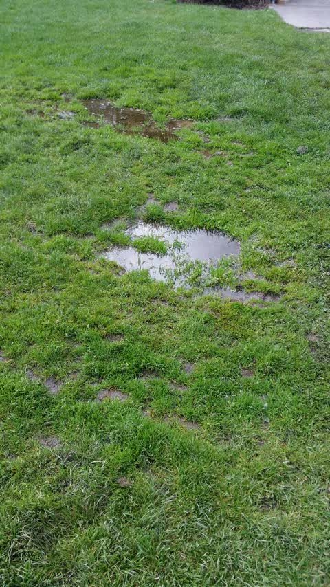
Parks —
very wet patch next to the cricket nets. it is often bit of a swamp - last summer was swampy a lot of the time. broken pipe?
Also reported on Halswell Road
- 305 Halswell Road — 57 reports
- 347A Halswell Road — 55 reports
- 303 Halswell Road — 19 reports
- 346 Halswell Road — 17 reports
- 341 Halswell Road — 16 reports
- 514 Halswell Road — 15 reports
- 339 Halswell Road — 15 reports
- 301 Halswell Road — 14 reports
The street’s crash record
NZTA’s record names Halswell Road in 32 crashes that hurt somebody since 2006 — 3 people killed, 6 seriously hurt.
The green nearby
- Halswell Domain — 87 m to the edge · Sports ground · 26 ha
- Kinrara Reserve — 396 m to the edge
- Rearsby Reserve — 429 m to the edge
- Fern Reserve — 436 m to the edge
- Cridland Drainage Reserve — 460 m to the edge
Parks within half a kilometre, measured to the boundary — the council’s open data.
The civic shelf nearby
- Halswell — 178 m away · Recreation centre · 339 Halswell Road
- Te Hāpua: Halswell Centre — 234 m away · Library · 341 Halswell Road, Halswell 8025
Libraries, halls and the rest within half a kilometre — the council’s open data.
On the doorstep
- Halswell Football Club — 91 m away · Sports centres
- Halswell Rugby League — 92 m away · Sports centres
- The Old Vicarage — 122 m away · Restaurants
- Halswell Bowling Club — 185 m away · Clubs
Businesses within four hundred metres, measured at the pin — OpenStreetMap and the council directories.
The bus nearby
The closest Metro stops, within four hundred and fifty metres.
The tracks through here
- Walk and bike track through Halswell — 169 m to the line · walk · bike
- Walk and bike track through Halswell — 487 m to the line · walk · bike
Tracks whose line passes within half a kilometre, measured to the line itself — the council’s open data.
The named ground
Named water within 500 m of this address, measured to the line or the edge; the council’s own structure register — bridges, boardwalks and steps standing nearby — the open map’s record.
The remembered names nearby
- Edward Paterson Esq. Chairman 1909 — 58 m away ·
EDWARD PATERSON ESQ. CHAIRMAN 1909 — 19— (weathered)
· 2008 - Lions Club Halswell District — 59 m away ·
LIONS CLUB HALSWELL DISTRICT (logo marker)
· 2008 - H.R.F.L.C. / Halswell Rugby Football League Club — 70 m away ·
H.R.F.L.C. / Halswell Rugby Football League Club / (dedication text partly illegible) / 19
· 2013
Inscribed plaques within two hundred and fifty metres — the register’s pins, not surveyed spots. The whole roll is at /plaques.
Renting nearby
new bonds in Halswell ran about $697 a week — $147 above the city median of $550 — the suburb page keeps the rent record →.
What was here — St Mary's Church Graveyard
on this spot · located to ±73 m · the place’s own record →
On the register. Nothing researched here yet.
What was here — St Mary's Church Lychgate and Setting
64 m away · located to ±3 m · the place’s own record →
On the register. Nothing researched here yet.
What was here — St Mary's Church and Setting
129 m away · located to ±14 m · the place’s own record →
On the register. Nothing researched here yet.
What was here — Halswell War Memorial and Setting
194 m away · located to ±3 m · the place’s own record →
On the register. Nothing researched here yet.
The civic layer
This ground votes in Halswell ward — the Halswell-Hornby-Riccarton community board. Ward lines don’t always follow suburb lines; this one is measured at the pin, not the suburb’s centre.
What stood on this ground → · On the map → · From the air — the Crown’s aerials back to 1936; search the address on RetroLens →
Questions, answered briefly
13 council reports on record since October 2019 — most often water leak (3), park - general request (2), graffiti (2).
Halswell, Christchurch — on Halswell Road.
The heritage register names 4 places at or beside it — St Mary's Church Graveyard, St Mary's Church Lychgate and Setting.
Halswell Domain — 87 m to its edge, 26 ha.