43 Clyde Road, Ilam
36 reports on record since May 2019 · 13 with photographs. The most-reported address on Clyde Road. Indicative rating valuation and school zones, hazards, bin day and what stood here before.
What gets reported here
- Overgrown Vegetation — 15
- Trees - General — 4
- Graffiti — 4
- Road Signage — 3
- Water Supply — 1
- Water General — 1
Photographed here 13 on record


Reported here
 Road Signage —
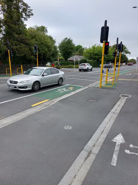
 Temp signage blocks cycle access to the detector loop, needs to be moved well off the loop to allow manoeuvres onto this.
 Pavement - Damaged —
 Another pot hole, but on the bridge this time.
- Overgrown Vegetation —
Vegetation is taking up half of a dual pedestrian and cycle way outside the University and is causing safety issues. Address is roughly outs
 Pavement - General —
 A contractor has placed a sign belonging to Highway 1 on the Clyde Rd shared path, part of Uni-Cycle. The position is on the painted diamond
 Water General —
 Blocked stream at Ilam stream. Large branch in water and chair/ rubbish blocking water flow. Pls can this be cleared up.
 Poles and Signage - General —
 Recent start of roadworks has made no provision for major cycle route and actively blocking cycle way for little reason. This route is used
 Road Signage —
 On pavement outside 54 Clyde Rd.
 Graffiti —
 Beside Clyde Rd., entrance to U o C, beside stream.
 Fallen Tree —
 This Willow has now fallen and blocking the Avon river, hanging over the cycleway and footpath. Can this please be considered urgent and a h
 Trees - General —
 Branches over hanging carriage way . The whole tree looks unstable at the root plate. There has been some minimal work done to lift canopy
- Overgrown Vegetation —
- Overgrown Vegetation —
- Overgrown Vegetation —
- Overgrown Vegetation —
- Trees - General —
- Overgrown Vegetation —
- Overgrown Vegetation —
- Overgrown Vegetation —
- Overgrown Vegetation —
- Trees - General —
- Overgrown Vegetation —
- Overgrown Vegetation —
- Overgrown Vegetation —
- Graffiti —
- Overgrown Vegetation —
- General Request —
- Graffiti —
- Trees - General —
- Graffiti —
- Overgrown Vegetation —
- Overgrown Vegetation —
- Road Signage —
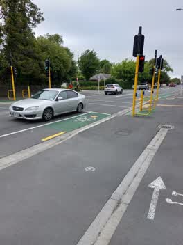
Cycle crossing on uni cycle way. The lights are not activated by riding over the diamonds or waiting at the cycle crossing on the Uni side o
 Roading/Streets —
 No longer responsive to bikes.
Water Supply —
Flooding —
Wastewater/Stormwater —
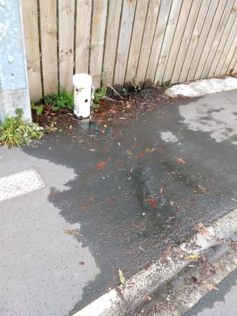
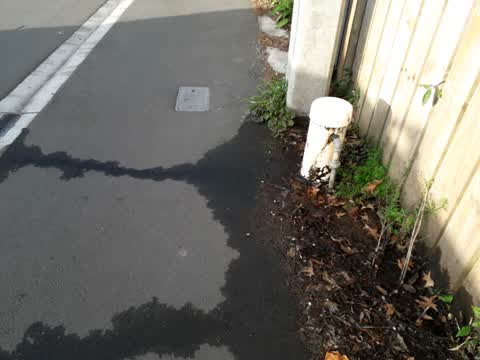
Wastewater air gap separator leaking and pouring water across footpath. Treat as urgent. is slippery for pedestrians.
Also reported on Clyde Road
- 56 Clyde Road — 19 reports
- 96 Clyde Road — 17 reports
- 54 Clyde Road — 11 reports
- 31 Clyde Road — 11 reports
- 75 Clyde Road — 9 reports
- 50A Clyde Road — 9 reports
- 48 Clyde Road — 8 reports
- 46 Clyde Road — 8 reports
The street’s crash record
NZTA’s record names Clyde Road in 76 crashes that hurt somebody since 2006 — 10 seriously hurt, nobody killed.
The green nearby
- Milnebank Reserve — 398 m to the edge
- Shand Crescent Reserve — 477 m to the edge
- Riccarton Bush — 493 m to the edge · 12 ha
Parks within half a kilometre, measured to the boundary — the council’s open data.
On the doorstep
- The Est@blishment Boutique Accommodation — 45 m away · B&Bs
- UC Print & Copy Centre — 239 m away · Printers & copy shops
- Mix Cafe — 269 m away · Cafés
- Anstice Optometrists — 375 m away · Optometrists
Businesses within four hundred metres, measured at the pin — OpenStreetMap and the council directories.
The bus nearby
- Clyde Rd near Hinau St — 112 m away · route 100, route 120
- Clyde Rd near Totara St — 250 m away · route 100, route 120
The closest Metro stops, within four hundred and fifty metres.
The tracks through here
- Walk and bike track through Ilam — 7 m to the line · walk · bike
- Walk and bike track through Ilam — 52 m to the line · walk · bike
- Walk and bike track through Ilam — 84 m to the line · walk · bike
- Walk and bike track through Ilam — 414 m to the line · walk · bike
- Walk and bike track through Ilam — 448 m to the line · walk · bike
Tracks whose line passes within half a kilometre, measured to the line itself — the council’s open data.
The named ground
Named water within 500 m of this address, measured to the line or the edge — the open map’s record.
Renting nearby
new bonds in Ilam ran about $548 a week — about the city median — the suburb page keeps the rent record →.
The civic layer
This ground votes in Riccarton ward — the Halswell-Hornby-Riccarton community board. Ward lines don’t always follow suburb lines; this one is measured at the pin, not the suburb’s centre.
What stood on this ground → · On the map → · From the air — the Crown’s aerials back to 1936; search the address on RetroLens →
Questions, answered briefly
36 council reports on record since May 2019 — most often overgrown vegetation (15), trees - general (4), graffiti (4).
Ilam, Christchurch — on Clyde Road.
Nothing on the heritage register at this exact spot — the record around this ground →
Milnebank Reserve — 398 m to its edge.