424 Worcester Street, Linwood
12 reports on record since January 2018 · 12 with photographs. The street’s heaviest record is 298 Worcester Street — 79 reports on file. Indicative rating valuation and school zones, hazards, bin day and what stood here before.
What gets reported here
- Roading/Streets — 5
- Rubbish/Recycling — 4
- Vandalism - General — 1
- Pavement - Damaged — 1
- Graffiti — 1
Photographed here 12 on record


Reported here
 Pavement - Damaged —
 A while ago Council workers dug up the footpath right outside our front gate to do something. The patch-up job on the footpath has slumped.
 Vandalism - General —
 Directly outside my house at 424 Worcester St Linwood. Box vandalised overnight - not sure what it is but it's full of wires.
 Graffiti —
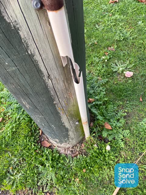
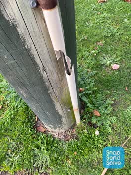
 Broken white plastic conduit cover on wooden Chorus pole CH 155623 by 424 Worcester Street.
 Rubbish/Recycling —
  Roading/Streets —
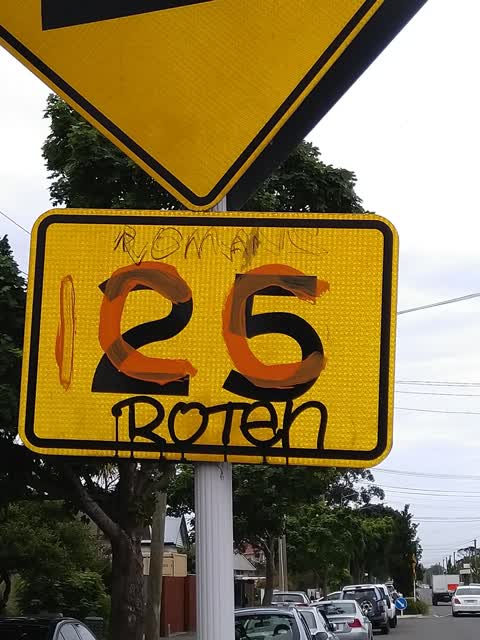
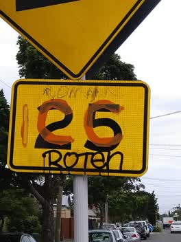
 Tagging obscuring speed sign on road hump. Near 422 Worcester St Linwood.
 Roading/Streets —
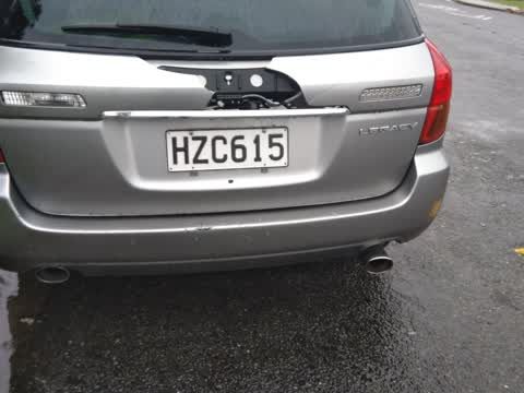
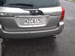
 Abandoned car, hasn't moved for months, flat tire, damaged from an apparent accident, registration expired in April.
Roading/Streets —
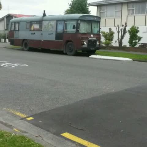
Living in bus on street. 8 weeks living in Supervalue car park. Now on been living on street for 4 days. Couldn't touch it due to private p
Roading/Streets —
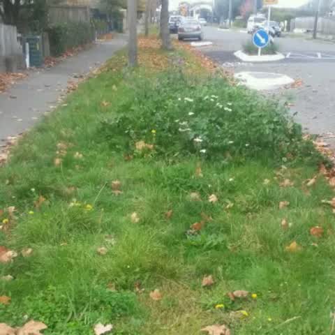
Berm is a jungle. Needs mowing. Flat inhabitants too lazy to do it. Makes the street look ghetto. We want t encourage pride here. Outside
Roading/Streets —
Car parked across our driveway. I can't exit my property. Rang police. They gave me Parks Towing number. Rand Parks -they said they aren't
Rubbish/Recycling —
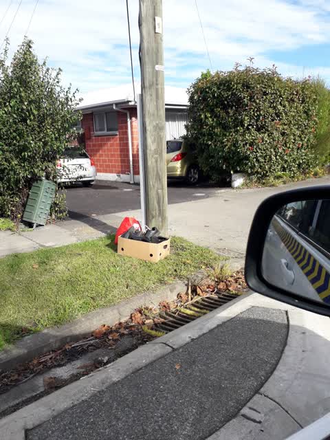
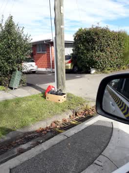
Outside 416 Worcester Street. Dumped rubbish.
Rubbish/Recycling —
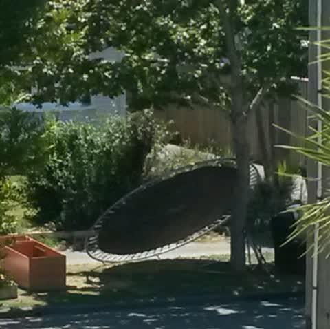
Since my previous report, the ferals have added to their rubbish pile out the front if their house. They have now dumped a broken trampoline
Rubbish/Recycling —
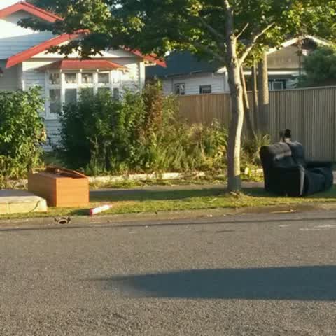
Illegal dumping. Had whiteware as well. Attracting scroungers. Eyesore.
Also reported on Worcester Street
- 298 Worcester Street — 79 reports
- 573 Worcester Street — 52 reports
- 398 Worcester Street — 48 reports
- 646 Worcester Street — 36 reports
- 475 Worcester Street — 35 reports
- 411 Worcester Street — 33 reports
- 506B Worcester Street — 28 reports
- 507 Worcester Street — 23 reports
The street’s crash record
NZTA’s record names Worcester Street in 50 crashes that hurt somebody since 2006 — 1 person killed, 11 seriously hurt.
The green nearby
- Hereford Playground — 130 m to the edge
- Doris Lusk Corner — 143 m to the edge
- Buccleugh Reserve — 330 m to the edge
- Welcome Rest — 462 m to the edge
- Essex Reserve — 476 m to the edge
Parks within half a kilometre, measured to the boundary — the council’s open data.
On the doorstep
- MC Imports — 46 m away · Bottle stores
- Ethnic Market - International Food Store — 150 m away · Supermarkets
- Worcester Discounter — 157 m away · Dairies & convenience
- AquaGym Swim Centre — 162 m away · Sports centres
Businesses within four hundred metres, measured at the pin — OpenStreetMap and the council directories.
The bus nearby
- Stanmore Rd near Worcester St — 193 m away · route 60
- Gloucester St near England St — 214 m away · route 5
The closest Metro stops, within four hundred and fifty metres.
The tracks through here
- Walk and bike track through Linwood — 197 m to the line · walk · bike
- Walk and bike track through Linwood — 215 m to the line · walk · bike
- Walk and bike track through Linwood — 220 m to the line · walk · bike
- Walk and bike track through Linwood — 264 m to the line · walk · bike
- Walk and bike track through Linwood — 290 m to the line · walk · bike
Tracks whose line passes within half a kilometre, measured to the line itself — the council’s open data.
The named ground
the council’s own structure register — bridges, boardwalks and steps standing nearby — the open map’s record.
The remembered names nearby
- Doris Lusk Corner plaque — 167 m away · 2024
- Plaque no. 311001 — 218 m away · 2024
Inscribed plaques within two hundred and fifty metres — the register’s pins, not surveyed spots. The whole roll is at /plaques.
Renting nearby
new bonds in Linwood ran about $478 a week — $72 below the city median of $550 — the suburb page keeps the rent record →.
What was here — Former Linwood Town Board Offices and Setting
180 m away · 388 Worcester Street · located to ±14 m · the place’s own record →
On the register. Nothing researched here yet.
The civic layer
This ground votes in Central ward — the Papanui-Innes-Central community board. Ward lines don’t always follow suburb lines; this one is measured at the pin, not the suburb’s centre.
What stood on this ground → · On the map → · From the air — the Crown’s aerials back to 1936; search the address on RetroLens →
Questions, answered briefly
12 council reports on record since January 2018 — most often roading/streets (5), rubbish/recycling (4), vandalism - general (1).
Linwood, Christchurch — on Worcester Street.
The heritage register names a place at or beside it — Former Linwood Town Board Offices and Setting.
Hereford Playground — 130 m to its edge.