35 Cressy Terrace
6 council reports since February 2020, 5 carrying a photograph. The street’s heaviest record is 32 Cressy Terrace, 16 reports on file.
From the air, then
Sourced from Canterbury Maps and partners. RNZAF, CC BY 3.0 NZ. Each frame is cut from Environment Canterbury’s historic imagery MapServer for that decade, only where the Footprints layer names a CC BY survey (NZAM-covered spots stay out). RetroLens holds more Crown aerials →
The green nearby
- Cressy Terrace Tennis Courts, 262 m to the edge
- Lyttelton Recreation Ground, 292 m to the edge · 3 ha
- Park Terrace Reserve, 356 m to the edge · 5 ha
- Corsair Bay Reserve, 441 m to the edge · 8 ha · playground, 9 pieces
Parks within half a kilometre, measured to the boundary, the council’s open data. The whole roll is at /parks.
On the doorstep
- The Lyttel Dumpling, 284 m away · Restaurants
- Pegasus Fishing, 311 m away · Fishing
- Mt Marine, 312 m away · Boatbuilder
- Lyttelton Recreation Ground, 375 m away · Sports centres
Businesses within four hundred metres, measured at the pin, OpenStreetMap and the council directories.
The bus nearby
- Brittan Tce near Seaview Tce, 303 m away · route 8
- Brittan Tce near Seaview Tce, 335 m away · route 8
The closest Metro stops, within four hundred and fifty metres.
The named ground
Named places within 1.5 km of this address; the council’s own structure register, bridges, boardwalks and steps standing nearby, the open map’s record.
Renting nearby
new bonds in Lyttelton ran about $600 a week, $50 above the city median of $550, the suburb page keeps the rent record →.
What gets reported here
Photographed here 5 on record

What’s on record
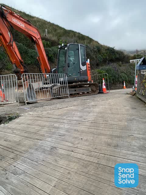
 Road Blockage, 22 Jan 2024
Good morning, I really need this one way road sorted as I am now experiencing abuse and damage, this is not my problem, Last week when Cre
- Hazard, vehicle, 10 Oct 2023
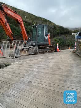 Roading/Streets, 19 Jul 2022
Pretty disappointed I cannot get access to my property tonight I know the water is being upgraded but talked to the workmen and they said I
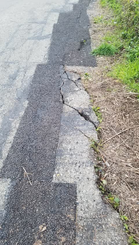
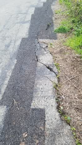 Roading/Streets, 17 Jul 2020
This road subsidence which has been present since heavy rain in 2011 and marked with barriers since then was patched about 3 weeks ago. The
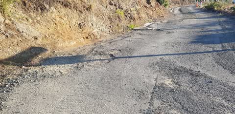
Roading/Streets, 19 Feb 2020
Seal needs repair, Drain needs cleared, gutters need clearing, road surface needs grading, Water scouring needs remediation.
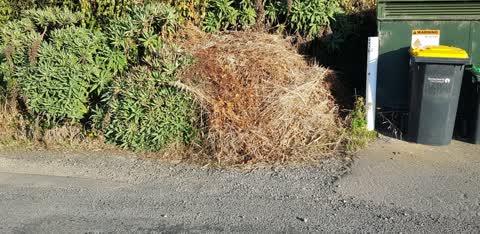
Rubbish/Recycling, 19 Feb 2020
This pile of garden waste has been there for 3 weeks. Suspect it is from no 62 Cressy terrace
Elsewhere on Cressy Terrace
- 32 Cressy Terrace, 16 reports
- 68 Cressy Terrace, 13 reports
- 2 Cressy Terrace, 13 reports
- 10 Cressy Terrace, 9 reports
- 68A Cressy Terrace, 7 reports
- 59 Cressy Terrace, 7 reports
- 43 Cressy Terrace, 7 reports
- 1 Cressy Terrace, 7 reports
The street’s crash record
NZTA’s record names Cressy Terrace in 3 crashes that hurt somebody since 2006, 2 seriously hurt, nobody killed.
The civic layer
This ground votes in Banks Peninsula ward, the Banks Peninsula community board is its local layer. Ward lines don’t always follow suburb lines; this one is measured at the pin, not the suburb’s centre. The whole roll is at /wards.
Cressy Terrace, the whole record → · Everything about Lyttelton → · What stood on this ground → · On the map → · From the air, RetroLens holds the Crown’s aerials back to 1936; search the address there →
Questions, answered briefly
6 council reports on record since February 2020, most often roading/streets (3), rubbish/recycling (1), road blockage (1).
Lyttelton, Christchurch, on Cressy Terrace.
Nothing on the heritage register at this exact spot, the record around this ground →
Cressy Terrace Tennis Courts, 262 m to its edge.