180 Queen Elizabeth II Drive, Mairehau
58 reports on record since November 2019 · 40 with photographs. The most-reported address on Queen Elizabeth II Drive. Indicative rating valuation and school zones, hazards, bin day and what stood here before.
What gets reported here
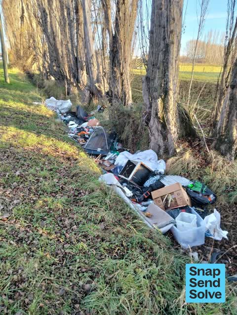
- Dumped Rubbish — 19
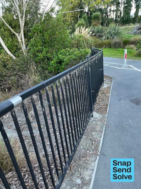
- Vandalism - General — 9
- Roading/Streets — 3
- Road Signage — 3
- Pavement - General — 3
- Overgrown Vegetation — 3
Photographed here 40 on record





Reported here
 Dumped Rubbish —
pallets dumped in the park
 Dumped Rubbish —
Dumped rubbish. -end of Philpots Rd. NB-this was-3days ago, so may have been reported and cleared
 Dumped Rubbish —
 Dumped Rubbish —
metal roof
 Overgrown Vegetation —
overgrown trees
 Trees - General —
totara trees not been cares for, mower goes around them but no one pulls out the long grass. lots of trees in this reserve like that
 General Request —
Scum on water surface in wetland
 Facility - General Request —
Chain and padlock missing from philpots road overflow gate
 Pavement - General —
There's a hidden wooden footpath below a lot of leaf litter, but there's a broken and dangerous area which needs fixing please. Potential ha
 Pavement - General —
Section of handrail has been removed/stolen. Believe this happened in the last few days. This is near the entrance to the Buller Stream Res
 General Request —
More council fencing has been stolen from along QE2 Drive and Winters road Subway. They are slowly stealing all the fencing and have now tak
 Pavement - Damaged —
Cycleway on QE2 Drive btw Philpotts Rd +Burwood Rd- variable damage from damaged asphalt +/- weeds in cracks, to overgrown vegetation narrow
 Park - General Request —
Both of the bollards on the Buller Stream walkway have had the padlocks removed. Maybe someone is driving through here? One bollard is loca
 Vandalism - General —
This is on the shared path beside Queen Elizabeth II Drive (SH74). There are a large number of damaged and or missing sections of fence cre
 Dumped Rubbish —
 Dumped Rubbish —
More rubbish added to this pile...
 Dumped Rubbish —
Someone has dumped a couch on top of the boxed drain on Philpotts Road. The timber is not in good shape here, there is a risk someone could
 Dumped Rubbish —
Please pick up
 Abandoned Vehicle —
 Vandalism - General —
The defense posts that were on this corner have been stolen and broken down at the ground level. The metal that has been left behind is expo
 Facility - General Request —
Missing aluminum fence along pathway possibly stolen.
 Park - General Request —
This fence on the entry to Buller Park is being dismantled overnight. The panels are being removed. A similar fence on the eastern corner of
- Vandalism - General —
 Vandalism - General —
The fencing panels are being removed on this fence
 Dumped Rubbish —
Fly tipping philpotts rd by qe2
 Vandalism - General —
Railing abd fence broken and dumped off pathway. Deliberste damsge
 Vandalism - General —
This fence section lying in the grass has been broken off from the fence on other side of road. CNR of Philpotts and QE2 Drive.
 Dumped Rubbish —
 Dumped Rubbish —
Box of toys
 Vandalism - General —
 Overgrown Vegetation —
Patgways oveegrown QE2
 Vandalism - General —
Railing broken from retaining fence
 Pavement - Damaged —
The bollard at the cycleway entrance is damaged. The bolt Is missing and it's lying on the ground. Visibility is low, if a cyclist or child
 Poles and Signage - General —
Reported this several weeks ago. It needs attention. The speed sign is incorrect.
- Damaged Street Sign —
- Street Gutters / Storm Water —
- Road Signage —
- Dumped Rubbish —
- Accessibility —
- Pavement - General —
- Road Signage —
- Dumped Rubbish —
- Vandalism - General —
- Dumped Rubbish —
- Dumped Rubbish —
- Dumped Rubbish —
- Dumped Rubbish —
- Dumped Rubbish —
- Overgrown Vegetation —
- Dumped Rubbish —
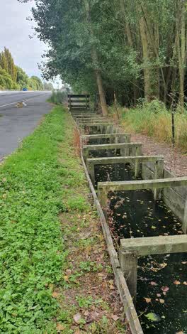 General Request —
Stagnant water, on water way running along Philpotts road on Oderings side
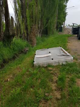 Rubbish/Recycling —
Dumped mattress
- Roading/Streets —
Kia ora, Vehicle registration HZW150 is dumped on the footpath. Is there anyway you can contact the RO and / or arrange for it to be m
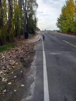 Roading/Streets —
Missing safe cycle/walking access on west side of Phillpoys road onto cycle/walkway along QEII drive. The point has hard curb and a dangerou
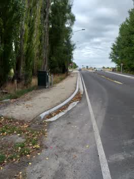 Roading/Streets —
VERY dangerous UNFINISHED cycle access to QEII cycle/walk way from north end of Phillpots road. Needs ramp + asphalting asap to avoid seriou
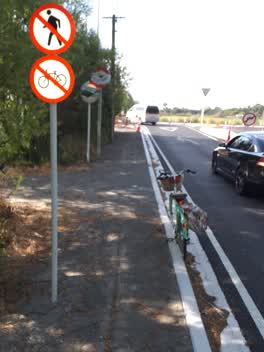 Road Signage —
Please move/remove these two signs from top end of Philpotts rd, as there IS a separated cycle/walkway along QEII drive 50m past these signs
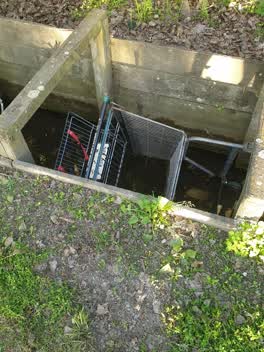 General - Abandoned Trolley —
Mad Butcher
Rubbish/Recycling —
Also reported on Queen Elizabeth II Drive
- 224R Queen Elizabeth II Drive — 23 reports
- 310 Queen Elizabeth II Drive — 17 reports
- 218 Queen Elizabeth II Drive — 15 reports
- 163 Queen Elizabeth II Drive — 11 reports
- 301 Queen Elizabeth II Drive — 8 reports
- 192–208 Queen Elizabeth II Drive — 6 reports
- 320L Queen Elizabeth II Drive — 2 reports
- 295R Queen Elizabeth II Drive — 2 reports
The street’s crash record
NZTA’s record names Queen Elizabeth II Drive in 13 crashes that hurt somebody since 2006 — 1 seriously hurt, nobody killed.
On the doorstep
- Oderings Garden Centre — 247 m away · Garden centres
Businesses within four hundred metres, measured at the pin — OpenStreetMap and the council directories.
The tracks through here
- Walk and bike track through Mairehau — 8 m to the line · walk · bike
- Walk and bike track through Mairehau — 79 m to the line · walk · bike
- Walk and bike track through Mairehau — 332 m to the line · walk · bike
Tracks whose line passes within half a kilometre, measured to the line itself — the council’s open data.
The named ground
Named water within 500 m of this address, measured to the line or the edge; the council’s own structure register — bridges, boardwalks and steps standing nearby — the open map’s record.
Renting nearby
new bonds in Mairehau ran about $409 a week — $141 below the city median of $550 — the suburb page keeps the rent record →.
The civic layer
This ground votes in Innes ward — the Papanui-Innes-Central community board. Ward lines don’t always follow suburb lines; this one is measured at the pin, not the suburb’s centre.
What stood on this ground → · On the map → · From the air — the Crown’s aerials back to 1936; search the address on RetroLens →
Questions, answered briefly
58 council reports on record since November 2019 — most often dumped rubbish (19), vandalism - general (9), roading/streets (3).
Mairehau, Christchurch — on Queen Elizabeth II Drive.
Nothing on the heritage register at this exact spot — the record around this ground →