218 Queen Elizabeth II Drive, Mairehau
15 reports on record since May 2018 · 14 with photographs. The street’s heaviest record is 180 Queen Elizabeth II Drive — 58 reports on file. Indicative rating valuation and school zones, hazards, bin day and what stood here before.
What gets reported here
- Overgrown Vegetation — 3
- Dumped Rubbish — 3
- Graffiti — 2
- Rubbish/Recycling — 1
- Roading/Streets — 1
- Park - General Request — 1
Photographed here 14 on record


Reported here
 Overgrown Vegetation —
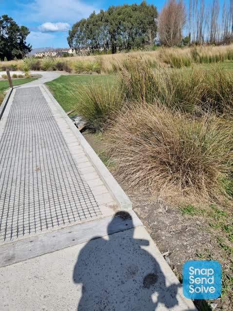
 grasses getting too big and need to be trimmed back from the cycle way.
 Park - General Request —
 it appears the park has been mowed recently by a machine in a very poor state if repair. all the grass areas and paths are trailed will line
 Graffiti on a fence, building or structure —
 Graffiti
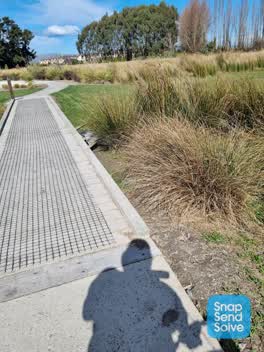
 Overgrown Vegetation —
 Grass overgrown on pathway. Has not been sprayed since council took over maintenance and this section of the track is significantly narrowed
 Dumped Rubbish —
 Deck tray of ute
 Dumped Rubbish —
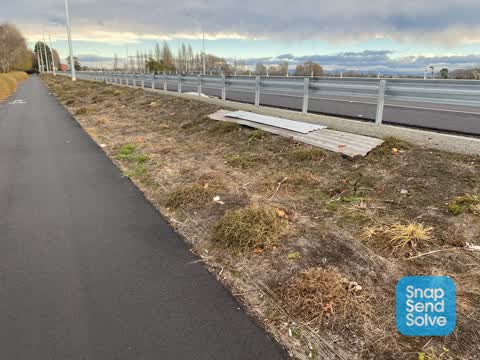
 Ute’s plastic deck lining has probably blown of a vehicle and landed on the shared path beside QE II (SH74).
 Accessibility —
 There is broken glass all down the cycle way in QE2 drive in Mairehau. A hazardous situation for cyclists and dog owners
- Fallen Tree —
 Overgrown Vegetation —
 Bushes are starting to grow out on to the path. Luckily the pathway is already wide.
 Dumped Rubbish —
 By bridge near seating
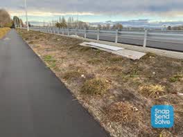 Rubbish/Recycling —
 Various rubbish along the new motorway, all the way from Innes Rd roundabout until Philpott’s Rd. Two pieces of roofing iron as well, which
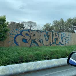 Graffiti —
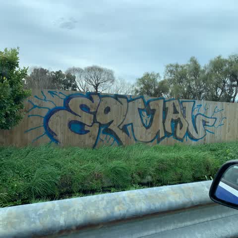
 Fencing on Qe2 drive between Innes and marshland road
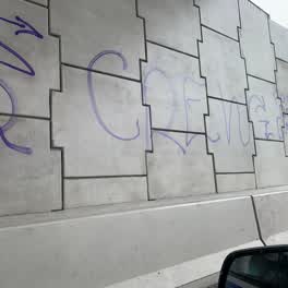 Graffiti —
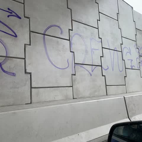
 Qe2 northern corridor under bridge
Roading/Streets —
Flooding —
Poor drainage and dangerous walkway next to the roadworks along QE2 drive from Grimseys rd through to Philpotts rd
Also reported on Queen Elizabeth II Drive
- 180 Queen Elizabeth II Drive — 58 reports
- 224R Queen Elizabeth II Drive — 23 reports
- 310 Queen Elizabeth II Drive — 17 reports
- 163 Queen Elizabeth II Drive — 11 reports
- 301 Queen Elizabeth II Drive — 8 reports
- 192–208 Queen Elizabeth II Drive — 6 reports
- 320L Queen Elizabeth II Drive — 2 reports
- 295R Queen Elizabeth II Drive — 2 reports
The street’s crash record
NZTA’s record names Queen Elizabeth II Drive in 13 crashes that hurt somebody since 2006 — 1 seriously hurt, nobody killed.
On the doorstep
- Oderings Garden Centre — 272 m away · Garden centres
Businesses within four hundred metres, measured at the pin — OpenStreetMap and the council directories.
The tracks through here
- Walk and bike track through Mairehau — 20 m to the line · walk · bike
- Walk and bike track through Mairehau — 307 m to the line · walk · bike
Tracks whose line passes within half a kilometre, measured to the line itself — the council’s open data.
The named ground
Named water within 500 m of this address, measured to the line or the edge; the council’s own structure register — bridges, boardwalks and steps standing nearby — the open map’s record.
Renting nearby
new bonds in Mairehau ran about $409 a week — $141 below the city median of $550 — the suburb page keeps the rent record →.
The civic layer
This ground votes in Innes ward — the Papanui-Innes-Central community board. Ward lines don’t always follow suburb lines; this one is measured at the pin, not the suburb’s centre.
What stood on this ground → · On the map → · From the air — the Crown’s aerials back to 1936; search the address on RetroLens →
Questions, answered briefly
15 council reports on record since May 2018 — most often overgrown vegetation (3), dumped rubbish (3), graffiti (2).
Mairehau, Christchurch — on Queen Elizabeth II Drive.
Nothing on the heritage register at this exact spot — the record around this ground →