341 Cranford Street, Mairehau
39 reports on record since September 2021 · 21 with photographs. The most-reported address on Cranford Street. Indicative rating valuation and school zones, hazards, bin day and what stood here before.
What gets reported here
Photographed here 21 on record





Reported here
 Pavement - General —
 This bollard needs re-locking in the vertical position. In addition, can high quality reflective white hi-vis be placed on the top and base
 Poles and Signage - General —
 A nearby wayfinding sign is being rotated 180 degrees to correct the direction. Can this sign also be looked at at the same time - it needs
 Poles and Signage - General —
 Kia ora Team, thanks for securing this sign at the base so it won’t turn. Unfortunately, it is pointing in the wrong direction. Could you pl
 Water Pollution - Sediment —
 small oil patch in water
 Poles and Signage - General —
 This wayfinding sign should be rotated so the direction is correct for direction to the city. I guess if the sign was rotated it would also
 Street Gutters / Storm Water —
 Quite a few branches lodged here that need clearing to avoid blocking water. This is a duck habitat. Thank you!
 Pest / Vermin —
 Wasps net among tussock. Next to river.
 Graffiti somewhere else —
 On cycle way sign on walkway Rutland St thru to exit on Cranford St
 Poles and Signage - General —
 This wayfinding sign on Cranford street is not fixed at the base. That is it can rotate in the wind. It was pointed in the wrong direction,
 Pavement - General —
 Kia ora Team, I see there a new bollard has been added to the east end of the Rutland Reserve Pathway. I assume this is still a task to do,
 Graffiti somewhere else —
 Cranford St. Kaiapoi sign for cycle trail. At entrance to walkway thru to Rutland reserve
 Pavement - Damaged —
 Can someone please go and tighten the screws on the cycle path bridge. They are all coming loose and the boards are popping up
 Overgrown Vegetation —
 Overgrown onto the footpath
 Graffiti —
 On bridge rails walkway Cranford St at entrance to walkway through to Rutland Street
 Graffiti —
 On walkway sign approaching Cranford Street
- Graffiti —
- Graffiti —
- Abandoned Vehicle —
- Pavement - Damaged —
- Overgrown Vegetation —
- Road Signage —
- Overgrown Vegetation —
- Graffiti —
- Graffiti —
- Graffiti —
- Overgrown Vegetation —
- Overgrown Vegetation —
- Overgrown Vegetation —
- Overgrown Vegetation —
- Overgrown Vegetation —
- Overgrown Vegetation —
- Pavement - General —
- Overgrown Vegetation —
 Graffiti —
 More graffiti, same bridge on walkway Cranford St
 Graffiti —
 Bridge Cranford St walkway. Between placrmakers and large roundabout
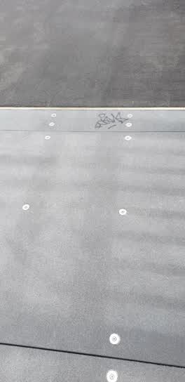 Graffiti —
 On bridge on footpath Cranford St heading to Papanui short distance from where cycleway comes out from Rutland St
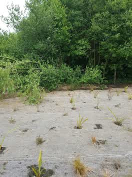 Parks —
 Tree has partially fallen down against fence. tree branch to be removed. note, path not designed for heavy vehicle loading. about 100 m from
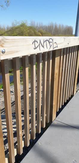 Graffiti —
 More on walkway bridge alongside Cranford St near large northern corridor roundabout
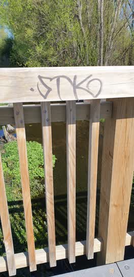 Graffiti —
 On walkway bridge south side alongside Cranford St approaching large roundabout.
Also reported on Cranford Street
- 401 Cranford Street — 26 reports
- 451 Cranford Street — 23 reports
- 342 Cranford Street — 14 reports
- 340 Cranford Street — 8 reports
- 319 Cranford Street — 4 reports
- 407 Cranford Street — 3 reports
- 321 Cranford Street — 3 reports
- 433 Cranford Street — 1 report
The street’s crash record
NZTA’s record names Cranford Street in 4 crashes that hurt somebody since 2006 — 1 seriously hurt, nobody killed.
The green nearby
- Lewisham Reserve — 244 m to the edge
- Rutland Reserve — 276 m to the edge · 2 ha
Parks within half a kilometre, measured to the boundary — the council’s open data.
On the doorstep
- Red Box Burger & Grill Cart — 91 m away · Fast food
- PlaceMakers — 120 m away · Hardware
- Waitomo — 181 m away · Petrol stations
- Cranford Mowers & Chainsaws — 185 m away · Hardware
Businesses within four hundred metres, measured at the pin — OpenStreetMap and the council directories.
The bus nearby
- Cranford St near Mcfaddens Rd — 242 m away · route 27, the Orbiter (anticlockwise)
- Cranford St near Mcfaddens Rd — 316 m away · route 27, the Orbiter (clockwise)
The closest Metro stops, within four hundred and fifty metres.
The tracks through here
- Walk and bike track through Mairehau — 30 m to the line · walk · bike
- Walk and bike track through Mairehau — 327 m to the line · walk · bike
- Walk and bike track through Mairehau — 342 m to the line · walk · bike
- Walk and bike track through Mairehau — 364 m to the line · walk · bike
- Walk and bike track through Mairehau — 480 m to the line · walk · bike
Tracks whose line passes within half a kilometre, measured to the line itself — the council’s open data.
The named ground
Named water within 500 m of this address, measured to the line or the edge; the council’s own structure register — bridges, boardwalks and steps standing nearby — the open map’s record.
Renting nearby
new bonds in Mairehau ran about $409 a week — $141 below the city median of $550 — the suburb page keeps the rent record →.
The civic layer
This ground votes in Papanui ward — the Papanui-Innes-Central community board. Ward lines don’t always follow suburb lines; this one is measured at the pin, not the suburb’s centre.
What stood on this ground → · On the map → · From the air — the Crown’s aerials back to 1936; search the address on RetroLens →
Questions, answered briefly
39 council reports on record since September 2021 — most often graffiti (12), overgrown vegetation (10), poles and signage - general (4).
Mairehau, Christchurch — on Cranford Street.
Nothing on the heritage register at this exact spot — the record around this ground →
Lewisham Reserve — 244 m to its edge.