177 Papanui Road, Merivale
15 reports on record since November 2017 · 14 with photographs. The street’s heaviest record is 258 Papanui Road — 37 reports on file. Indicative rating valuation and school zones, hazards, bin day and what stood here before.
What gets reported here
- Vandalism - General — 2
- Rubbish and Bins - General — 2
- Parks — 2
- Overgrown Vegetation — 2
- Facility - General Request — 2
- Roading/Streets — 1
Photographed here 14 on record


Reported here
 Graffiti on a fence, building or structure —
  Dumped Rubbish —
 As per the picture. I think I know who is doing this. A strange guy who still lives with his parents down Winchester Street. I will find out
 Facility - General Request —
 Please remove rubbish in white plastic container thank you
 Rubbish and Bins - General —
 Please empty bin thanks
 Rubbish and Bins - General —
 Please empty this bin it has been overflowing for a fortnight. Please get the person to pick up the rubbish around the bin in the undergrowt
 Vandalism - General —
  Facility - General Request —
 These seats need staining to promote. Longevity I put a request through a couple of years ago and nothing has been done. Thank you
 Overgrown Vegetation —
 Remove these invasive weeds thank you
 Vandalism - General —
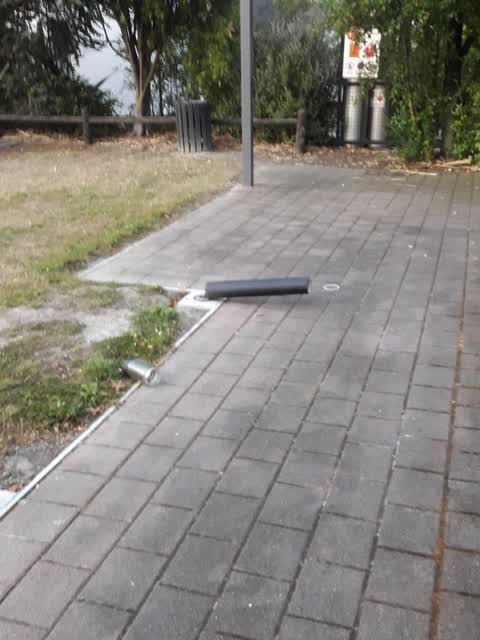
 Most of these lights are bent and a couple knocked over, exposing the electrical cords. In Merivale Green
- Pavement - Damaged —
 Overgrown Vegetation —
 Please spray these awful invasive plants b4 they take over the garden
 Parks —
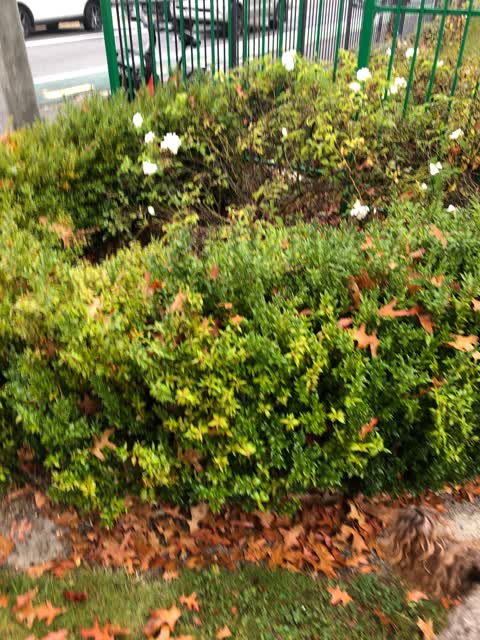
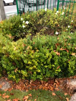
 Why do the contractors not prune the buxus hedge or prune the roses in this section of the village green. Not pruned coming up 2 years. Plea
Parks —
Broken bollard
 Graffiti —
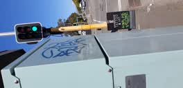
 utility box outside 176 Papanui rd
Roading/Streets —
Subsided footpath
Also reported on Papanui Road
- 258 Papanui Road — 37 reports
- 165 Papanui Road — 18 reports
- 1 Papanui Road — 17 reports
- 176 Papanui Road — 16 reports
- 27 Papanui Road — 15 reports
- 175 Papanui Road — 14 reports
- 71 Papanui Road — 12 reports
- 79E Papanui Road — 11 reports
The street’s crash record
NZTA’s record names Papanui Road in 160 crashes that hurt somebody since 2006 — 27 seriously hurt, nobody killed.
The green nearby
- Merivale Village Green — 10 m to the edge
Parks within half a kilometre, measured to the boundary — the council’s open data.
On the doorstep
- Harcourts — 10 m away · Real estate
- Six Ounces Cafe — 19 m away · Cafés
- The Brewers — 24 m away · Bars & pubs
- Expression Tattoo Studio — 34 m away · Tattoo & piercing
Businesses within four hundred metres, measured at the pin — OpenStreetMap and the council directories.
The bus nearby
- Papanui Rd near Rugby St — 77 m away · route 1, route 95
- Papanui Rd near St Albans St — 101 m away · route 1, route 95
The closest Metro stops, within four hundred and fifty metres.
The tracks through here
- Walk and bike track through Merivale — 497 m to the line · walk · bike
Tracks whose line passes within half a kilometre, measured to the line itself — the council’s open data.
The named ground
Named water within 500 m of this address, measured to the line or the edge — the open map’s record.
The remembered names nearby
- Donated by the Merivale Precinct Society to Commemorate — 29 m away ·
DONATED BY THE MERIVALE PRECINCT SOCIETY TO COMMEMORATE THEIR 21ST ANNIVERSARY IN 1991
· 2006
Inscribed plaques within two hundred and fifty metres — the register’s pins, not surveyed spots. The whole roll is at /plaques.
Renting nearby
new bonds in Merivale ran about $604 a week — $54 above the city median of $550 — the suburb page keeps the rent record →.
What was here — Dwelling and Setting, Long Cottage
119 m away · 10/142 Rugby Street · located to ±15 m · the place’s own record →
On the register. Nothing researched here yet.
What was here — Dwelling and Setting, Amwell
125 m away · 166 Papanui Road · located to ±16 m · the place’s own record →
On the register. Nothing researched here yet.
What was here — Dwelling and Setting, Orana
170 m away · 146 Papanui Road · located to ±18 m · the place’s own record →
On the register. Nothing researched here yet.
What was here — Former St Albans Automatic Telephone Exchange and Setting
184 m away · 29 St Albans Street · located to ±25 m · the place’s own record →
On the register. Nothing researched here yet.
The civic layer
This ground votes in Fendalton ward — the Fendalton-Waimairi-Harewood community board. Ward lines don’t always follow suburb lines; this one is measured at the pin, not the suburb’s centre.
What stood on this ground → · On the map → · From the air — the Crown’s aerials back to 1936; search the address on RetroLens →
Questions, answered briefly
15 council reports on record since November 2017 — most often vandalism - general (2), rubbish and bins - general (2), parks (2).
Merivale, Christchurch — on Papanui Road.
The heritage register names 4 places at or beside it — Dwelling and Setting, Long Cottage, Dwelling and Setting, Amwell.
Merivale Village Green — 10 m to its edge.