1 Te Awakura Terrace, Mount Pleasant
15 reports on record since November 2020 · 6 with photographs. The most-reported address on Te Awakura Terrace. Indicative rating valuation and school zones, hazards, bin day and what stood here before.
What gets reported here
Photographed here 6 on record


Reported here
 Rubbish and Bins - General —
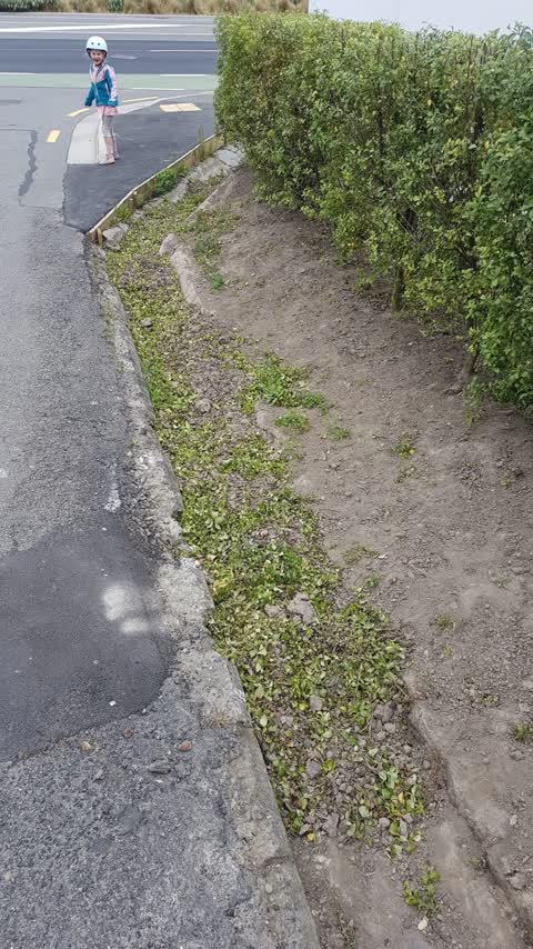
 Resident from 1 Te Awakura Terrace has dug soil. A red bin which is placed across the road on Main Road is now full of earth. It is yellow b
- Street Gutters / Storm Water —
Drain grate is lifted and soil is piled on the street next to the drain
 Park - General Request —
 Scott Park... is this the correct place for a billboard? I get it's mobile but a carpark full of these would be inconvenient and unsightly.
- Damaged Road —
Resident at number one is digging under the road edge again
- Damaged Road —
Resident is damaging road at the moment. Digging away at road edge. Ongoing issue but needs urgent action. Road at risk of collapse.
 Street Gutters / Storm Water —
 Drain has been blocked with sand bags and is now full of mud
 Water Leak —
 This water pipe is leaking and eroding the ground under the road
- Damaged Road —
Te Awakura Terrace has been even further undermined underneath on the property of 1 Te Awakura Terrace. There is concern that the edge of t
- Damaged Road —
Road edge becoming more eroded, undermined and unstable
- Street Gutters / Storm Water —
Resident at number 1 te awakura see putting green waist into the storm drain pipe.
- Roads - General —
The bank underneath Te Awakura Terrace has been completely dug away and the road is now ‘cantilevered’ and likely to collapse.
 Vandalism - General —
 - Water Leak —
- Water Leak —
 Wastewater/Stormwater —
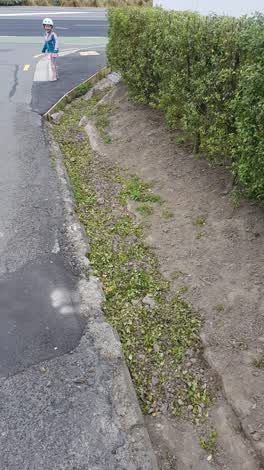
 The owner of this house makes a habit of pulling weeds and dumping topsoils and the weeds in the stormwater drain. He usually does it before
Also reported on Te Awakura Terrace
- 53 Te Awakura Terrace — 7 reports
- 16 Te Awakura Terrace — 5 reports
- 51 Te Awakura Terrace — 4 reports
- 39 Te Awakura Terrace — 4 reports
- 37 Te Awakura Terrace — 4 reports
- 10 Te Awakura Terrace — 4 reports
- 65 Te Awakura Terrace — 3 reports
- 63 Te Awakura Terrace — 3 reports
The street’s crash record
NZTA’s record names Te Awakura Terrace in 3 crashes that hurt somebody since 2006 — 0 seriously hurt, nobody killed.
The green nearby
- Scott Park Ferrymead — 21 m to the edge · 2 ha
- The Brae — 142 m to the edge
- Te Awakura Reserve — 180 m to the edge
- King Park — 348 m to the edge · 2 ha
- Settlers Reserve — 351 m to the edge · 13 ha
Parks within half a kilometre, measured to the boundary — the council’s open data.
On the doorstep
- Connect Chiropractic — 380 m away · Alternative
- Anytime Fitness — 389 m away · Gyms & fitness
- The Kebab King Ferrymead — 394 m away · Fast food
- Best Turkish Food Co. — 396 m away · Restaurants
Businesses within four hundred metres, measured at the pin — OpenStreetMap and the council directories.
The bus nearby
- Main Rd near Te Awakura Tce — 55 m away · route 3
- St Andrews Hill Rd near The Brae — 143 m away · route 140
The closest Metro stops, within four hundred and fifty metres.
The tracks through here
- Walk and bike track through Mount Pleasant — 10 m to the line · walk · bike
- Walk and bike track through Mount Pleasant — 10 m to the line · walk · bike
- Walk and bike track through Mount Pleasant — 72 m to the line · walk · bike
- Walk and bike track through Mount Pleasant — 342 m to the line · walk · bike
- Walk and bike track through Mount Pleasant — 377 m to the line · walk · bike
Tracks whose line passes within half a kilometre, measured to the line itself — the council’s open data.
The named ground
Named water within 500 m of this address, measured to the line or the edge; the council’s own structure register — bridges, boardwalks and steps standing nearby — the open map’s record.
The remembered names nearby
- Jonathan McGregor Smith / on Mt. D’Archiac — 208 m away ·
JONATHAN McGREGOR SMITH / on Mt. D’Archiac / May 6th 1955 – June 1st 2003 / Grandson of Ro
· 2009
Inscribed plaques within two hundred and fifty metres — the register’s pins, not surveyed spots. The whole roll is at /plaques.
Renting nearby
new bonds in Mount Pleasant ran about $700 a week — $150 above the city median of $550 — the suburb page keeps the rent record →.
What was here — Former Dwelling and Setting
166 m away · 2A Main Road · located to ±7 m · the place’s own record →
On the register. Nothing researched here yet.
The civic layer
This ground votes in Heathcote ward — the Spreydon-Cashmere-Heathcote community board. Ward lines don’t always follow suburb lines; this one is measured at the pin, not the suburb’s centre.
What stood on this ground → · On the map → · From the air — the Crown’s aerials back to 1936; search the address on RetroLens →
Questions, answered briefly
15 council reports on record since November 2020 — most often damaged road (4), water leak (3), street gutters / storm water (3).
Mount Pleasant, Christchurch — on Te Awakura Terrace.
The heritage register names a place at or beside it — Former Dwelling and Setting.
Scott Park Ferrymead — 21 m to its edge, 2 ha.