22 Mistral Road
7 council reports since May 2021, 6 carrying a photograph. The most-reported address on Mistral Road.
From the air, then
Sourced from Canterbury Maps and partners. LINZ, CC BY 3.0 NZ. Each frame is cut from Environment Canterbury’s historic imagery MapServer for that decade, only where the Footprints layer names a CC BY survey (NZAM-covered spots stay out). RetroLens holds more Crown aerials →
The green nearby
- Lassiter Reserve, 62 m to the edge
- Styx Mill Conservation Reserve, 129 m to the edge · Regional · 63 ha
- O'neill Reserve, 208 m to the edge
- Glen Oaks Reserve, 222 m to the edge · 2 ha
- Beechwood Reserve, 240 m to the edge
Parks within half a kilometre, measured to the boundary, the council’s open data. The whole roll is at /parks.
On the doorstep
- Richard Hadlee Retirement Village, 342 m away · Business
Businesses within four hundred metres, measured at the pin, OpenStreetMap and the council directories.
The bus nearby
- O'Neill Ave near Beechwood Dr, 125 m away · route 107
- O'Neill Ave near Beechwood Dr, 132 m away · route 107
The closest Metro stops, within four hundred and fifty metres.
The tracks through here
- Walk and bike track through Northwood, 429 m to the line · walk · bike
- Walk and bike track through Northwood, 441 m to the line · walk · bike
- Walk and bike track through Northwood, 442 m to the line · walk · bike
- Walk and bike track through Northwood, 453 m to the line · walk · bike
Tracks whose line passes within half a kilometre, the council’s open data.
The named ground
Named water within 500 m of this address, measured to the line or the edge; Named places within 1.5 km of this address; the council’s own structure register, bridges, boardwalks and steps standing nearby, the open map’s record.
Renting nearby
new bonds in Northwood ran about $530 a week, $20 below the city median of $550, the suburb page keeps the rent record →.
What gets reported here
Photographed here 6 on record


What’s on record
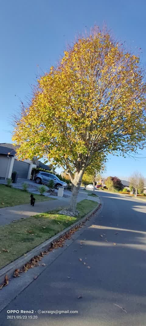
 Overgrown Vegetation, 5 Jun 2025
 I slipped walking on my front path because of the hazard from the leaves from the council tree on the berm that overhangs our front property
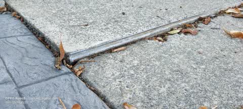
 Pavement - Damaged, 24 May 2024
 Damaged repair between 2 concrete slabs
 Fallen Tree, 20 Mar 2024
 Safety concern to be noted. Tree is developing v splits and could be a possible danger to people and vehicles.
 Overgrown Vegetation, 17 Mar 2024
 Removal of tree or limb as per attached photo as of encroachment of my boundary. Autumn leaves land on our property and overflow cutters whi
- Overgrown Vegetation, 26 Nov 2023
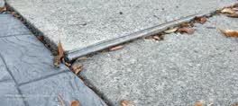 Roading/Streets, 23 May 2021
 Trip Hazard outside my address. Would appreciate to get this repaired please.
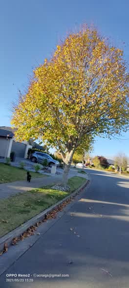 Roading/Streets, 23 May 2021
 Would like council to remove / replant as the tree is over hanging my address and it makes a mess with leaves. It is the largest in the stre
Elsewhere on Mistral Road
- 16 Mistral Road, 6 reports
- 17 Mistral Road, 4 reports
- 15 Mistral Road, 3 reports
- 12 Mistral Road, 3 reports
- 7 Mistral Road, 2 reports
- 6 Mistral Road, 2 reports
- 44 Mistral Road, 2 reports
- 46 Mistral Road, 1 report
The civic layer
This ground votes in Harewood ward, the Fendalton-Waimairi-Harewood community board is its local layer. Ward lines don’t always follow suburb lines; this one is measured at the pin, not the suburb’s centre. The whole roll is at /wards.
Mistral Road, the whole record → · Everything about Northwood → · What stood on this ground → · On the map → · From the air, RetroLens holds the Crown’s aerials back to 1936; search the address there →
Questions, answered briefly
7 council reports on record since May 2021, most often overgrown vegetation (3), roading/streets (2), pavement - damaged (1).
Northwood, Christchurch, on Mistral Road.
Nothing on the heritage register at this exact spot, the record around this ground →
Lassiter Reserve, 62 m to its edge.