2 Ensors Road, Opawa
13 reports on record since February 2021 · 9 with photographs. The street’s heaviest record is 29 Ensors Road — 16 reports on file. Indicative rating valuation and school zones, hazards, bin day and what stood here before.
What gets reported here
Photographed here 9 on record


Reported here
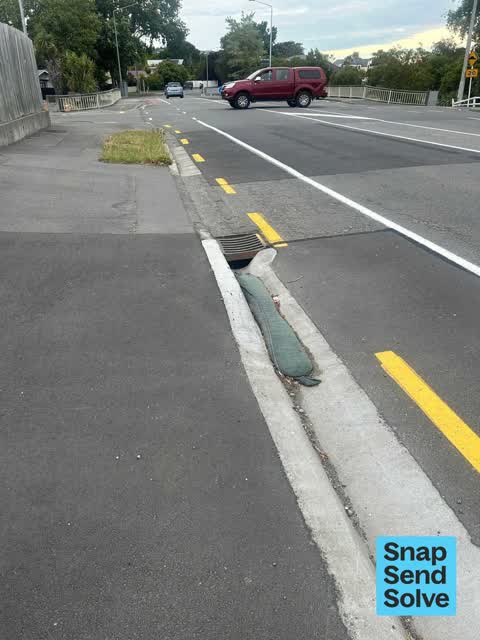
 Street Gutters / Storm Water —
 This long flood barrier was used weeks ago while repairing a fire hydrant. It was just left behind, forgotten and is now 20 metres further d
 Graffiti on a fence, building or structure —
 Graffiti on ccc managed lamp post pole
 Damaged Street Sign —
 Traffic island sign damaged and broken
 Graffiti on a road, footpath or bridge —
 Brass plaque damaged
 Vandalism - General —
 New plants ripped out and thrown in river
 Dumped Rubbish —
  Vandalism - General —
 Plaque on bridge has been damaged in the attempt to remove it.
 Graffiti —
 - Pavement - General —
- Road Signage —
- Dumped Rubbish —
- Pothole —
Parks —
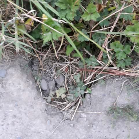
several holes in walkway beside river Fifield Tce side near St Martin's Road Ensors bridge. dangerous and people could trip. please fill. t
Also reported on Ensors Road
- 29 Ensors Road — 16 reports
- 34 Ensors Road — 8 reports
- 87R Ensors Road — 6 reports
- 32 Ensors Road — 6 reports
- 38I Ensors Road — 5 reports
- 38F Ensors Road — 4 reports
- 26 Ensors Road — 4 reports
- 21A Ensors Road — 4 reports
The street’s crash record
NZTA’s record names Ensors Road in 16 crashes that hurt somebody since 2006 — 1 seriously hurt, nobody killed.
The green nearby
- Acorn Reserve — 58 m to the edge
- Risingholme Park — 181 m to the edge · Botanic · 2 ha
Parks within half a kilometre, measured to the boundary — the council’s open data.
On the doorstep
- Opawa Tennis — 142 m away · Sports centres
- Opawa Bowling Club — 379 m away · Sports centres
Businesses within four hundred metres, measured at the pin — OpenStreetMap and the council directories.
The bus nearby
- St Martins Rd near Ensors Rd — 46 m away · the Orbiter (anticlockwise)
- St Martins Rd near Ensors Rd — 79 m away · the Orbiter (clockwise)
The closest Metro stops, within four hundred and fifty metres.
The tracks through here
- Walk and bike track through Opawa — 13 m to the line · walk · bike
- Walk and bike track through Opawa — 33 m to the line · walk · bike
- Walk and bike track through Opawa — 47 m to the line · walk · bike
- Walk and bike track through Opawa — 63 m to the line · walk · bike
- Walk and bike track through Opawa — 64 m to the line · walk · bike
Tracks whose line passes within half a kilometre, measured to the line itself — the council’s open data.
The named ground
Named water within 500 m of this address, measured to the line or the edge; the council’s own structure register — bridges, boardwalks and steps standing nearby — the open map’s record.
The remembered names nearby
- Officially Opened by E. H. Andrews, Mayor Chairman — 205 m away ·
OFFICIALLY OPENED BY E. H. ANDREWS, MAYOR CHAIRMAN OF RESERVES COMMITTEE J. N. CLARKE NOV
· 2009 - J. R. McKenzie Gave Risingholme to This City 1943 — 207 m away ·
J. R. McKENZIE GAVE RISINGHOLME TO THIS CITY 1943
· 2009 - Risingholme Community Centre Inc. 1944 — 1994 This Plaque — 228 m away ·
RISINGHOLME COMMUNITY CENTRE INC. 1944 — 1994 This plaque was unveiled by Vicki Buck, Mayo
· 2009
Inscribed plaques within two hundred and fifty metres — the register’s pins, not surveyed spots. The whole roll is at /plaques.
Renting nearby
new bonds in Opawa ran about $555 a week — about the city median — the suburb page keeps the rent record →.
What was here — Dwelling and Setting, Cardowan
246 m away · 64 Opawa Road · located to ±15 m · the place’s own record →
On the register. Nothing researched here yet.
The civic layer
This ground votes in Heathcote ward — the Spreydon-Cashmere-Heathcote community board. Ward lines don’t always follow suburb lines; this one is measured at the pin, not the suburb’s centre.
What stood on this ground → · On the map → · From the air — the Crown’s aerials back to 1936; search the address on RetroLens →
Questions, answered briefly
13 council reports on record since February 2021 — most often vandalism - general (2), dumped rubbish (2), street gutters / storm water (1).
Opawa, Christchurch — on Ensors Road.
The heritage register names a place at or beside it — Dwelling and Setting, Cardowan.
Acorn Reserve — 58 m to its edge.