208 Stanmore Road, Richmond
12 reports on record since October 2015 · 12 with photographs. The street’s heaviest record is 277 Stanmore Road — 52 reports on file. Indicative rating valuation and school zones, hazards, bin day and what stood here before.
What gets reported here
- Dumped Rubbish — 3
- Graffiti — 2
- Water Leak — 1
- Traffic Signals — 1
- Road Signage — 1
- Pavement - General — 1
Photographed here 12 on record


Reported here
 Graffiti on a traffic light pole or cabinet, or wa —
 graffiti on traffic control cabinet nearby
 Pavement - General —
 Not flush with the concrete path, didn't see it walking into sun. Twisted ankle.
 Park - General Request —
 Have have bought my 87 year old mum to walk along this stretch thinking there were some seats to sit on and watch the world go by. Very impo
 Dumped Rubbish —
 smashed glass on city to sea path by stanmore road. dangerous for bike and animals
 Traffic Signals —
 Why aren't the crossing signals on City to Sea pathway activated yet? Safety issue when we crossed today - a driver stripped to give way to
 Road Signage —
 Sign lying by the footpath at 208 Stanmore Road needs reerecting or removal.
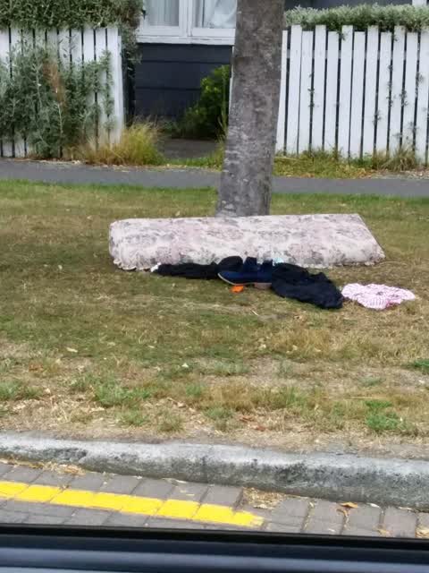
 Dumped Rubbish —
  Dumped Rubbish —
 Open hole from a drain in ground dangerous for people walking that don't see it.
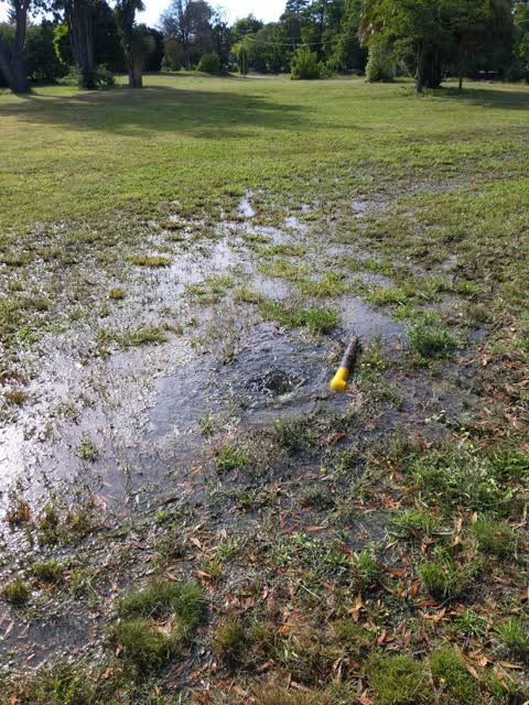
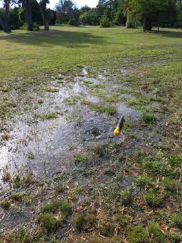 Water Leak —
 Water leaking out at an alarming rate!
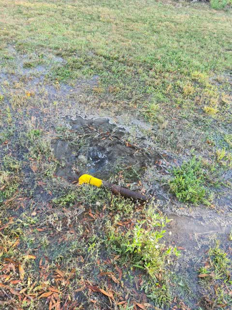
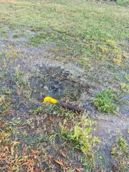 Flooding —
 Looks like cars have gotten in and driven over a water pipe. It's pouring water out and has caused a bit of flooding already by the entrance
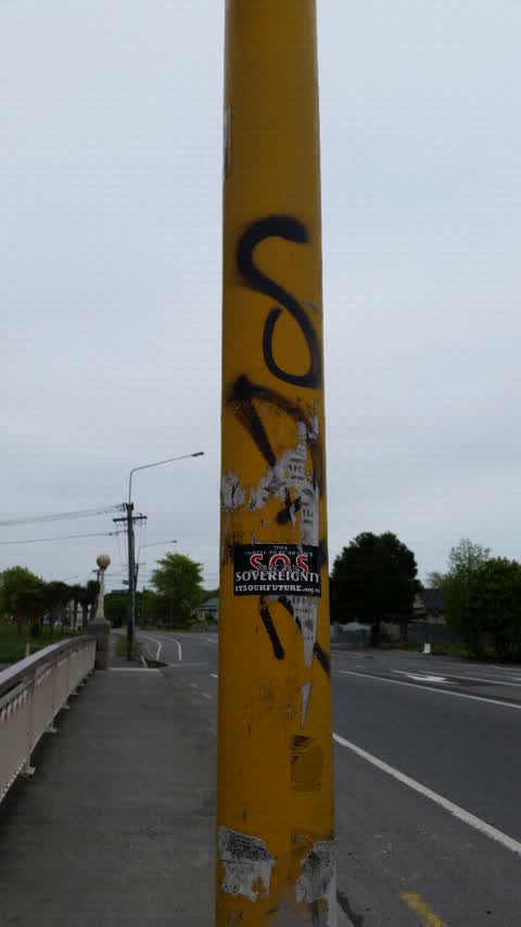
Graffiti —
Graffiti —
On a trafic lights post
Also reported on Stanmore Road
- 277 Stanmore Road — 52 reports
- 295 Stanmore Road — 42 reports
- 213 Stanmore Road — 28 reports
- 211 Stanmore Road — 21 reports
- 337 Stanmore Road — 20 reports
- 249A Stanmore Road — 18 reports
- 240 Stanmore Road — 17 reports
- 319 Stanmore Road — 16 reports
The street’s crash record
NZTA’s record names Stanmore Road in 57 crashes that hurt somebody since 2006 — 1 person killed, 9 seriously hurt.
The green nearby
- Beverley Park — 95 m to the edge · 3 ha
- Alexandra Park — 295 m to the edge
- Avon Riverbank True Right — 377 m to the edge · 11 ha
- Richmond Playground — 418 m to the edge
Parks within half a kilometre, measured to the boundary — the council’s open data.
On the doorstep
- Richmond Vege Mart — 154 m away · Fruit & veg
- Christchurch Community Corrections — 175 m away · Government
- Richmond Discount Furniture — 181 m away · Furniture
- Red Orchid — 204 m away · Restaurants
Businesses within four hundred metres, measured at the pin — OpenStreetMap and the council directories.
The bus nearby
- Stanmore Rd near Draper St — 104 m away · route 60, the Orbiter (clockwise)
- Stanmore Rd near Lychgate Cl — 138 m away · route 60
The closest Metro stops, within four hundred and fifty metres.
The tracks through here
- Walk and bike track through Richmond — 22 m to the line · walk · bike
- Walk and bike track through Richmond — 43 m to the line · walk · bike
- Walk and bike track through Richmond — 79 m to the line · walk · bike
- Walk and bike track through Richmond — 145 m to the line · walk · bike
- Walk and bike track through Richmond — 151 m to the line · walk · bike
Tracks whose line passes within half a kilometre, measured to the line itself — the council’s open data.
The named ground
Named water within 500 m of this address, measured to the line or the edge; the council’s own structure register — bridges, boardwalks and steps standing nearby — the open map’s record.
Renting nearby
new bonds in Richmond ran about $499 a week — $51 below the city median of $550 — the suburb page keeps the rent record →.
What was here — Holy Trinity Avonside Lychgate and Setting
204 m away · 168 Stanmore Road · located to ±4 m · the place’s own record →
On the register. Nothing researched here yet.
What was here — Holy Trinity Avonside Graveyard and Setting
232 m away · 168 Stanmore Road · located to ±55 m · the place’s own record →
On the register. Nothing researched here yet.
The civic layer
This ground votes in Central ward — the Papanui-Innes-Central community board. Ward lines don’t always follow suburb lines; this one is measured at the pin, not the suburb’s centre.
What stood on this ground → · On the map → · From the air — the Crown’s aerials back to 1936; search the address on RetroLens →
Questions, answered briefly
12 council reports on record since October 2015 — most often dumped rubbish (3), graffiti (2), water leak (1).
Richmond, Christchurch — on Stanmore Road.
The heritage register names 2 places at or beside it — Holy Trinity Avonside Lychgate and Setting, Holy Trinity Avonside Graveyard and Setting.
Beverley Park — 95 m to its edge, 3 ha.