142 Scarborough Road, Scarborough
12 reports on record since January 2020 · 5 with photographs. The street’s heaviest record is 2 Scarborough Road — 45 reports on file. Indicative rating valuation and school zones, hazards, bin day and what stood here before.
What gets reported here
- Water Leak — 4
- Park - General Request — 3
- Water Pollution - Sediment — 1
- Wastewater/Stormwater — 1
- Parks — 1
- Graffiti — 1
Photographed here 5 on record


Reported here
 Water Leak —
 Mains water leak, looks like it is the old 200mm AC pipe again
 Water Leak —
 Water pouring out of unoccupied property on Taylor’s mistake Rd
- Park - General Request —
- Park - General Request —
- Damaged Street Sign —
- Water Leak —
- Graffiti —
- Water Pollution - Sediment —
- Water Leak —
 Park - General Request —
 Overgrown vegetation over walkway
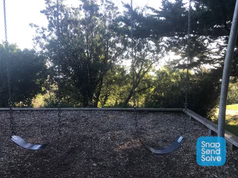
 Parks —
 There used to be a lovely view of the beach/sea right through to Kaikouras on a good day from the swings. But these trees have got out of co
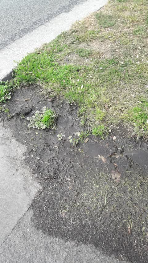
Wastewater/Stormwater —
water coming out of ground
Also reported on Scarborough Road
- 2 Scarborough Road — 45 reports
- 9 Scarborough Road — 21 reports
- 19 Scarborough Road — 13 reports
- 97 Scarborough Road — 12 reports
- 15A Scarborough Road — 12 reports
- 106 Scarborough Road — 8 reports
- 5 Scarborough Road — 6 reports
- 53 Scarborough Road — 5 reports
The street’s crash record
NZTA’s record names Scarborough Road in 1 crash that hurt somebody since 2006 — 1 seriously hurt, nobody killed.
The green nearby
- Nicholson Park — you are in it · 4 ha
- Whitewash Reserve — 41 m to the edge · Regional · 9 ha
- Scarborough Beach — 241 m to the edge · Regional · 5 ha
- Scarborough Park — 301 m to the edge · Botanic
Parks within half a kilometre, measured to the boundary — the council’s open data.
On the doorstep
- Slipway Office - Sumner Boating & Fishing Club — 248 m away · Harbour Master
- Sumner Boating & Fishing Club — 248 m away · Association
- Scarborough Fare Cafe — 367 m away · Cafés
- Ocean Cafe & Bar — 370 m away · Restaurants
Businesses within four hundred metres, measured at the pin — OpenStreetMap and the council directories.
The tracks through here
- Walk and bike track through Scarborough — 406 m to the line · walk · bike
Tracks whose line passes within half a kilometre, measured to the line itself — the council’s open data.
The named ground
Named places within 1.5 km of this address; the council’s own structure register — bridges, boardwalks and steps standing nearby — the open map’s record.
The remembered names nearby
- In Loving Memory of Valerie May Johnson 1913 – 1998 — 34 m away ·
IN LOVING MEMORY OF VALERIE MAY JOHNSON 1913 – 1998 WHO LOVED THESE HILLS AND THE VIEW OF
· 2009 - In Remembrance of (My Lovely Lady) Daryl Brown and Her Love — 40 m away ·
IN REMEMBRANCE OF (MY LOVELY LADY) DARYL BROWN AND HER LOVE FOR SUMNER & THE SEA Seat dona
· 2009 - In Loving Memory of Alan James Samson — 67 m away ·
In Loving Memory of ALAN JAMES SAMSON 2.10.47 – 20.9.04 A very special man. You were the l
· 2009
Inscribed plaques within two hundred and fifty metres — the register’s pins, not surveyed spots. The whole roll is at /plaques.
Renting nearby
new bonds in Scarborough ran about $620 a week — $70 above the city median of $550 — the suburb page keeps the rent record →.
The civic layer
This ground votes in Heathcote ward — the Spreydon-Cashmere-Heathcote community board. Ward lines don’t always follow suburb lines; this one is measured at the pin, not the suburb’s centre.
What stood on this ground → · On the map → · From the air — the Crown’s aerials back to 1936; search the address on RetroLens →
Questions, answered briefly
12 council reports on record since January 2020 — most often water leak (4), park - general request (3), water pollution - sediment (1).
Scarborough, Christchurch — on Scarborough Road.
Nothing on the heritage register at this exact spot — the record around this ground →
Nicholson Park — the address is inside it, 4 ha.