9 Scarborough Road, Scarborough
21 reports on record since July 2021 · 16 with photographs. The street’s heaviest record is 2 Scarborough Road — 45 reports on file. Indicative rating valuation and school zones, hazards, bin day and what stood here before.
What gets reported here
Photographed here 16 on record


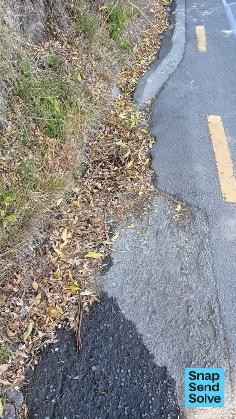


Reported here
 Sewer - Leak / Blockage —
 There is sewer spewing out of the sewer pipe.
 Street Gutters / Storm Water —
 Hi I messaged some time ago... These drains are broken a new plastic time was smashed the same day it was installed. Is also blocked. Thanks
 Street Gutters / Storm Water —
 This is the fixed gully outside the garage at 9 Scarborough road. It's full of large pieces of concrete and the plastic pipe is now broken.
 Street Gutters / Storm Water —
 The drain at 9 Scarborough road was fixed but was blocked the same day the guy said Higgins need to come out and dig up the road as there is
 Street Gutters / Storm Water —
 Hi the drain here has been blocked for weeks. It needs clearing once a month. Thanks
 Street Gutters / Storm Water —
 Hi the first photo of drain looked clear at 7.30 am today but was blocked by 8.30 am today. The other photo of drain is still not clear. Tha
 Street Gutters / Storm Water —
 The grid in photo is totally blocked. It was cleared a year ago. Thanks
 Street Gutters / Storm Water —
 Hi the drain is completely blocked. Outside the garage at 9 Scarborough Road. Thanks Lorraine
 Street Gutters / Storm Water —
 Hi unfortunately the drain is blocked again/ possibly never unblocked. Thanks Outside the garage at 9 Scarborough Road.
 Overgrown Vegetation —
 Hi the track from the garage on the road by 9 Scarborough Road is over grown and needs a good trim. All the walk on residents are over 75 ye
 Street Gutters / Storm Water —
 Hi, The storm water drain is blocked outside the garage on the road at 9 Scarborough Road. It's blocked every week.... Probably need a weekl
- Street Gutters / Storm Water —
- Street Gutters / Storm Water —
- Pest / Vermin —
- Street Gutters / Storm Water —
 Pavement - Damaged —
 Retaining wall is damaged underneath footpath along Scarborough beach near water pipes outlet which drains onto the beach
 Pavement - General —
 Boundary fence missing parts & badly damaged
 Pavement - General —
 Overloaded rubbish bin
- Graffiti —
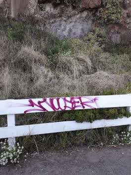 Graffiti —
 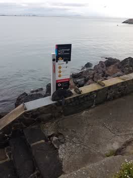 Parks —
 Seal puppy by itself next to the Scarborough Beach signed at the entry steps before the lifeboat station
Also reported on Scarborough Road
- 2 Scarborough Road — 45 reports
- 19 Scarborough Road — 13 reports
- 97 Scarborough Road — 12 reports
- 15A Scarborough Road — 12 reports
- 142 Scarborough Road — 12 reports
- 106 Scarborough Road — 8 reports
- 5 Scarborough Road — 6 reports
- 53 Scarborough Road — 5 reports
The street’s crash record
NZTA’s record names Scarborough Road in 1 crash that hurt somebody since 2006 — 1 seriously hurt, nobody killed.
The green nearby
- Scarborough Beach — 24 m to the edge · Regional · 5 ha
- Nicholson Park — 80 m to the edge · 4 ha
- Scarborough Park — 119 m to the edge · Botanic
- Whitewash Reserve — 124 m to the edge · Regional · 9 ha
- Bernie Hansen Reserve — 447 m to the edge
Parks within half a kilometre, measured to the boundary — the council’s open data.
On the doorstep
- Slipway Office - Sumner Boating & Fishing Club — 81 m away · Harbour Master
- Sumner Boating & Fishing Club — 83 m away · Association
- Scarborough Fare Cafe — 185 m away · Cafés
- Ocean Cafe & Bar — 188 m away · Restaurants
Businesses within four hundred metres, measured at the pin — OpenStreetMap and the council directories.
The bus nearby
- Nayland St near Head St — 441 m away · route 3
The closest Metro stops, within four hundred and fifty metres.
The tracks through here
- Walk and bike track through Scarborough — 213 m to the line · walk · bike
Tracks whose line passes within half a kilometre, measured to the line itself — the council’s open data.
The named ground
Named places within 1.5 km of this address; the council’s own structure register — bridges, boardwalks and steps standing nearby — the open map’s record.
The remembered names nearby
- In Memory of / Gordon and Jack Dalziel — 34 m away ·
In memory of / GORDON and JACK DALZIEL / 'Life long Residents of Sumner' / 2002
· 2002 - This Seat Was Donated by the / Sumner Senior Citizens Club — 127 m away ·
THIS SEAT WAS DONATED BY THE / SUMNER SENIOR CITIZENS CLUB / TO COMMEMORATE THEIR / 25TH A
· 1998 - World War Ii Road Blocks / 1942 — 128 m away ·
WORLD WAR II ROAD BLOCKS / 1942 / THESE CONCRETE BLOCKS WERE ORIGINALLY SITUATED / ON THE
· 2000
Inscribed plaques within two hundred and fifty metres — the register’s pins, not surveyed spots. The whole roll is at /plaques.
Renting nearby
new bonds in Scarborough ran about $620 a week — $70 above the city median of $550 — the suburb page keeps the rent record →.
What was here — Sumner Clock Tower and Setting
220 m away · 147R Esplanade · located to ±11 m · the place’s own record →
On the register. Nothing researched here yet.
The civic layer
This ground votes in Heathcote ward — the Spreydon-Cashmere-Heathcote community board. Ward lines don’t always follow suburb lines; this one is measured at the pin, not the suburb’s centre.
What stood on this ground → · On the map → · From the air — the Crown’s aerials back to 1936; search the address on RetroLens →
Questions, answered briefly
21 council reports on record since July 2021 — most often street gutters / storm water (12), pavement - general (2), graffiti (2).
Scarborough, Christchurch — on Scarborough Road.
The heritage register names a place at or beside it — Sumner Clock Tower and Setting.
Scarborough Beach — 24 m to its edge, 5 ha.