379 Marine Parade, South New Brighton
16 reports on record since January 2019 · 13 with photographs. The most-reported address on Marine Parade. Indicative rating valuation and school zones, hazards, bin day and what stood here before.
What gets reported here
Photographed here 13 on record


Reported here
 Hazard — vehicle —
 Keep coming back and staying in same spot for weeks now
 Graffiti on a fence, building or structure —
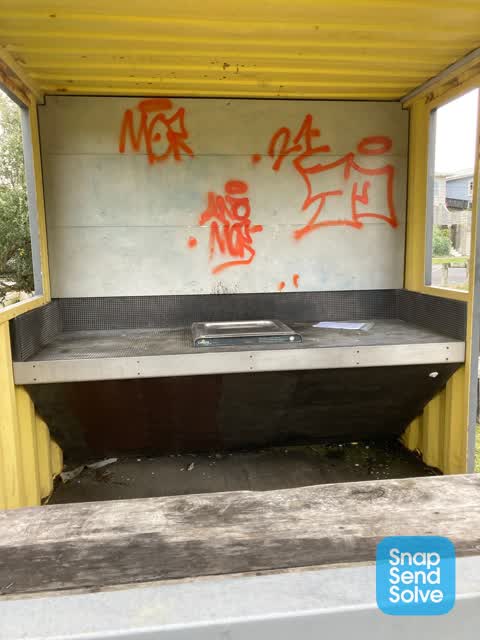
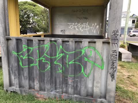
 Container bbq building in the park by the basketball court has been tagged
 Graffiti on a fence, building or structure —
 Someone has spraypainted the letters ASAP on the BBQ container building in the park across the road from 379 Marine Parade South Brighton.
- Facility - General Request —
- Fallen Tree —
- Park - General Request —
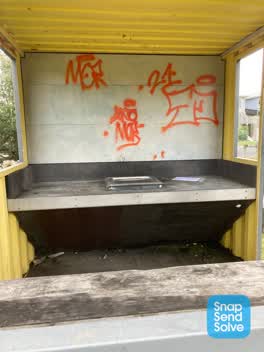 Graffiti —
 In bbq area
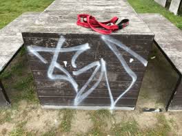 Graffiti —
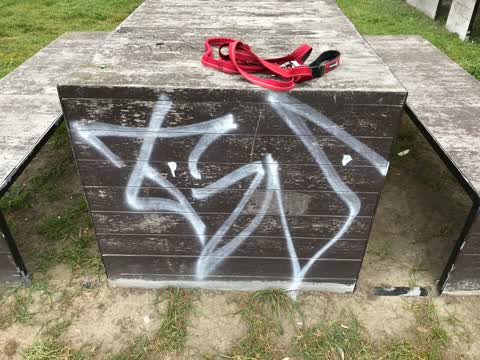
 Tags on seats at bbq area
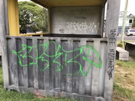 Graffiti —
 Tags on bbq area
Parks —
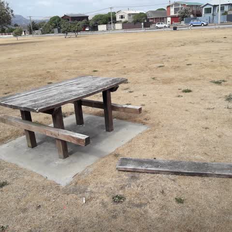
picnic seat plank off table
Roading/Streets —
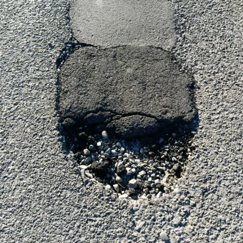
Contractor did terrible repair job on hole in road.
Parks —
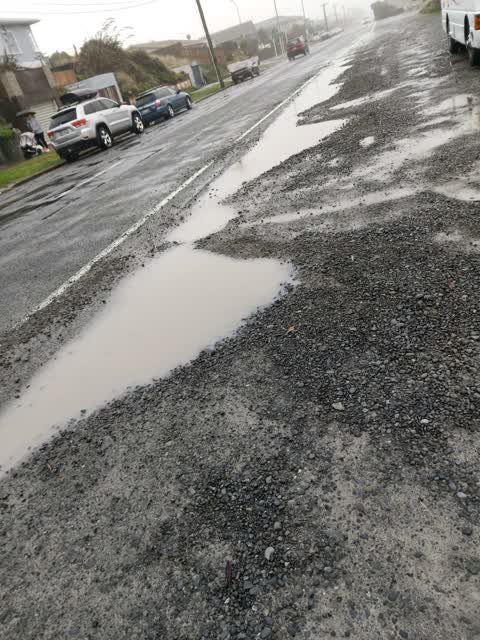
holes in road side
Roading/Streets —
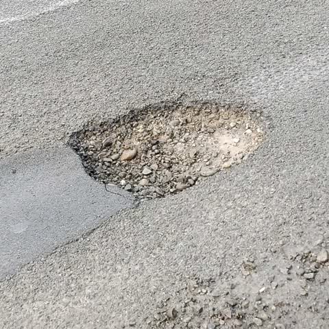
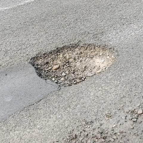
hole in road
Roading/Streets —
hole in road
Parks —
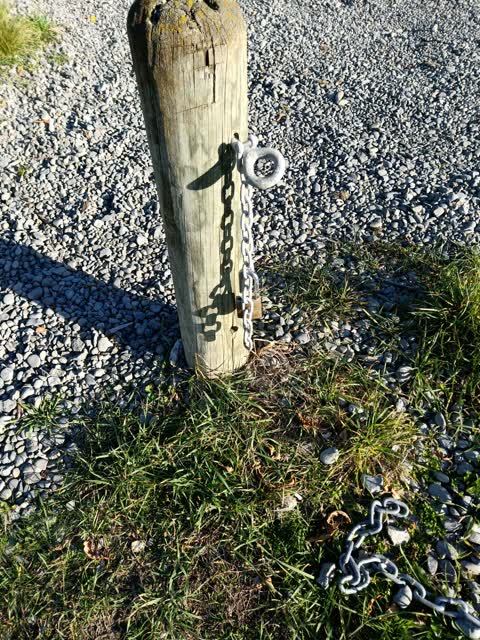
broken chain to te karoro karoro reserve
Parks —
Bin overflowing. Next to surf vlub
Also reported on Marine Parade
- 490–500 Marine Parade — 14 reports
- 419 Marine Parade — 13 reports
- 374 Marine Parade — 12 reports
- 502 Marine Parade — 10 reports
- 420 Marine Parade — 9 reports
- 501 Marine Parade — 7 reports
- 435 Marine Parade — 7 reports
- 372 Marine Parade — 7 reports
The street’s crash record
NZTA’s record names Marine Parade in 2 crashes that hurt somebody since 2006 — 0 seriously hurt, nobody killed.
The green nearby
- Te Karoro Karoro Reserve — you are in it · 2 ha
- South New Brighton Beach — 57 m to the edge · Regional · 37 ha
Parks within half a kilometre, measured to the boundary — the council’s open data.
On the doorstep
- Common Ground - South Brighton — 304 m away · Fast food
- Dune Cafe — 304 m away · Cafés
- Green Bear Coffee — 327 m away · Coffee roasters
- Challenge — 378 m away · Petrol stations
Businesses within four hundred metres, measured at the pin — OpenStreetMap and the council directories.
The bus nearby
The closest Metro stops, within four hundred and fifty metres.
The named ground
Named places within 1.5 km of this address; the council’s own structure register — bridges, boardwalks and steps standing nearby — the open map’s record.
The remembered names nearby
- In Recognition of the Assistance Given to the Christchurch — 7 m away ·
IN RECOGNITION OF THE ASSISTANCE GIVEN TO THE CHRISTCHURCH CITY COUNCIL BY BILL JARMAN IN
· 2003 - In Loving Memory of / Paula Marie Bobby — 127 m away ·
IN LOVING MEMORY OF / PAULA MARIE BOBBY
· 2000
Inscribed plaques within two hundred and fifty metres — the register’s pins, not surveyed spots. The whole roll is at /plaques.
Renting nearby
new bonds in South New Brighton ran about $640 a week — $90 above the city median of $550 — the suburb page keeps the rent record →.
The civic layer
This ground votes in Coastal ward — the Coastal-Burwood-Linwood community board. Ward lines don’t always follow suburb lines; this one is measured at the pin, not the suburb’s centre.
What stood on this ground → · On the map → · From the air — the Crown’s aerials back to 1936; search the address on RetroLens →
Questions, answered briefly
16 council reports on record since January 2019 — most often parks (4), roading/streets (3), graffiti (3).
South New Brighton, Christchurch — on Marine Parade.
Nothing on the heritage register at this exact spot — the record around this ground →
Te Karoro Karoro Reserve — the address is inside it, 2 ha.