502 Marine Parade
10 council reports since July 2023, 9 carrying a photograph. The street’s heaviest record is 379 Marine Parade, 16 reports on file.
From the air, then
Sourced from Canterbury Maps and partners. RNZAF, CC BY 3.0 NZ. Each frame is cut from Environment Canterbury’s historic imagery MapServer for that decade, only where the Footprints layer names a CC BY survey (NZAM-covered spots stay out). RetroLens holds more Crown aerials →
The green nearby
- South New Brighton Park, 390 m to the edge · Sports ground · 30 ha · playground, 69 pieces
Parks within half a kilometre, measured to the boundary, the council’s open data. The whole roll is at /parks.
The bus nearby
- Estuary Rd near Halsey St, 309 m away · route 60
- Estuary Rd near Halsey St, 324 m away · route 60
The closest Metro stops, within four hundred and fifty metres.
The named ground
Named places within 1.5 km of this address; the council’s own structure register, bridges, boardwalks and steps standing nearby, the open map’s record.
Renting nearby
new bonds in South New Brighton ran about $640 a week, $90 above the city median of $550, the suburb page keeps the rent record →.
What gets reported here
Photographed here 9 on record


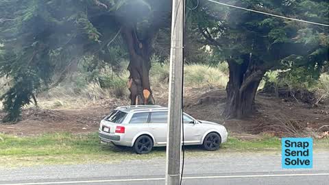


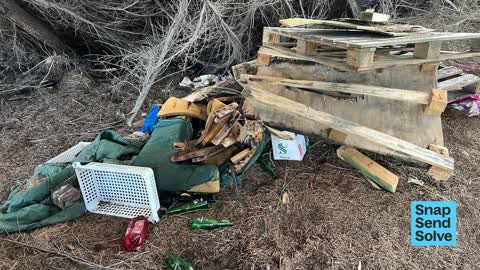
What’s on record
 Park - General Request, 21 Sept 2026
please remove branches. fire risk
 Hazard, vehicle, 12 Feb 2026
A from camper has been squatting in this location since before Christmas. His vehicle registration is RER75. The caravan is there 24/7 and h
 Fallen Tree, 8 Jan 2026
Tree fallen over track
 Hazard, vehicle, 6 Jan 2025
I’ve lost count of how many reports of this same person & vehicle illegally camping. He is living out of his car (with 2 cats) & sleeps. Thi
 Hazard, vehicle, 21 Oct 2024
He’s back, after 2 weeks living in car the police moved him on as local complaint of trespassing on property by neighbour. Has now returned
 Hazard, vehicle, 7 Oct 2024
Strange behaviour present for more than a week new signage of blood on boot up our drive looking for cats Sick individual Dr John Cook
 Hazard, vehicle, 7 Oct 2024
Been parking here since at least Tuesday. Dumping rubbish outside the car daily. Living in car, getting into neighbours property. Please mov
 Abandoned Vehicle, 1 Oct 2024
Has been there 5-6 days now. Carjam on rego is I think someone is living in it or abandoned vehicle
 Park - General Request, 11 Sept 2024
Rubbish dumping, overgrown area attracting significant nuisance
- Dumped Rubbish, 30 Jul 2023
Elsewhere on Marine Parade
- 379 Marine Parade, 16 reports
- 490–500 Marine Parade, 14 reports
- 419 Marine Parade, 14 reports
- 374 Marine Parade, 12 reports
- 420 Marine Parade, 9 reports
- 501 Marine Parade, 7 reports
- 435 Marine Parade, 7 reports
- 372 Marine Parade, 7 reports
The street’s crash record
NZTA’s record names Marine Parade in 2 crashes that hurt somebody since 2006, 0 seriously hurt, nobody killed.
The civic layer
This ground votes in Coastal ward, the Coastal-Burwood-Linwood community board is its local layer. Ward lines don’t always follow suburb lines; this one is measured at the pin, not the suburb’s centre. The whole roll is at /wards.
Marine Parade, the whole record → · Everything about South New Brighton → · What stood on this ground → · On the map → · From the air, RetroLens holds the Crown’s aerials back to 1936; search the address there →
Questions, answered briefly
10 council reports on record since July 2023, most often hazard, vehicle (5), park - general request (2), fallen tree (1).
South New Brighton, Christchurch, on Marine Parade.
Nothing on the heritage register at this exact spot, the record around this ground →
South New Brighton Park, 390 m to its edge, 30 ha.